
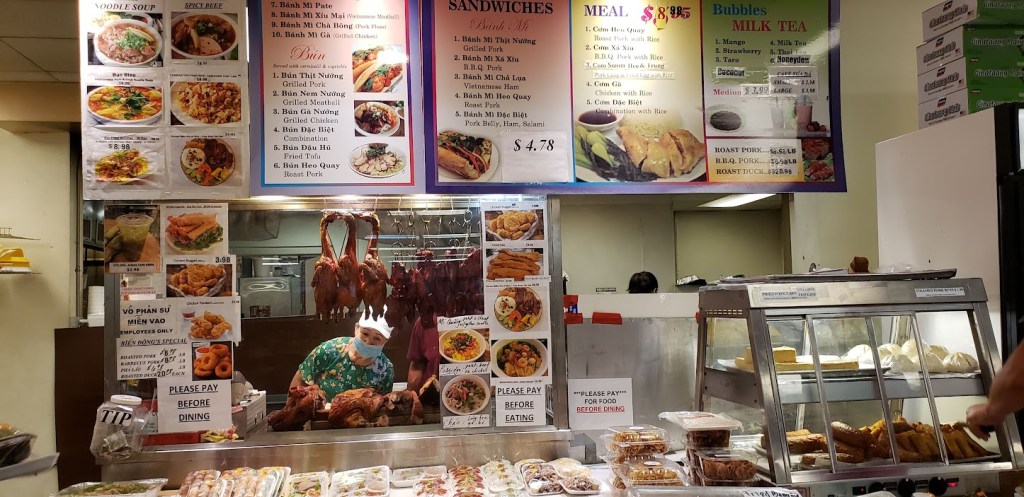
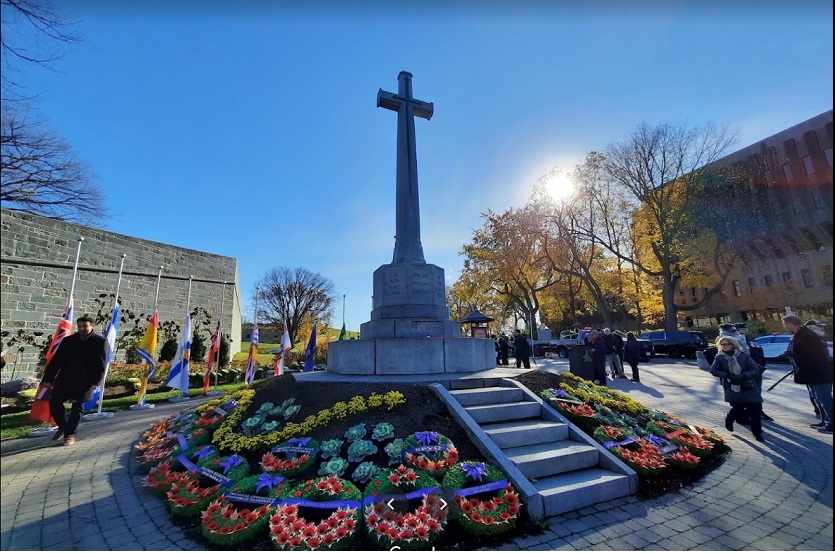
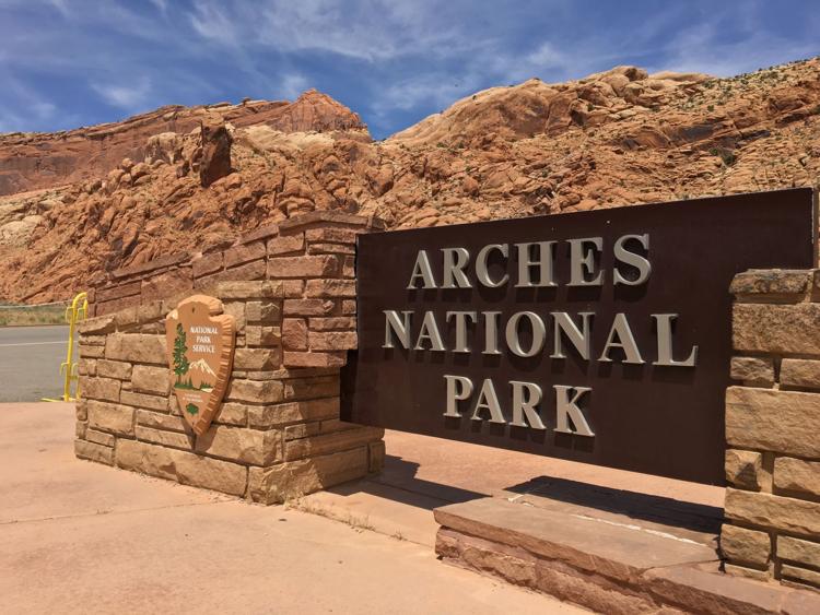
CHƯƠNG TRÌNH HỌP MẶT 2023
Louisiana – Florida
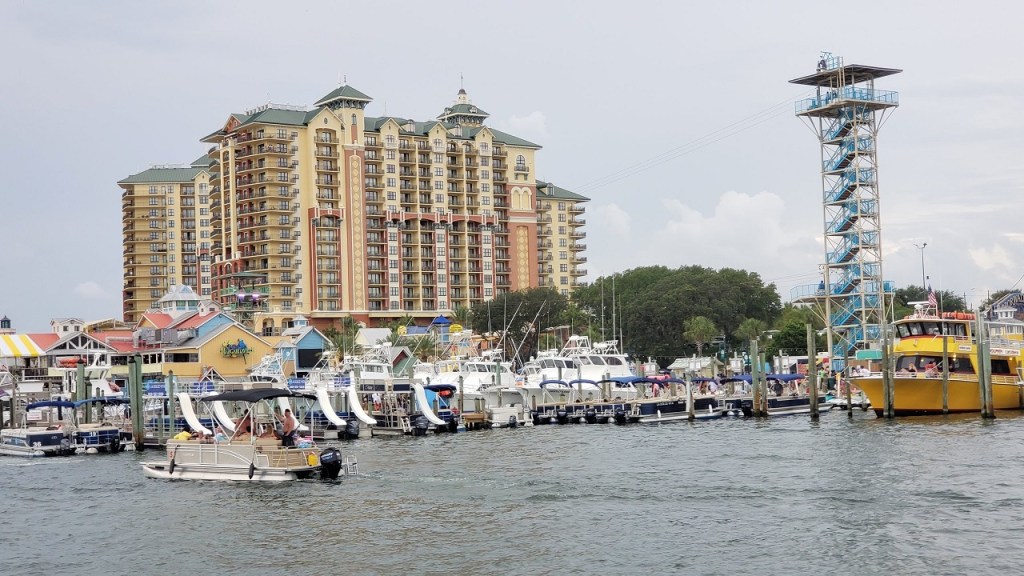
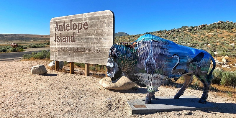
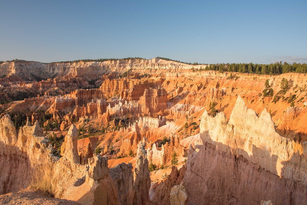
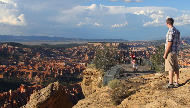
New Orleans
Day 1 – Saturday:
1. Arrival:
Lái xe từ Houston, Dallas – Texas. Khởi hành bằng máy bay từ California, Canada và những nơi xa khác đến phi trường Louis Armstrong New Orleans International Airport. Ra phi trường đón bạn từ xa về.
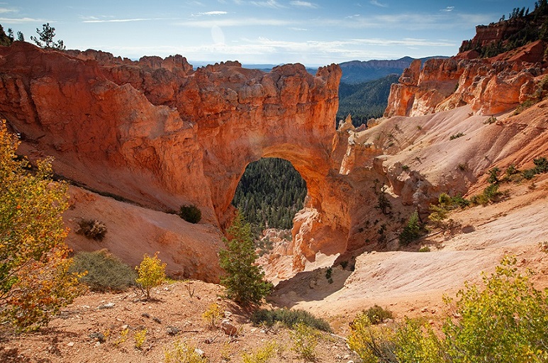
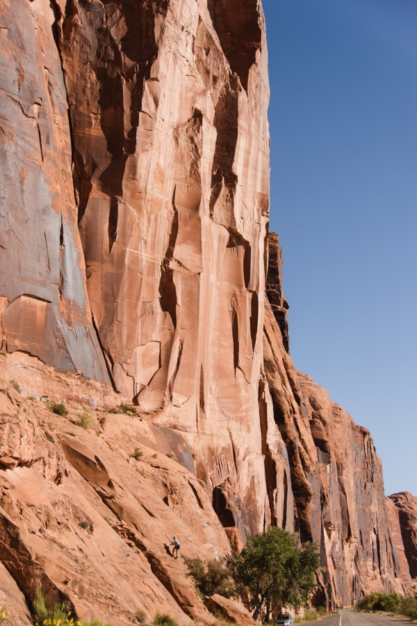
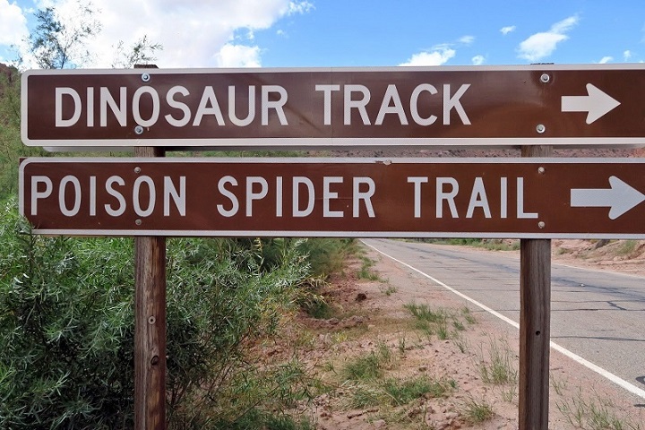
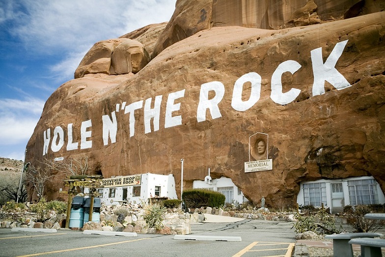
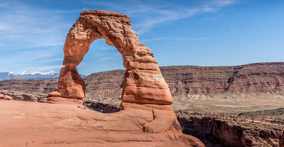
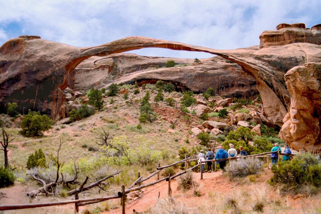
2. Oak Alley Plantation:
Cách phi trường MSY 40 miles, đồn điền trồng mía Oak Alley Plantation được nhiều người biết đến bởi vẻ đẹp của hàng cây sồi đại thụ được trồng từ thế kỷ 18. Open 8:30AM–5PM
https://www.oakalleyplantation.org/
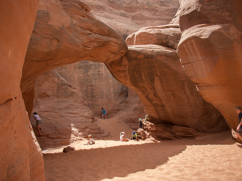
3. Swamp Tour:
Thăm khu đầm lầy, rừng ngập nước đa dạng, kỳ vĩ được ví như “bảo tàng” thiên nhiên khổng lồ, mang nét nguyên sơ, huyễn hoặc tựa cõi mộng. 14 miles from airport. Open 9AM–4PM.
https://www.cajunprideswamptours.com/tours/swamp-tours
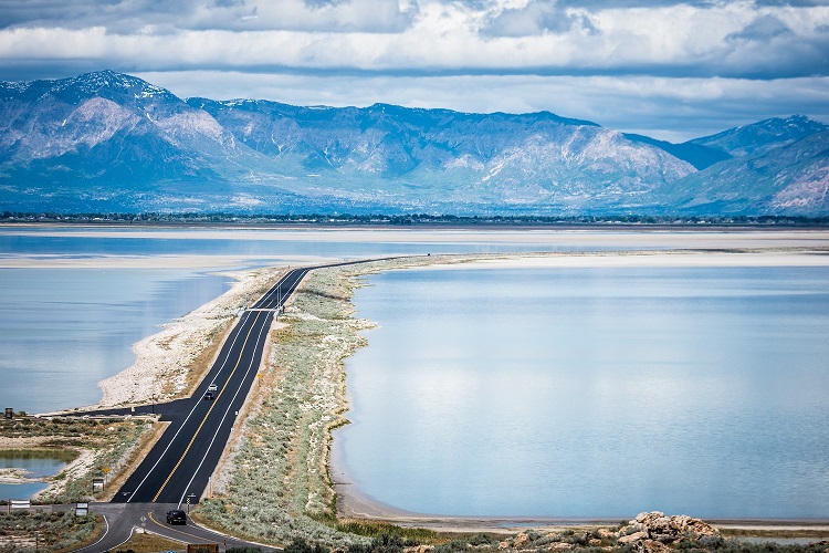
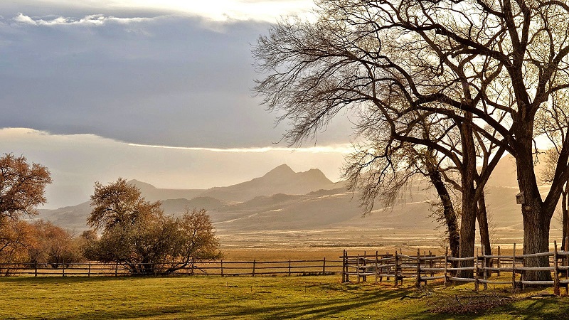
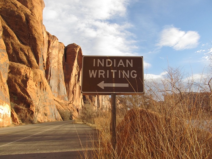
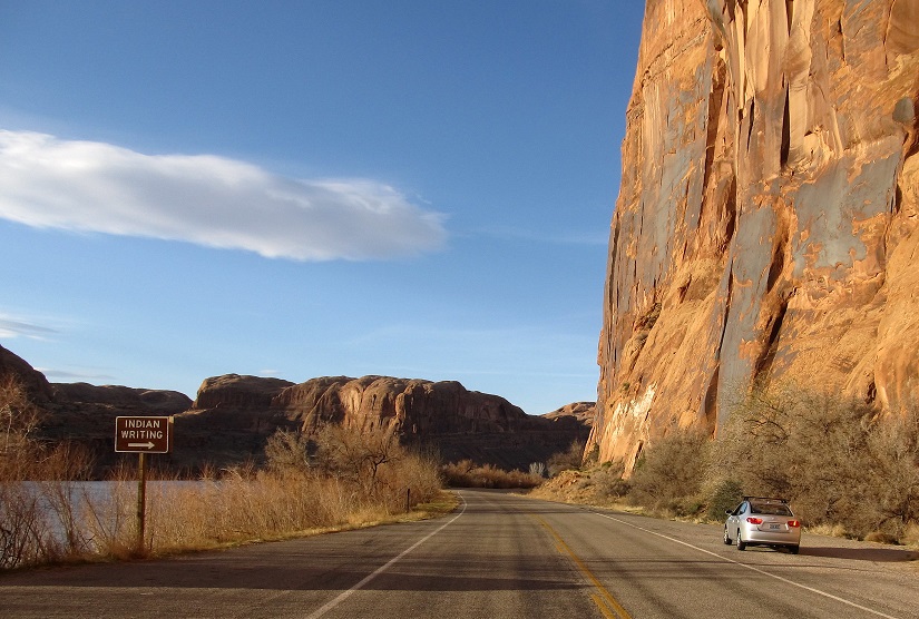
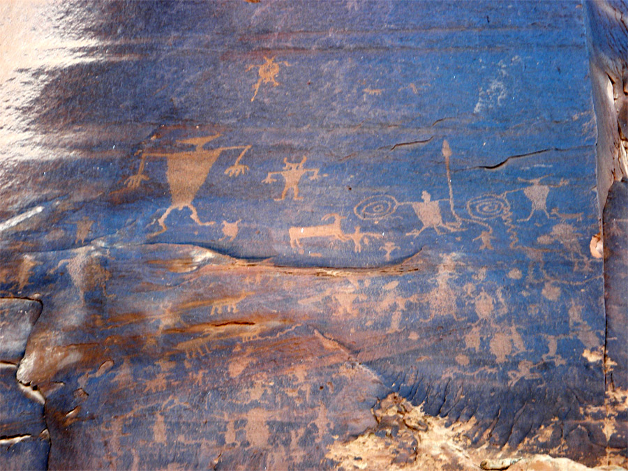
4. New Orleans’ levees – Great Wall of Louisiana:
Ngắm hoàng hôn bên bờ hồ Pontchartrain.
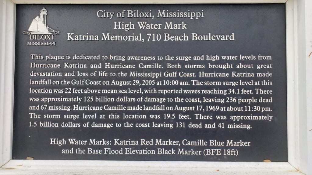
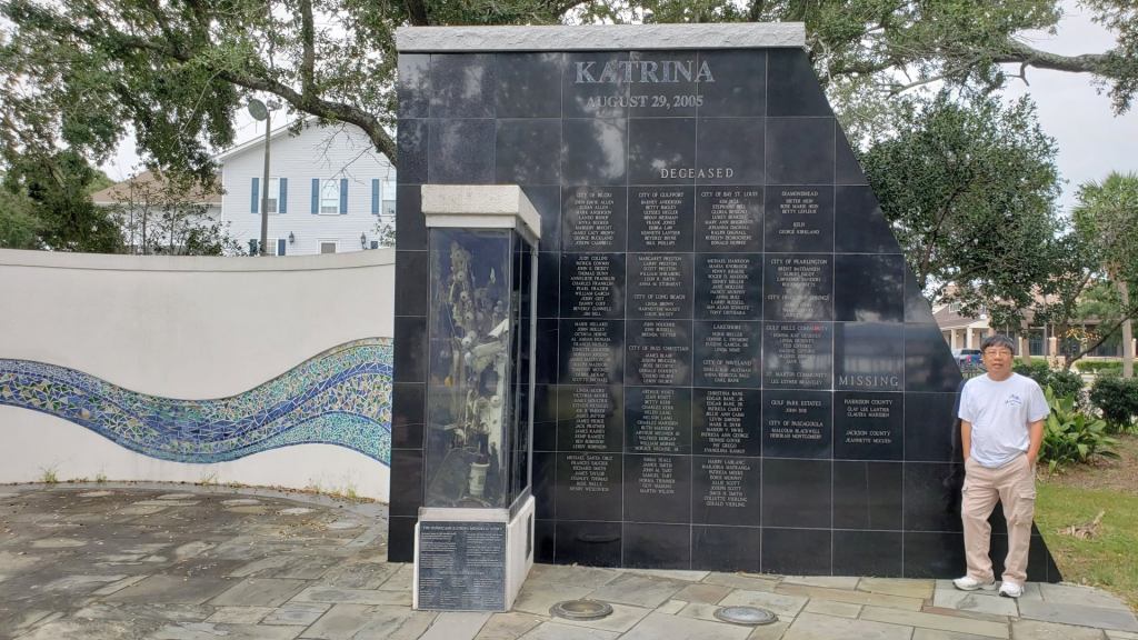
Leo lên con đê đoạn bên bờ hồ Pontchartrain và cây cầu Causeway. Ngay dưới chân đê là những xóm nhà không bị ngập lụt vì bão Ida vừa qua nhờ hệ thống chống bão lụt quy mô cho New Orleans được xây dựng sau khi cơn bão Katrina đã gây thiệt hại về nhân mạng, tài sản rất lớn, làm đình trệ nền kinh tế của New Orleans và Louisiana trong nhiều năm trời.
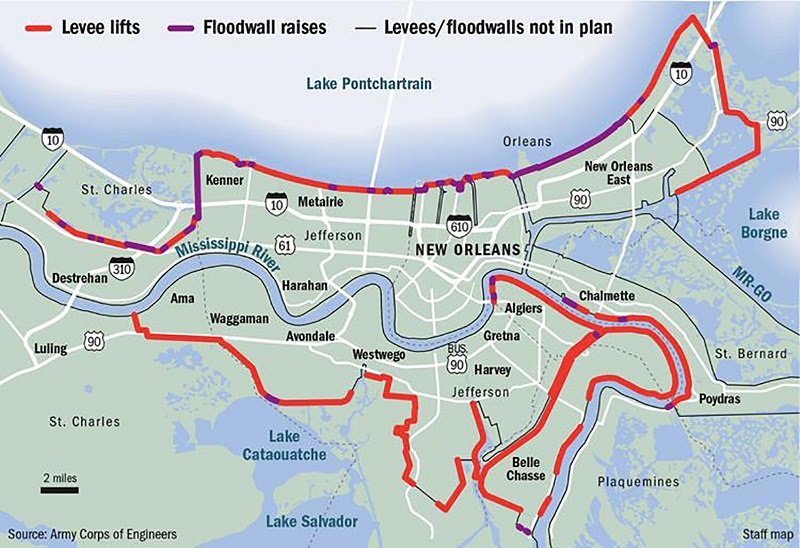
Sau cơn bão Katrina đổ vào New Orleans hồi cuối tháng 8 năm 2005, công binh Hoa Kỳ đã được giao nhiệm vụ xây dựng một hệ thống phòng chống lũ lụt tại đây với ngân sách hàng chục tỉ đô la. Hệ thống phòng thủ này bao gồm những máy bơm, hệ thống đê và tường chống lũ lụt có khả năng chống chọi với những “cơn bão thế kỷ”, được thiết kế và tính toán dựa trên cơn bão dữ có sức công phá dữ dội nhất như Katrina.
5. Uống cà phê nghe nhạc Jazz:
311 Bourbon Street + 8am-9:30pm Daily + Live Jazz Daily 10am-Close
6. New Orleans by Night:
Ăn tối xong, đi dạo French Quarter vào buổi tối, xem khung cảnh nhộn nhịp của nơi này.
Cả thế giới không đâu có. Chỉ một con phố nhỏ Bourbon, mỗi buổi tối, nhất là vào cuối tuần, cả ngàn người tản bộ hoặc vào các quán nhâm nhi một vài ly rượu cho ấm áp lòng người cô quạnh, rồi ngắm các người đẹp đi vài đường lả lướt trên sàn nhẩy thật mát mắt. Nếu du khách quan niệm “nghệ thuật vị nghệ thuật” thì những màn biểu diễn của những người đẹp miền Nam Hoa Kỳ, cũng xin được nhìn với con mắt bao dung của nghệ thuật. Xin nhớ điểm đặc thù của New Orleans là rượu pha cocktail brandy là nghệ thuật tuyệt vời của giới ăn chơi sành điệu. Đại lộ Canal với những hàng cột điện cổ kính trên hai trăm năm chiếu ánh quang huy hoàng giữa lòng trung tâm thành phố, khiến các sử gia khoác cho một danh xưng đầy quyến rũ: “Con đường sáng nhất thế giới”. Mọi thứ ở New Orleans dường như chỉ bắt đầu khi thành phố lên đèn.
Day 2 – Sunday:
1. Jackson Square:
Đậu xe sau quán Café Du Monde uống cà phê sáng rồi đi thăm những nơi gần quán Café
2. Uptown & Garden District:
Đến trạm xe điện phía sau Café Du Monde mua vé one-day pass $3 đi thăm thành phố. Xuống trạm Audubon Park. Ghé thăm 2 trường Tulane và Layola Universities đối diện công viên.
3. Bourbon Street:
Xe điện (Streetcars) sẻ trở về và dừng lại đầu đường Bourbon. Đi dạo trên đường Bourbon và những con đường quanh đó để thấy French Quarter lúc ban ngày.
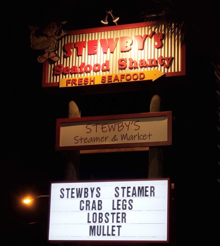
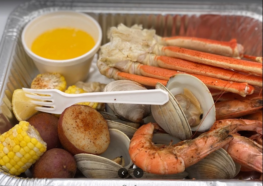
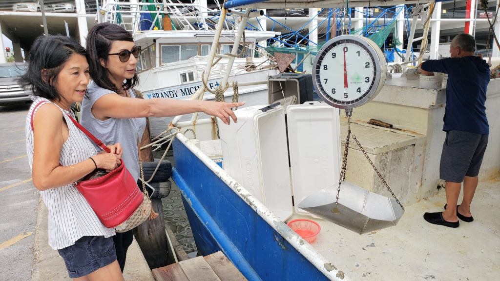
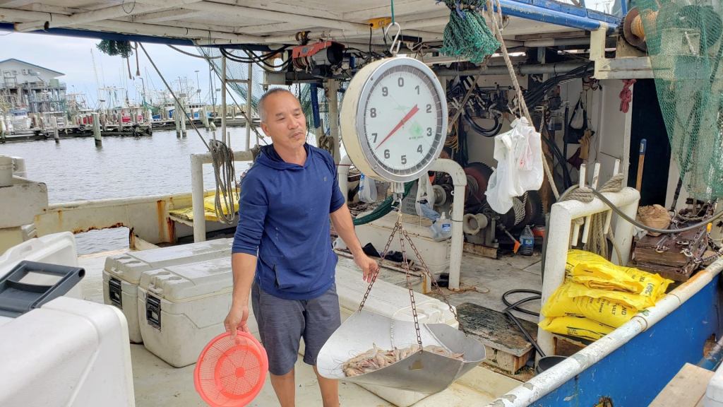
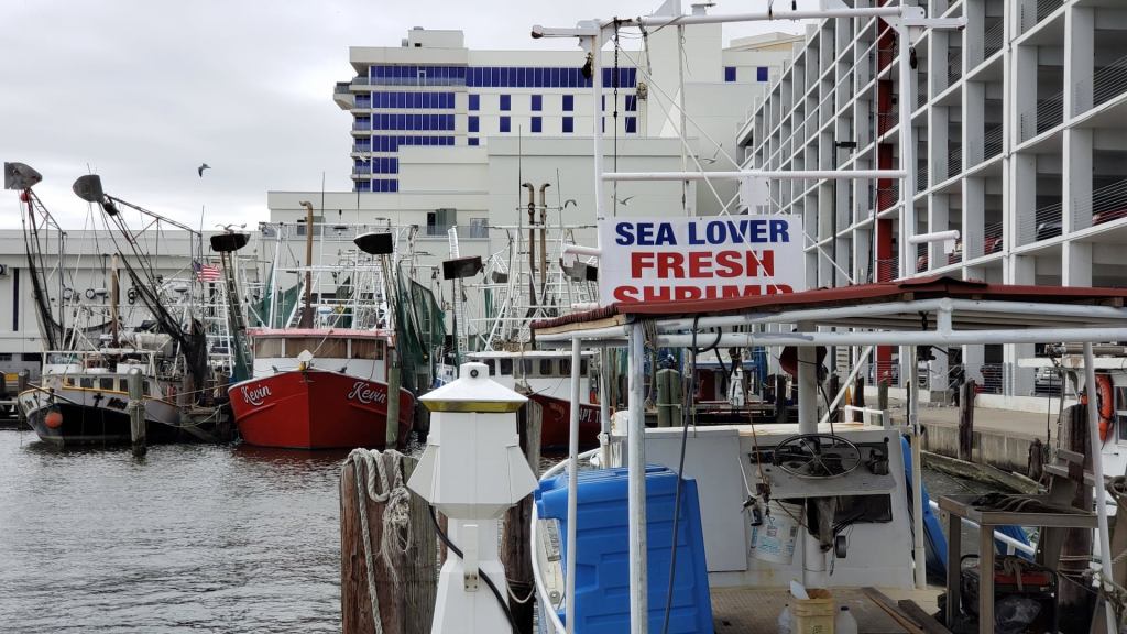
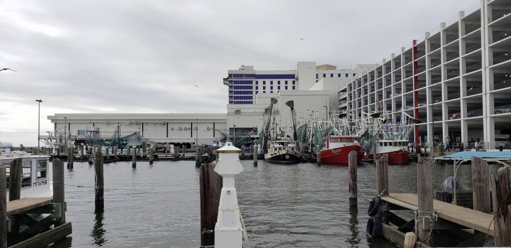
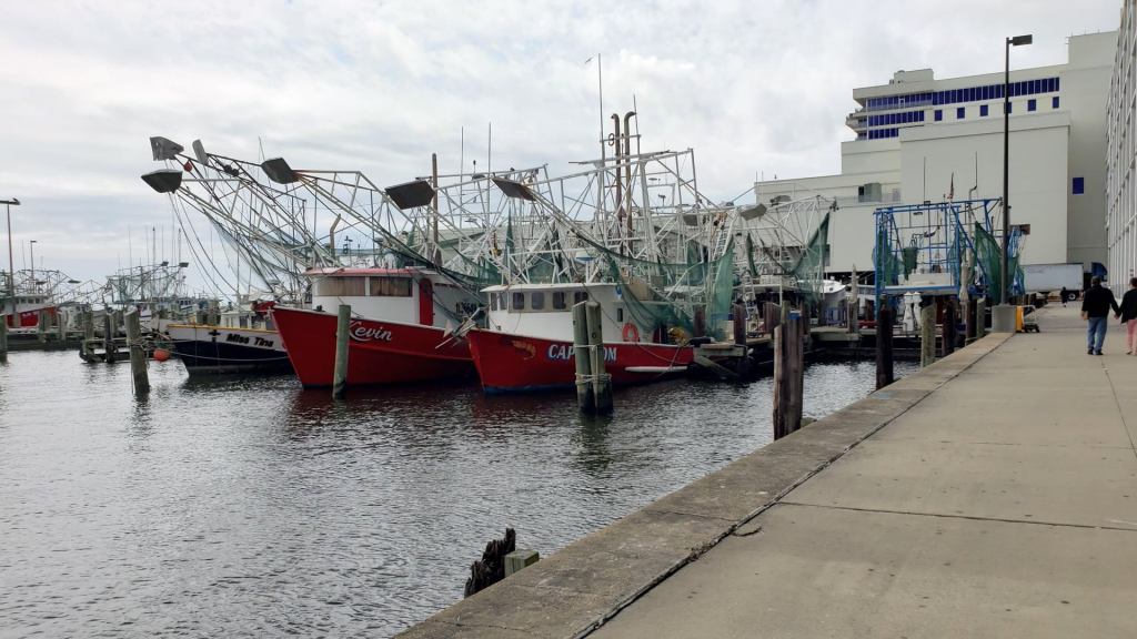
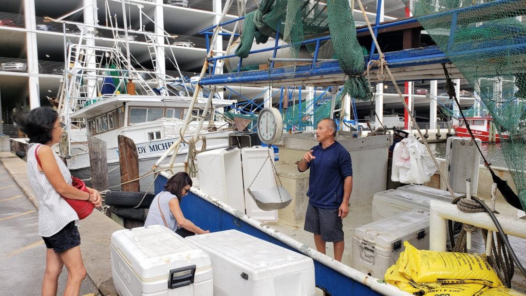
4. Theresa Seafood
Lạc trôi về vùng miệt thứ Louisiana diện kiến dung nhan “Nữ tướng Tôm Tươi” mà đài VOA đã từng lặn lội đến đây làm phóng sự về tấm gương tần tảo làm việc nuôi 10 người con khôn lớn và tạo dựng nên cơ ngơi ngày nay.
Mua tôm tươi mới từ tàu chở vào vựa hải sản.
Florida
Lên đường đi Florida là tiểu bang được mệnh danh là thiên đường của biển, là nơi quanh năm ấm áp và ngập tràn nắng.
Từ New Orleans tới Florida phải đi qua 3 tiểu bang : Louisiana, Mississipi và Alabama.
Tiểu bang Alabama được biết qua tác phẩm nổi tiếng “Giết con chim nhại – To Kill a Mockingbird”. Đoạn băng ngang thành phố Mobile của tiểu bang Alabama, chui xuống một đường hầm dưới lòng sông đi thêm 52 miles là đến ranh giới bang Florida.
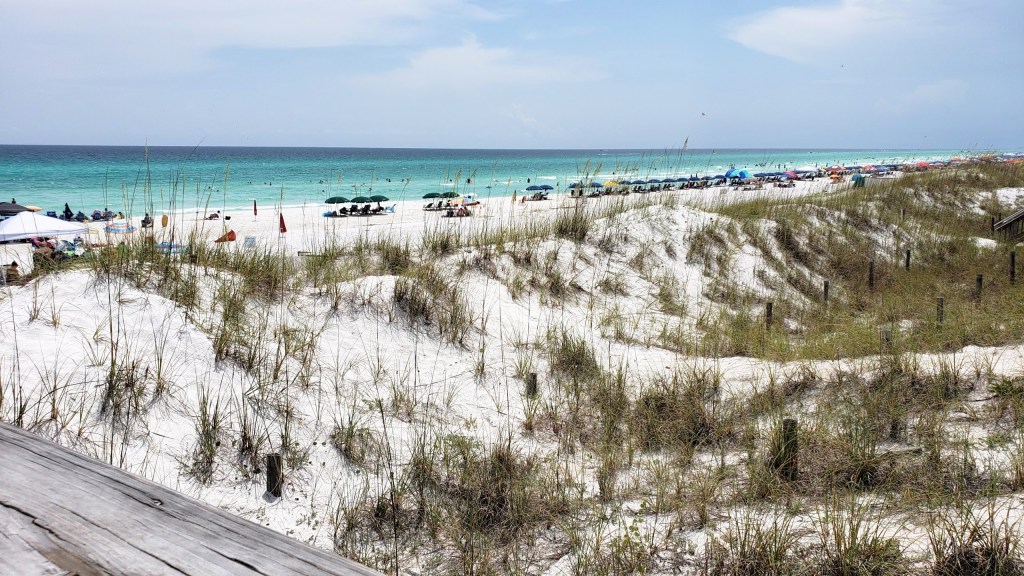
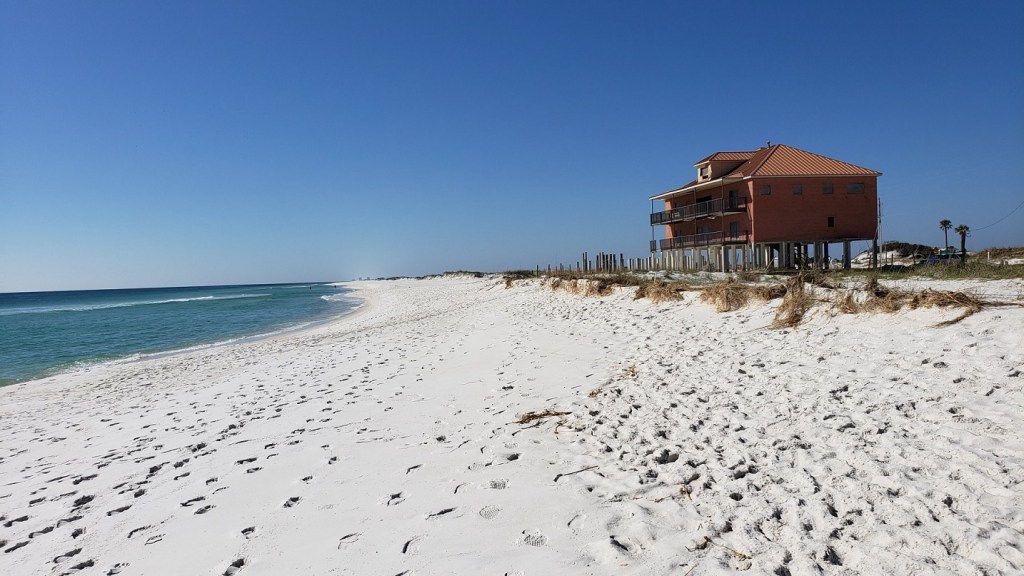
5. Destin:
Vùng biển Destin thường được gọi là Emerald Coast biển xanh như ngọc, cát trắng chói mắt, sóng cũng vừa phải.
Đến Destin bằng con đường ven biển 98, hai bên đường có nhiều đụn cát trắng, phía tay phải là biển, bên tay trái là cái đầm rộng lớn, có một cái cù lao tên là Crab Island nhưng không thấy cái đảo nhỏ nầy nhô lên khỏi mặt nước, nhiều thuyền nhỏ và những người lội nước khoảng tới ngực đi chơi ở đó. Ở đó có nhiều trò chơi cho đủ mọi lứa tuổi, có thuyền bán thức ăn ….Tất cả sinh hoạt đều ở trên mặt nước như một khu chợ nổi.
Lái xe dọc theo đường ven biển Scenic Gulf Dr, nhà cửa và các căn condo to lớn đã gần như lấp đầy, che hẳn tấm mắt của người đi trên đường. Nhiều bãi tắm nối tiếp nhau, để tìm được một chổ đậu xe thật trần ai, nhất là vào ngày lễ.
Ra biển, cát trắng ngoài sức tưởng tượng, như đang đi trên một tấm thảm nhung.
Day 3 – Monday:
![]() CRAB ISLAND
CRAB ISLAND
Nếu các bạn có dip đi Destin nên trải nghiệm tới Crab Island nha. Zui lắm các bạn ơi :)) Chắc mình sẽ đi mỗi năm quá. Canh ngày trời nắng thì nhìn nước sẽ đẹp hơn. Các bạn có thể liên lạc với anh Tony Phạm để mướn pontoon chở các bạn ra Crab Island chơi nha, ảnh vừa ” đẹp trai, 6 múi, da ngăm” mà còn nhiệt tình , zui tính nữa. Đây sdt của ảnh nè các bạn 850-376-5034
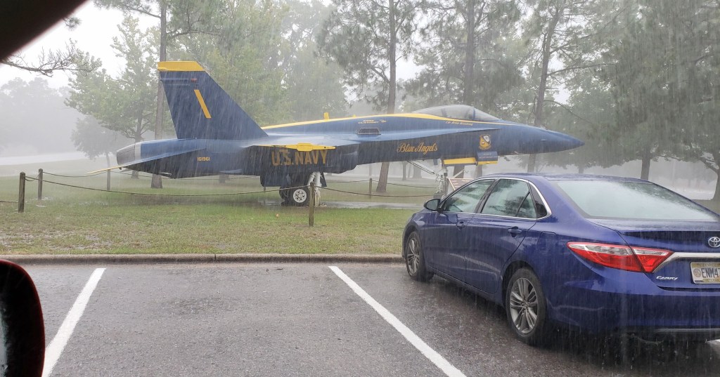
![]() FORT WALTON BEACH :
FORT WALTON BEACH :
Ghé thăm Air Force Armament Museum kế bên Eglin Air Force Base.
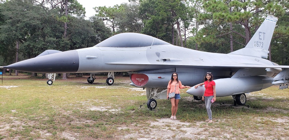
Là căn cứ không quân lớn nhất Hoa Kỳ, Eglin Air Force Base là trung tâm thử nghiệm các loại vũ khí phi hạt nhân của lực lượng không quân. Viện bảo tàng vũ khí không quân trưng bày nhiều phi cơ chiến đấu và các loại bom.
![]() OKALOOSA ISLAND
OKALOOSA ISLAND
Cho những ai thích vùng biển vắng, hoang sơ. Những đàn chim hải âu, bồ nông, cò, vạc bay về đậu trên những cồn cát.
![]() HABORWALK VILLAGE
HABORWALK VILLAGE
Khu phố đi bộ HaborWalk Village ngay bến cảng khá dễ thương. Cảnh sông nước với thuyền bè tưng bừng ngược xuôi, hàng quán sinh hoạt và người qua lại ồn ào, náo nhiệt.
Day 4 – Tuesday
Northwest Florida Beaches Tour
Đi thăm một số ngôi làng và thành phố vùng Tây Bắc Florida với những phố biển xanh ngát trời mây, ru mình trên những con sóng hồn nhiên.
Nét chung của những phố miền biển nơi đây là một bên là biển xanh sóng vỗ rì rào, một bên là các dãy khách sạn, khu resort, condo hướng mình đón gió biển. Phóng tầm nhìn ra xa một chút sẽ thấy một màu xanh đại dương tươi mát hòa với màu trời trong vắt như ngọc. Khách lãng du chỉ cần lái xe một quãng ngắn, tìm chỗ đậu xe xong đi bộ một chút là ra tới bãi biển.
Phố biển gió mây lồng lộng, chạy dài nối tiếp nhau nhưng mỗi nơi cũng có đặc trưng riêng.
![]() MIRAMAR BEACH :
MIRAMAR BEACH :
Những condo vươn cao, mặt trước là biển, mặt sau gần vịnh, bên hông là hồ. Màu xanh của sân golf hợp với cái màu lóng lánh của mặt nước trong lành buổi sáng sớm.
![]() SEASIDE :
SEASIDE :
Seaside đơn giản chỉ là một làng nhỏ ven biển.
Vẫn giữ được nét yên bình, sạch sẽ và trong lành của một vùng quê.
Trường làng đúng là “cây xanh lá vây quanh” . Đứng dưới những tàng lá xanh thấy học trò sinh hoạt trong sân trường. Những lớp học xây tách rời nhau vây quanh hành lang như những vệ tinh quanh một quỹ đạo.
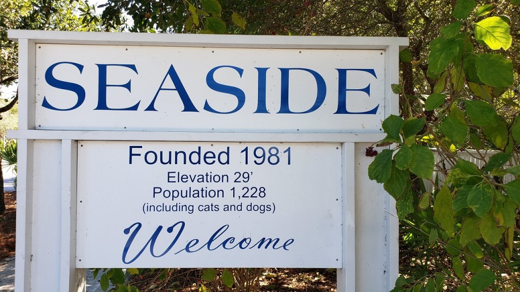
Làng Seaside với những con đường lát đá, những ngôi nhà trổ gác cao để sáng uống cà phê khẽ ngắm mặt trời lên trên biển.
Đi thăm những ngôi nhà trong làng khiến người ta hát khe khẻ bài Sắc Màu:
Một màu xanh xanh, chấm thêm vàng vàng
Một màu nâu nâu, một màu tím tím
Màu nâu tím mắt em tôi ôi đẹp dịu dàng
Một màu xanh lam, chấm thêm màu chàm …
![]() ROSEMARY BEACH
ROSEMARY BEACH
Con đường đi vào phố biển có công viên nằm giữa 2 làn xe với những hàng cây rợp bóng. Cư dân và du khách di chuyển bằng xe đạp trên những con đường nhỏ như lạc vào một khu phố ở châu Âu.
![]() PANAMA CITY BEACH
PANAMA CITY BEACH
Vùng biển này kéo dài 27 miles và bình dân hơn nên những bãi biển khá ồn ào, náo nhiệt, nơi đây là của tuổi trẻ, các sinh viên Đại Học khắp nơi thường tụ tập về đây quậy dịp nghĩ spring break.
Day 5 – Wednesday
 Pensacola:
Ghé tiệm Six Kids Store Super Deli để mua mực và cá còn nguyên con. Tiệm của anh Long cách Làng Quảng Pensacola khoảng 3 miles. Anh Long cũng là “Lý trưởng” của làng, lúc trước cư ngụ tại làng An Hải bên kia sông Hàn , Đà Nẳng. Qua Mỹ năm 1980 lúc 13 tuổi.
Biển ở đây không có cá chuồn, cá đù, cá hố như bên mình, nhưng cá ngân, cá ngừ, cá mú, cá hanh thì nhiều vô kể. Đồ biển tiệm anh chỉ để trong tủ lạnh vài ngày là có hàng mới.
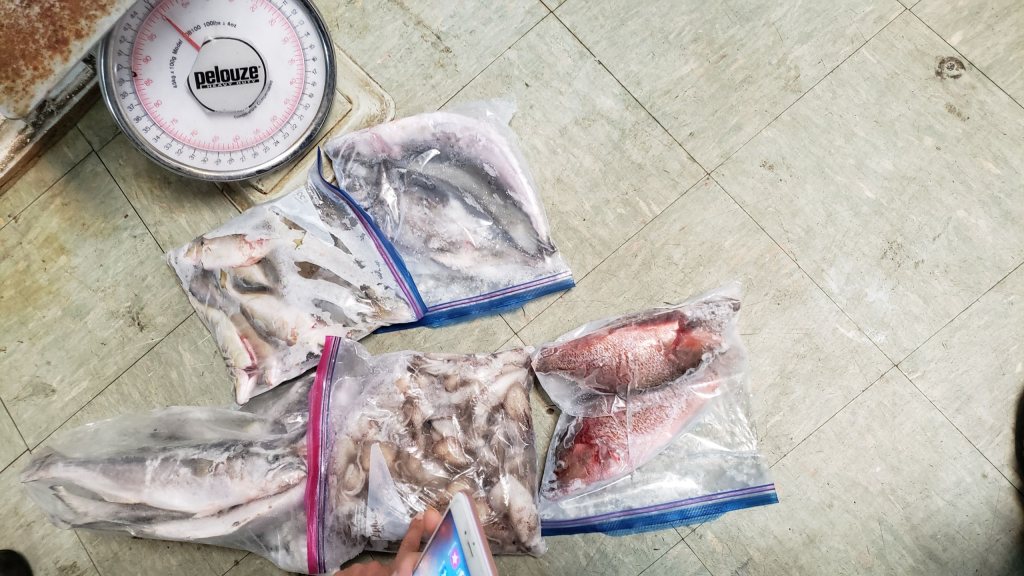
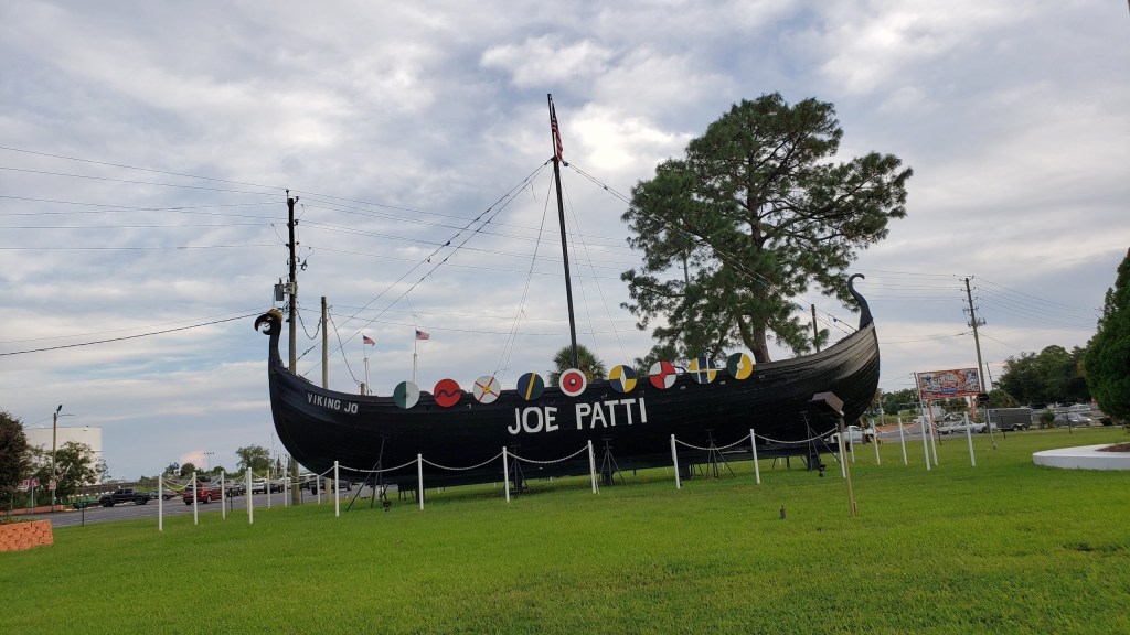
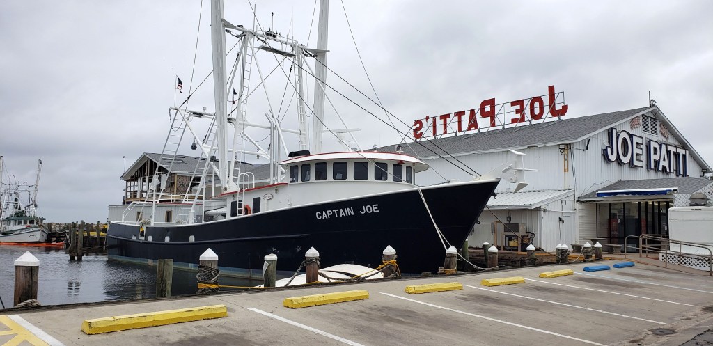
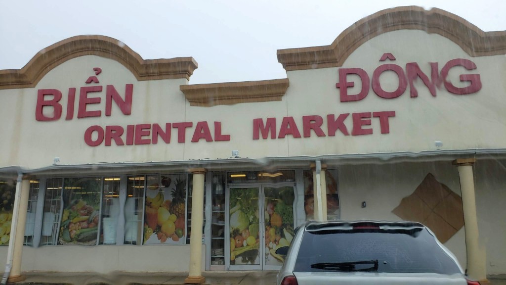
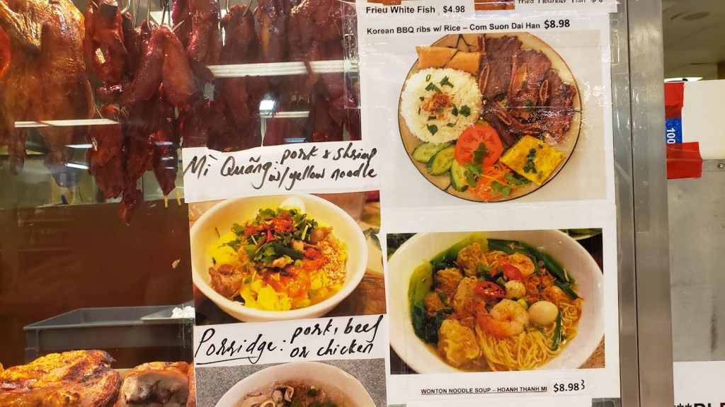
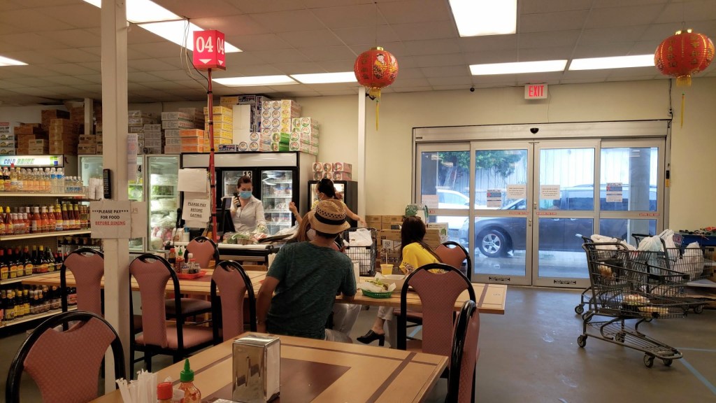
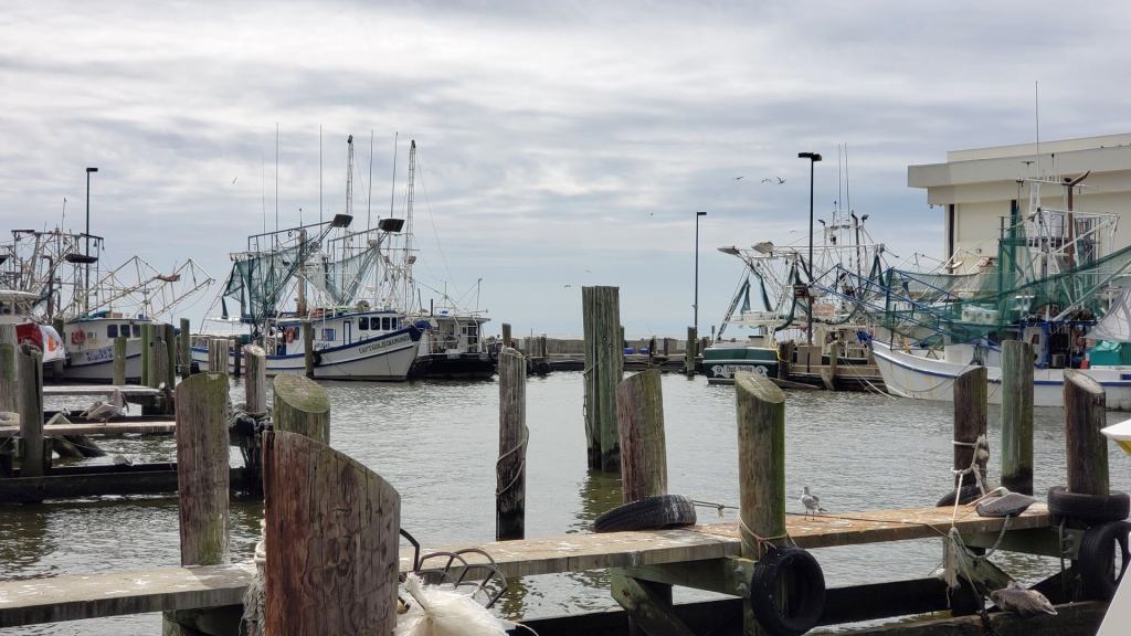
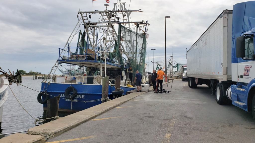
Thăm chợ hải sản lớn nhất Florida là Joe Patti rồi qua chợ Biển Đông mua những thứ cần thiết.
Không hổ danh là Đệ nhất Seafood của khu vực, Joe Patti trang trí cửa tiệm với 2 con tàu lớn. Tàu Viking ở bãi cỏ trước tiệm và tàu sắt đậu bên hông. Hàng ngày tàu đánh cá, đánh tôm từ vịnh Mexico cập ngay sau lưng tiệm không phải chờ đợi mất thời gian và hải sản được tiếp nhận kịp thời để chất lượng vẫn đảm bảo tươi tốt.
Tiệm Joe Patti hình như lúc nào cũng đông khách. Du khách phương xa cũng ghé đến nhiều.
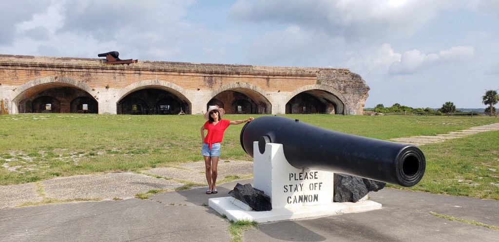
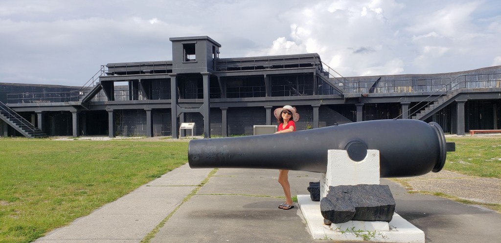
Ghé thăm Fort Pickens.
Từ Fort Pickens đi theo con đường ven biển State Highway 399 đến Navarre Beach
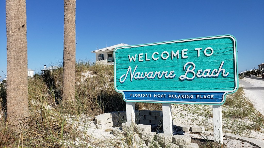
Bãi biển Navarre là một sự lựa chọn hoàn hảo cho việc tìm kiếm sự rung cảm với thiên nhiên.
Bốn trong số sáu loài rùa biển ở Hoa Kỳ được tìm thấy tại bãi biển này. Rùa biển đến bãi biển Navarre vì sự yên tĩnh và bóng tối, người ta giúp bảo vệ rùa bằng cách giữ cho các bãi biển không có vật thể và ánh sáng nhân tạo. Mùa làm tổ của chúng là từ đầu tháng 5 đến cuối tháng 10, trong thời gian đó bạn có thể thấy rùa đẻ trứng trên các bãi biển, miễn là bạn tuân theo các quy tắc tham quan.
Khi bão nhiệt đới Sally tràn qua Florida và rút đi vào tháng 9, để lại những con sao biển nằm la liệt trên bờ cát ở bãi biển Navarre.
Những vỏ ốc đầy màu sắc, lớn nhỏ khác nhau trôi dạt từ trong lòng biển tụ về đấy. Giẫm lên những xác vỏ ốc đã vỡ ra thành triệu triệu mảnh nhỏ, bắt đầu đi tìm những vỏ ốc biển của mình.
Lang thang dọc biển nhặt vỏ sò, vỏ ốc và thỉnh thoảng thích thú tìm được một vỏ sò đẹp. Khi đưa tay chạm vào một vỏ ốc đang nằm trên bãi, dường như sóng vừa cuộn đưa vỏ ốc ấy lên trước mặt.
Mong tìm được một vỏ ốc sand-dollar nguyên vẹn, nhưng tìm mãi không được. Chắc là phải nhặt những mảnh sand-dollar nhỏ để ráp lại thành một sand-dollar lớn.
Bãi biển Navarre thực sự được biết đến nhiều nhất với phim Jaws của đạo diển Steven Spielberg’s, khi phần lớn bộ phim được quay ở đây.
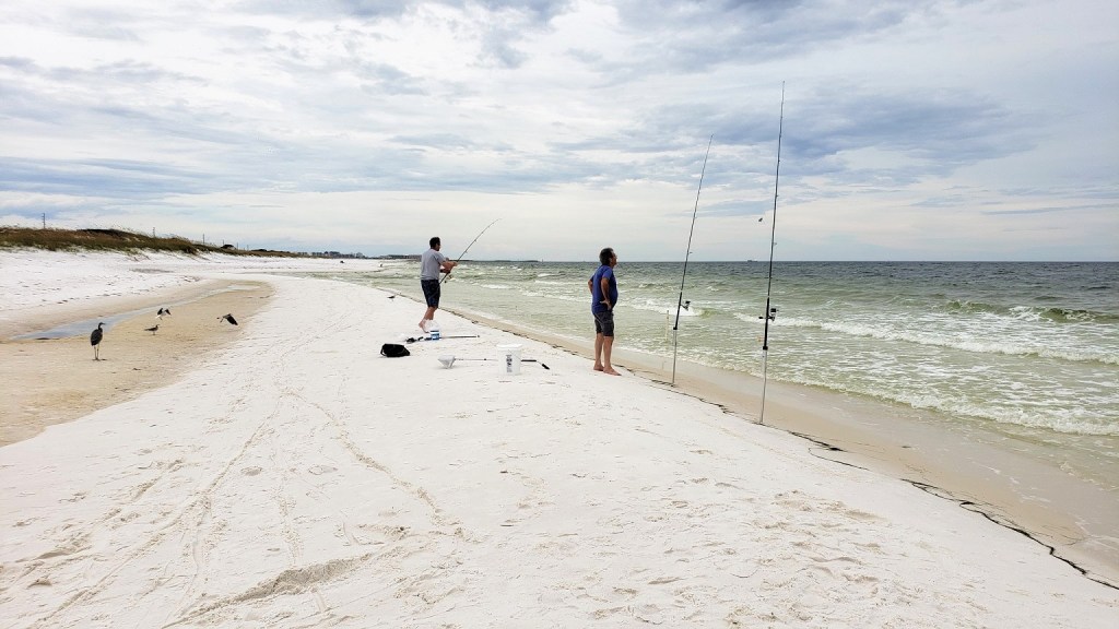
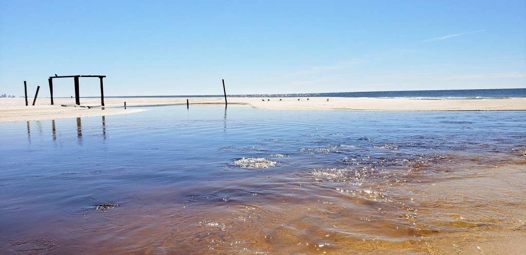
Một đặc điểm đáng chú ý khác của bãi biển này là nơi đây có cầu tàu (Fishing Pier) dài nhất ở Vịnh Mexico, là một địa điểm nổi tiếng để câu cá và ngắm cá heo.![]()
![]()
Day 6 – Thursday
![]() CAMP HELEN STATE PARK
CAMP HELEN STATE PARK
Con đường cát trắng ra biển có hàng cây thông cát (sand pine) dẫn lối với bao nhiêu là hoa vàng bên biển xanh. ![]()
![]()
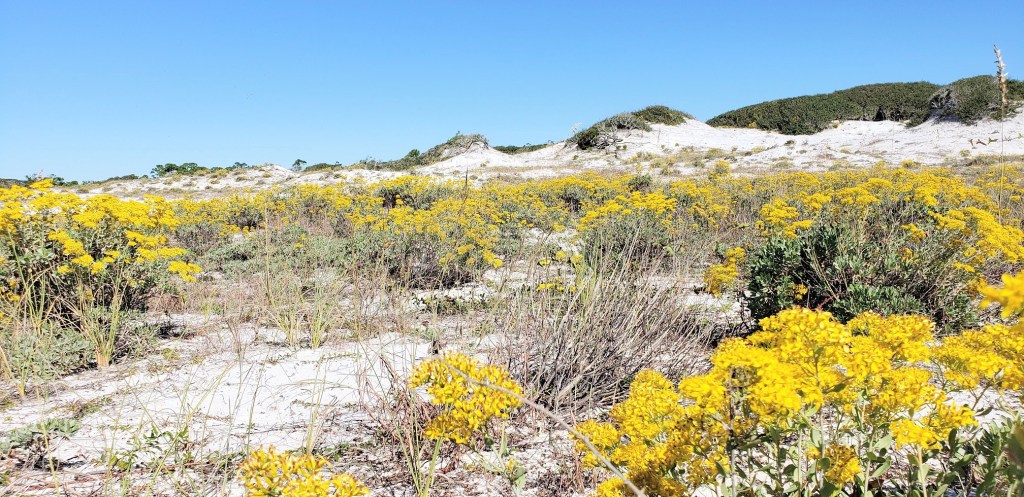
Công viên Camp Helen ba mặt giáp nước với Vịnh Mexico và Hồ Powell. Sự kết hợp độc đáo khiến nó trở thành một kỳ quan sinh thái. Hồ Powell bao quanh phía bắc và phía đông của công viên, và là một trong những hồ cồn cát ven biển (coastal dune lake) hiếm hoi lớn nhất chỉ được tìm thấy ở một vài nơi trên thế giới.
Các cồn cát ven hồ là hệ sinh thái nước ngọt rất quý hiếm. Những hồ này chỉ được tìm thấy ở một số địa điểm trên thế giới như là New Zealand, Úc, Madagascar và ở Hoa Kỳ dọc theo bờ biển Oregon, Nam Carolina và Tây Bắc Florida.
Nước trong hồ có màu nâu. Chất hữu cơ tự nhiên từ lá cây rơi xuống hồ và các khoáng chất khác nhau tạo ra màu nâu, được gọi là tannin. Điều kiện này là hoàn toàn tự nhiên. Hãy coi nó như lá trà được ngâm trong nước!
Màu vàng của hoa, màu nâu của nước hồ theo con kênh chảy ra biển, màu trắng của cát, màu xanh của cây cỏ và đại dương và những hàng trụ gỗ còn sót lại của chiếc cầu tàu khiến người ta có cảm giác chơi vơi và khác lạ với biển.
![]() SANDESTIN:
SANDESTIN:

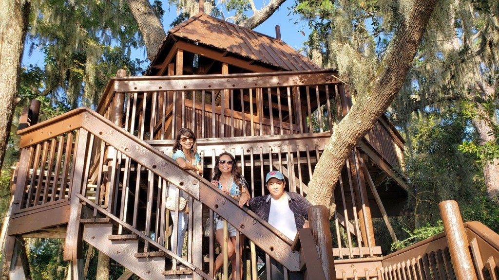
Ngôi làng Baytowne Wharf lẩn khuất giữa những lùm cây xanh mát. Trong làng có những quán ăn và khu trò chơi cho trẻ em. Mùa hè đông đúc thì tối có ca nhạc ngoài trời. Phía sau làng là bến thuyền và chỗ thả du thuyền xuống lòng vịnh Choctawhatchee rộng mênh mông.
Chụp hình kỷ niệm với Treehouse ở bến thuyền.
Dinner

About Sand
Cát dọc theo bờ biển Tây Bắc Florida là một trong những bãi cát trắng nhất, sạch nhất và mềm mại nhất trên thế giới! Điều bạn có thể không biết, đó là khi đi bộ trên các bãi biển ở đây, bạn thực sự đang đi bộ trên dãy núi Appalachian.
Dãy núi Appalachian chạy song song với bờ Đông nước Mỹ, bắt đầu từ cực Bắc là Canada xuống đến tiểu bang Alabama ở cực Nam, tổng cộng dài khoảng 2000 miles (3200 km).
Cát được tạo thành chủ yếu từ những mảnh tinh thể thạch anh rất nhỏ đã được những con sông rửa sạch từ trên núi.
Từ những ngọn núi, tinh thể thạch anh sau đó được đưa xuống Vịnh Mexico qua các con sông chảy vào vịnh, chẳng hạn như sông Apalachicola ở phía đông Destin. Từ Vịnh, nó trôi dạt vào các bãi biển khi thủy triều cuốn nó vào bờ, tập trung vào các bãi biển nguyên sơ ngày nay, và được làm trắng hơn nhờ sức nóng của mặt trời.
Du khách say mê và gọi là “những bãi biển trắng như đường” của Tây Bắc Florida. Cát tích tụ tạo ra các dải cát dọc theo con sông uốn khúc và các dòng suối trên hành trình dài của nó xuôi về phía nam đến các rìa của vùng nước màu ngọc lục bảo của Vịnh Mexico. Cát trắng giúp các bãi biển nơi đây không nóng lên vào mùa hè, đi chân trần trên cát vẫn mát. Sugar White Sand là sự bổ sung hoàn hảo cho Vùng nước xanh ngọc lục bảo của Vịnh Mexico.
Một trong những điều thú vị là quá trình này là nó vẫn đang diễn ra ngày hôm nay! Đó là lý do tại sao cát trắng đã không biến mất vì xói mòn mặc dù nhiều cơn bão đã đi qua khu vực trong những năm qua; Sông Apalachicola liên tục cung cấp thạch anh nghiền thàng bột cát mới vào bờ để giữ cho các bãi biển trắng như tuyết.


