Capitol Reef National Park is the second biggest national park in Utah, second only to Canyonlands National Park near Moab.
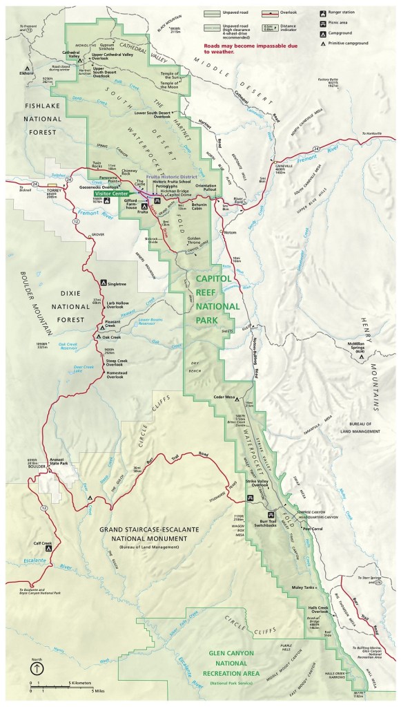
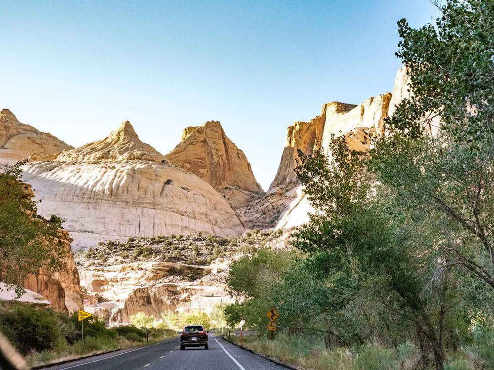
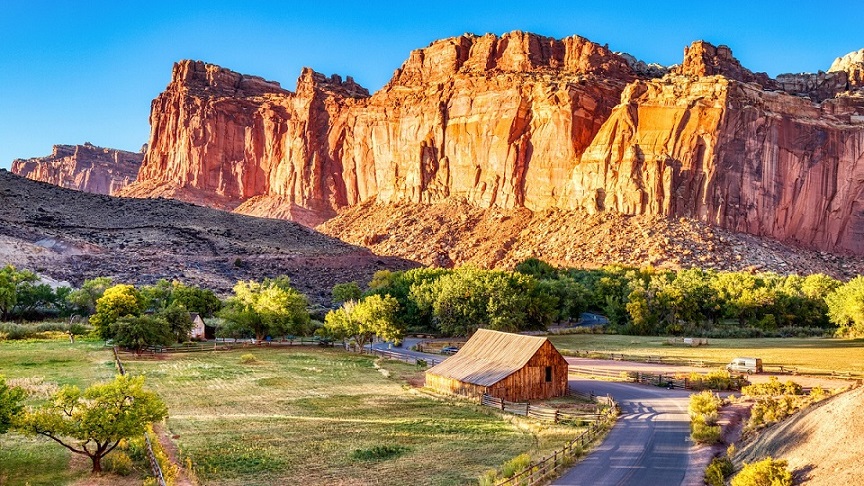
Located in south-central Utah in the heart of red rock country, Capitol Reef National Park is a hidden treasure filled with cliffs, canyons, domes, and bridges. Capitol Reef runs predominantly north to south, at 60 miles long but only 6 miles wide.
The area of Capitol Reef is located in what’s scientifically called the Waterpocket Fold, or a literal wrinkle in the Earth’s crust (as unnerving as that sounds) created over millions of years of deposition, uplift, and erosion. This fold extends for over 100 miles and creates a stunning visual display of rock that makes you feel like you’re driving into an actual shelf of ocean reef above-ground. This reef-like appearance lends to the park’s name, as well as the naturally-occurring white domes of Navajo Sandstone. These domes are visually similar to those found on the tops of “capitol” buildings throughout the U.S, hence the name Capitol Reef.
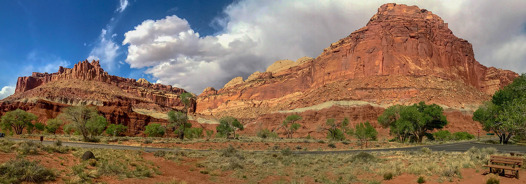
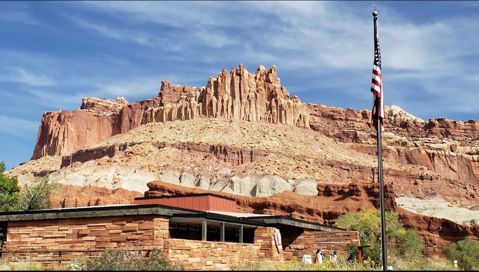
The Castle – Directly across the highway from the visitor center rises a huge sandstone cliff known as “The Castle”. At its highest point this colorful formation rises nearly 1,000-feet above the surrounding valley.
Capitol Reef is an easy going, straight forward and family friendly park to visit. You can visit in half a day and accomplish most of the best bits, unlike Zion, where you need at least two full days to do everything.
Fruita Historic District is the most-visited and most accessible part of Capitol Reef National Park. Many of Capitol Reef’s top attractions are located in this park area, just off Highway 24. Here you’ll find historic buildings from the Mormon homestead, the Capitol Reef Visitor Center, and several hikes and scenic drives.
The other two areas, Cathedral Valley and the Waterpocket District (Strike Valley), are more remote and difficult to access. Capitol Reef was named a national monument by President Roosevelt in 1937, and a national park in 1971.
Unlike other national parks, there is no official entrance station. Instead, visitors are expected to self-pay at either the visitor center or the north end of the Capitol Gorge Scenic Drive.
Sites to See Along Capitol Reef NP -Driving Tour
Capitol Dome
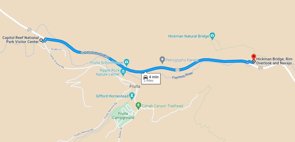
Capitol Dome is best viewed from the Hickman Bridge Trailhead, on Utah State Route 24, two miles (3.2 km) east of the visitor center. The trailhead parking area has a vault toilet and is suitable for passenger cars and a limited number of RVs.
Capitol Dome is a majestic white sandstone formation that resembles the U.S. Capitol building. The park was partly named for this landmark.
https://goo.gl/maps/cKuaEfjahFnWG3bZA
Scenic Drive
Beginning in the Fruita District and ending at Capitol Gorge Road. More than ten viewpoints along this short drive have must-see views of this park’s historic area.
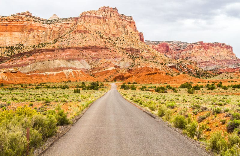
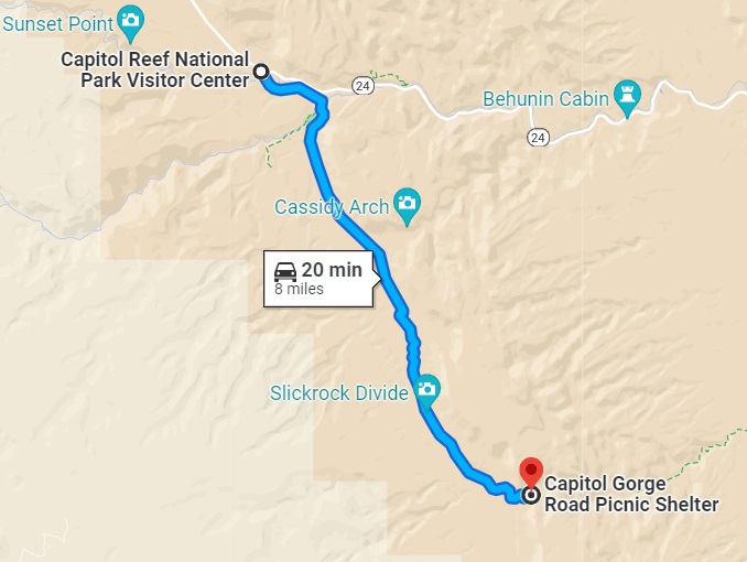
The Capitol Reef Scenic Drive is the perfect way to get up close and personal with the Waterpocket Fold. This 8-mile stretch begins at Gifford House near the Fruita Utah orchards and continues to the Capitol Gorge trailhead parking lot. Along the way, you’ll see varying mesas and plateaus of all different colors plus unique plants and vegetation. There are plenty of pull-outs along the way if you want to get out and explore further on foot. Make sure to set aside 1 -1 1/2 hours to do this drive at your own pace.
Continue south past Slickrock Divide to where the rock lining the reef deepens into a ruby red and forms odd columns and spires that resemble statuary. Called the Egyptian Temple, this is one of the most striking and colorful areas along the road.
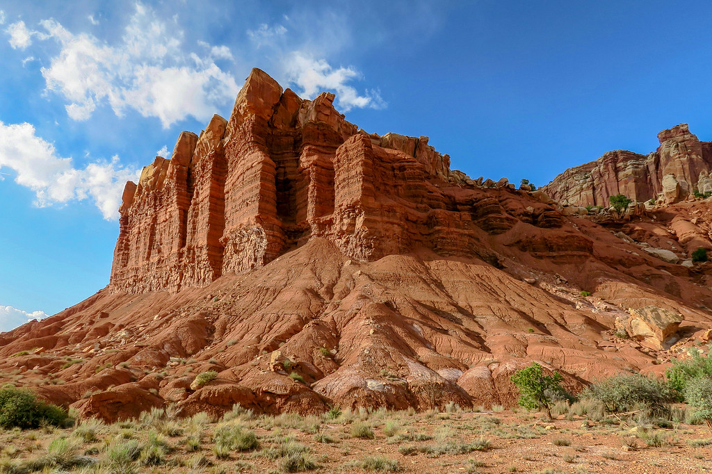
A formation known as the Egyptian Temple along the Scenic Drive in Capitol Reef National Park. The Egyptian Temple provides one of the most striking and beautiful examples of weathering and erosion.
A few miles into the scenic drive, you’ll reach the turn for the unpaved Grand Wash Road, providing access to popular trails like the Cassidy Arch Trail.
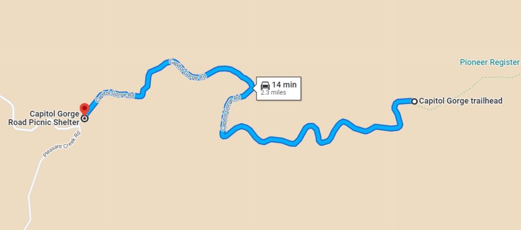
At the end of the 8-mile drive, the unpaved Capitol Gorge Road continues for another 2 miles.
https://goo.gl/maps/oFf45htmfAbyhSMeA
Capitol Gorge Road
Followed the Scenic Drive, taking in the wide open spaces and richly colored towering bluffs then turned onto the Capitol Gorge Road, an unpaved road that was 2.4 miles (3.8 km) one way. Taking this road as not only is the scenery breathtaking but you can also see up close impressive geology, such as solution pockets.
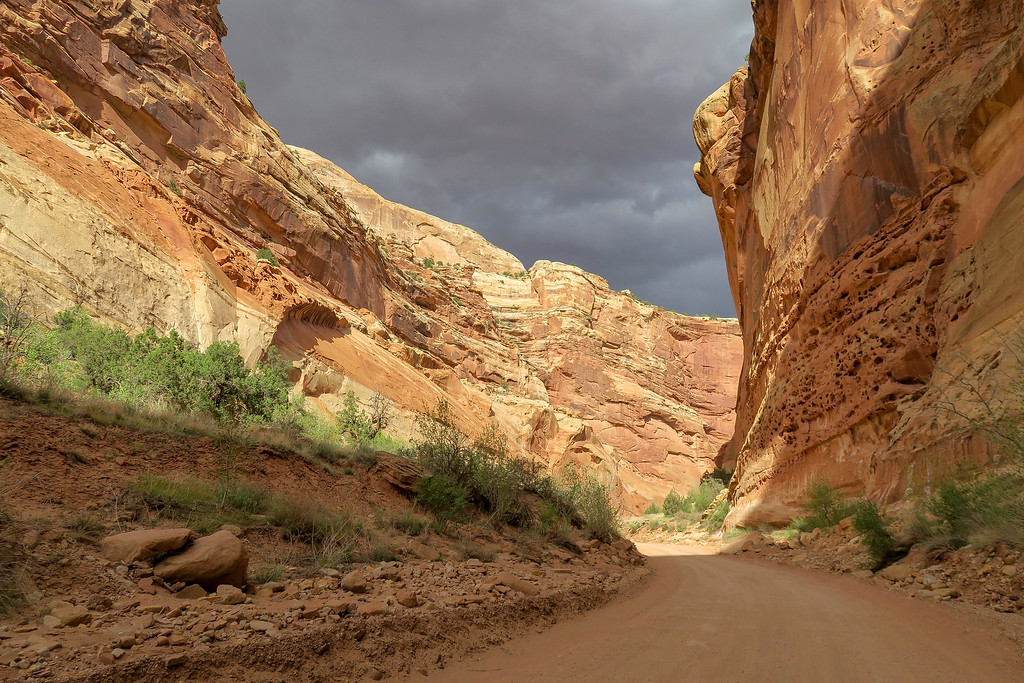
The deeper into the gorge the tighter the surrounding cliffs squeezed in.
Solution Pockets are found in sediment that has become rocks from being under immense pressure. Weak parts of the sediment have been eroded away by the elements, leaving small pockets in the rock’s surface, which I found to be interesting to look at.

Capitol Gorge is about 2.5 miles and ends at a trailhead to Capitol Gorge. the road is levely as it winds up through a canyon. Be sure to take the short trail further into the gorge, where you will see interesting geology, pioneer carvings, and diverse flora.
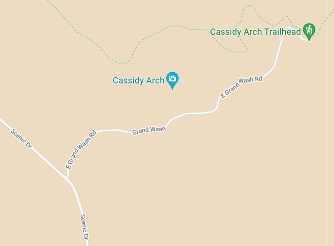
Grand Wash Road
Turn off Scenic Drive onto Grand Wash Road, which extends 1.3 twisting miles, to reach the Grand Wash trailhead and several scenic and historic pullouts. The trailheads for the Cassidy Arch Trail and Grand Wash Trail are at the end of the road, along with parking and restrooms.
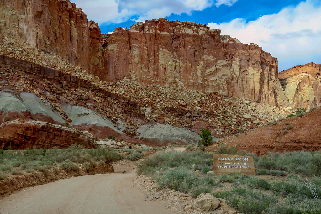
Grand Wash – About three-and-a-half miles south of the visitor center, on Scenic Drive, a gravel road breaks east into a nearby canyon. This is the road through Grand Wash. At about a mile-and-a-half in length
The Scenic Drive leaves the Fremont River valley and climbs a desert slope, with the rock walls of the Waterpocket Fold rising to the east. Turn east to explore Grand Wash, a dry channel etched through the sandstone. A dirt road with sheer rock walls rising along the sandy streambed.
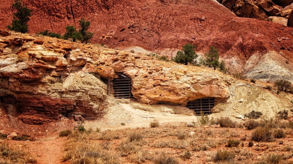
Uranium Mines – Immediately after turning onto Grand Wash Road our attention was drawn to a couple small holes dug into the base of the adjacent cliff. Believe it or not these are historic uranium mines dug in the early to mid-20th Century. When the park was created, and then expanded, many of these old mines were shut down.
Fruita Historic District
Pick Fresh Fruit and Walk Through History in Fruita Utah
The small settlement of Fruita inside the park has more than 2,500 fruit trees, some of which were originally planted by Mormon pioneers. Fruita was first established by Mormon settlers in 1880 and received its namesake due to its vast collection of orchards. Today the settlement is federally owned, and visitors can stroll through the orchards and eat fruit fresh off the trees.
Although the orchards are considered “historic landscape,” visitors are encouraged to explore and pick fruits freely. Picking is free.
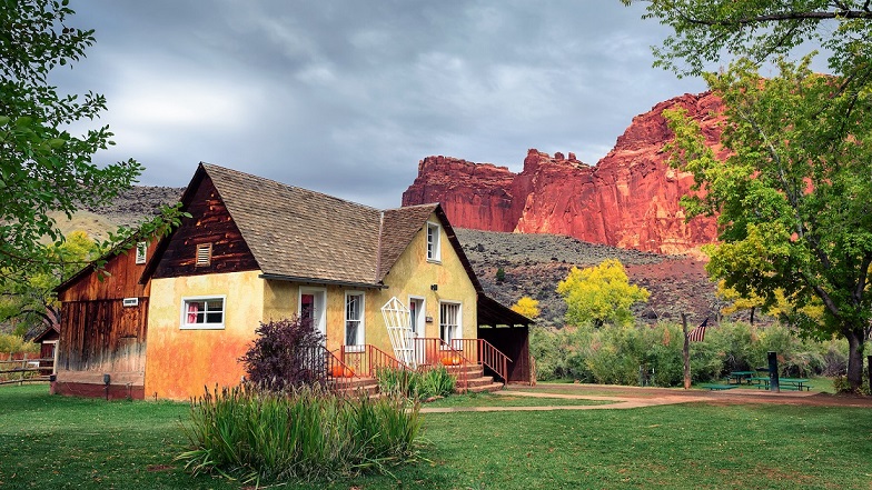
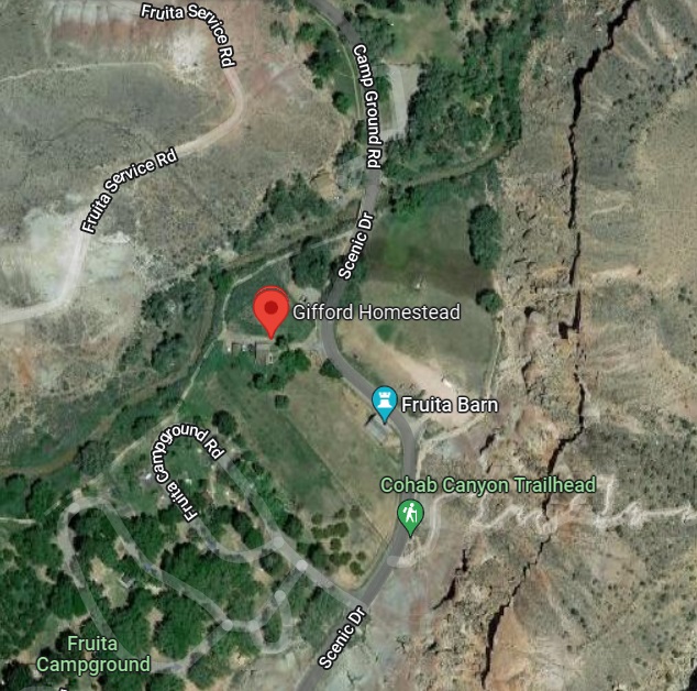
Visit the Gifford Homestead in the Fruita Valley, which was important enough for famous Western writer Wallace Stegner to describe it in his book American Places. The restored farmhouse, along with its barn, smokehouse, and garden, was built in 1908 by a Mormon polygamist and gives visitors a picture of Mormon life in the early 1900s.
The Gifford Homestead, one of the last remaining structures in old Fruita, sells local craftsmen’s dolls, soap, quilts, jams & jellies, and books. The pie, on the other hand, is the star of the show. They’re well-known for their fruit pies made with locally farmed ingredients! Stop in for some ice cream and a slice of fresh fruit pie. They should not be missed!
You may buy exquisite baked pies, coffee, scones, and cakes inside the home, which you can enjoy on picnic tables right outside the front door, surrounded by a serene scenery. The greenery of Gifford Homestead will astound you, especially after seeing the canyons’ red colors!
https://goo.gl/maps/XUHte7ETsDCpbLU56
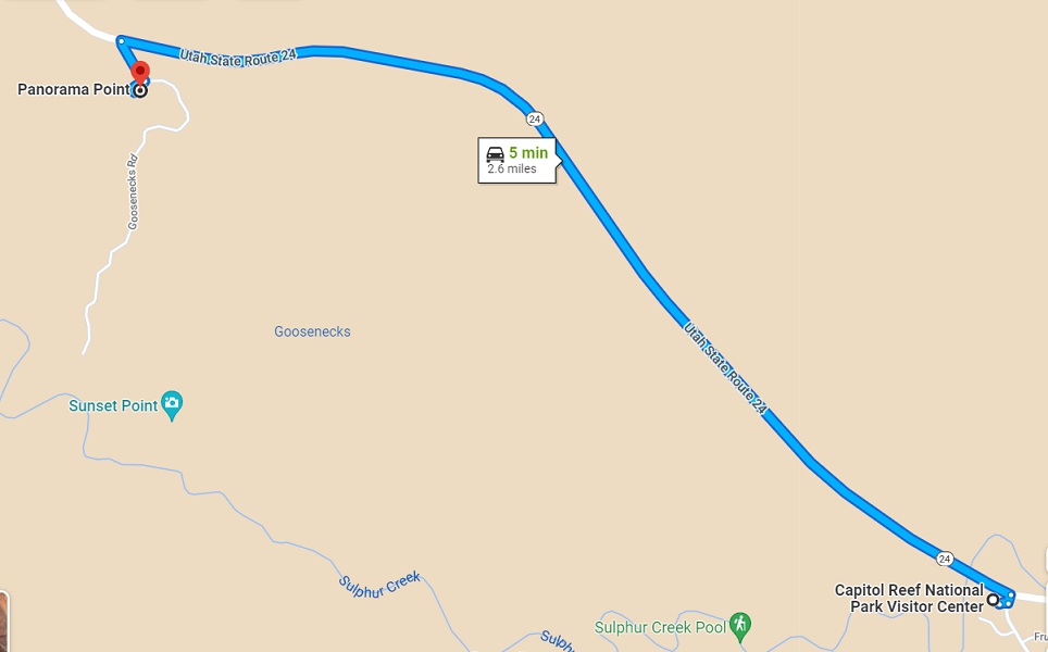
Goosenecks
Catch the Views at Goosenecks and Panorama Point for Epic Views of the Waterpocket Fold

For dramatic and vertigo-inducing views of the steep canyons created by the Waterpocket Fold, take the turn-off from Route 24 towards the Goosenecks Overlook. On the way you’ll find Panorama Point, a quick drive on a paved roadway to a viewpoint that gives you the promised 360-degree views. However, suppose you continue further along the gravel road. In that case, you’ll arrive at the Googenecks, a super easy 0.1-mile trek allowing you to look directly down the steep canyon edge created by a simple sulphur creek below. This drop is believed to have formed over the last six million years and the very bottom exposes Kaibab Limestone, which can be up to 270 million years old!
Chimney Rock
The most recognizable rock formations in Capitol Reef can be spotted from the road. Chimney Rock is a tall, vertical stretch of the mesa that has been separated from erosion to form its own unique column reaching up to the sky.
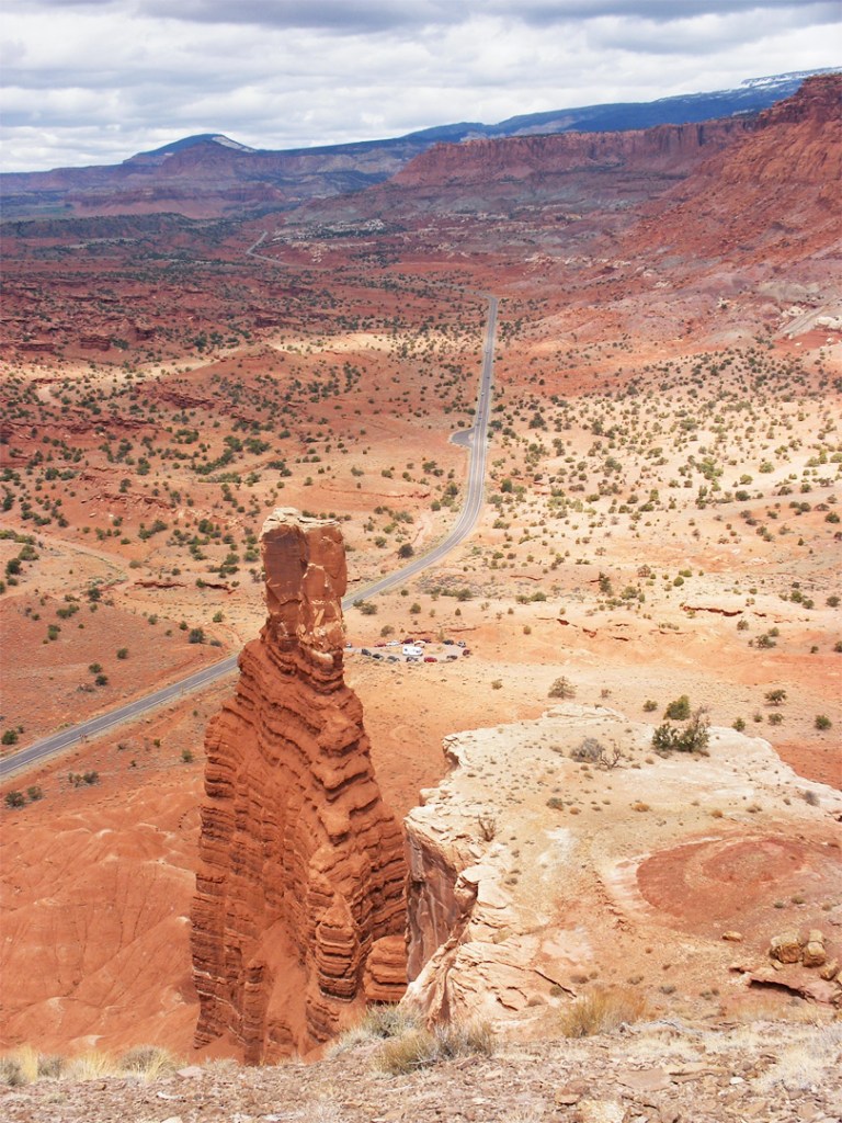
Chimney Rock is an impressive stone tower located along Highway 24 about three-miles west of the visitor center.