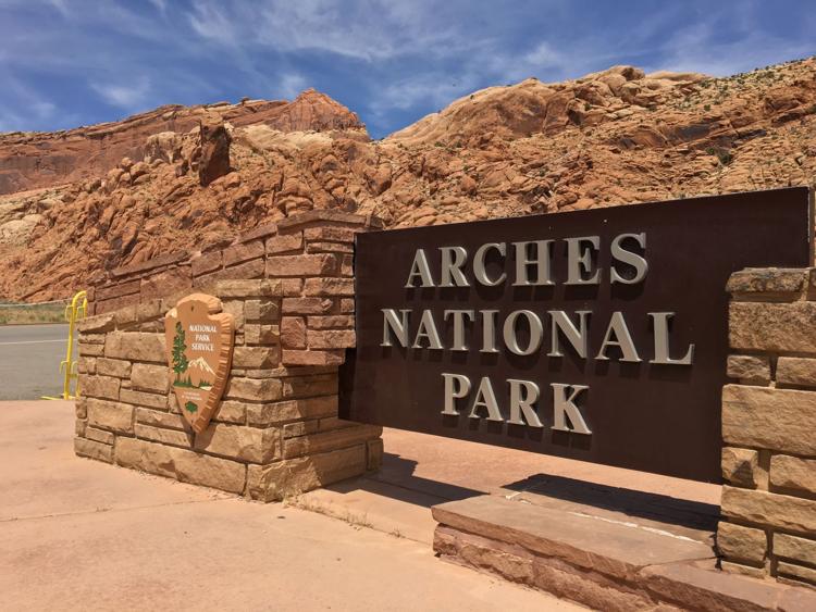
Arches National Park is one of the top national parks in America: it’s a 73,234-acre wonderland of eroded sandstone fins, towers, ribs, gargoyles, hoodoos, balanced rocks, and, of course, arches northwest of Moab. The park protects an amazing landscape that includes the largest proliferation of arches in the world. Over 2,000 arches have been cataloged in Arches National Park.
Driving through Arches National Park
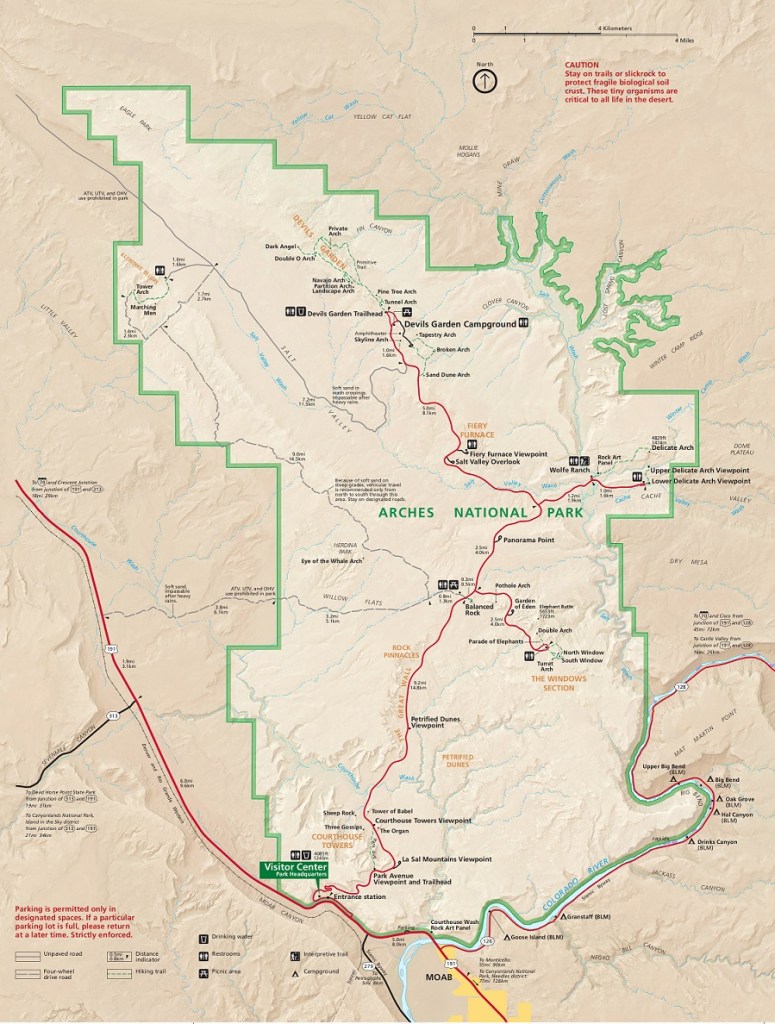
You can spend a couple hours or the better part of a day driving the 36 mile (round trip) road through Arches National Park. With plenty of places to stop and snap pictures and panoramic views for miles, you can enjoy the brilliant artistry and majesty of Arches without having to leave your vehicle.
Best places to stop during a drive through Arches National Park
If you’re simply just driving through the park and time is a luxury, making a stop at all the designated view points and points of interest is really the best way to get the most of your experience. If time is of concern, or you really want an abbreviated tour featuring the highlights, we recommend the following itinerary:
LA SAL MOUNTAINS VIEWPOINT
Make your first stop the La Sal Mountains Viewpoint to take in the amazing sight of the La Sal Mountains, Utah’s second highest mountain range, juxtaposed against Arches’ red rock spires.
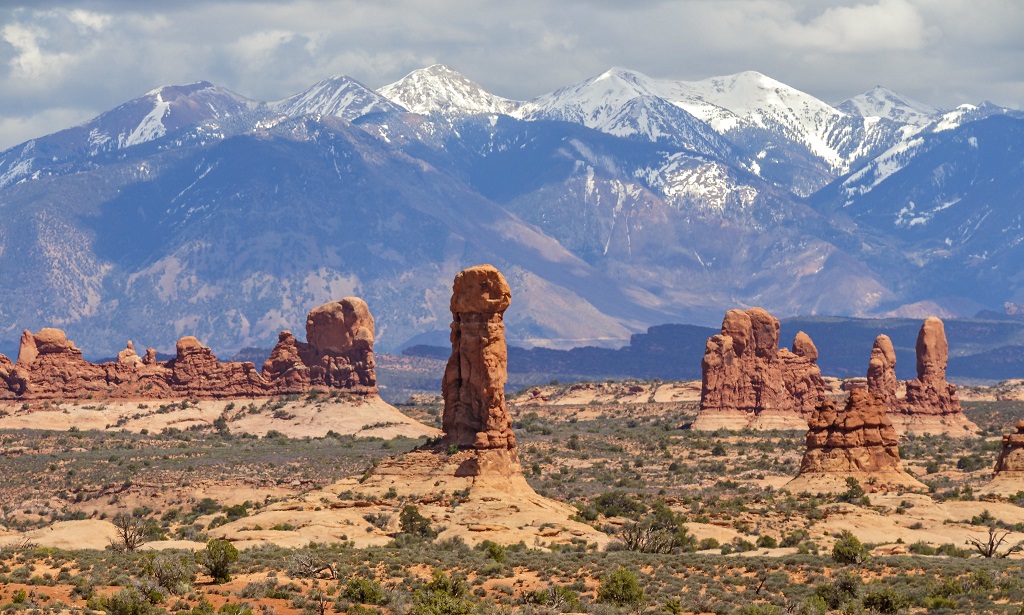
La Sal Mountains, Panorama Point, Arches National Park
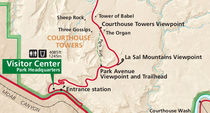
COURTHOUSE TOWERS VIEWPOINT
Courthouse Towers Viewpoint should be your next stop to click a quick picture of the towering skyscraper-esque sandstone walls and spires.
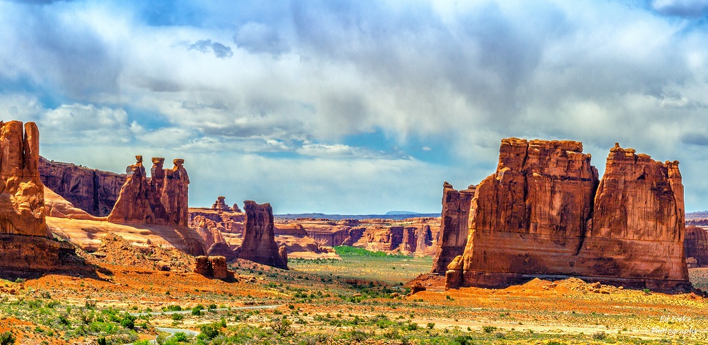
The courthouse towers on the right, rise 4800 feet from the desert floor, with the three gossips on the left greets visitors at Arches National Park near Moab Utah
BALANCED ROCK
Balanced Rock is arguably one of the most unique formations in the Park and a must see on your tour.
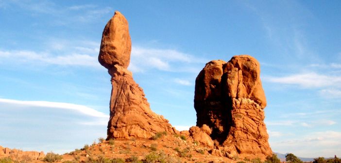
Likewise, Balanced Rock is worth a quick stop. You’ll drive past it numerous times in the park so you may as well park and walk up close once.
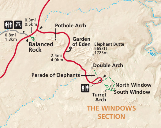
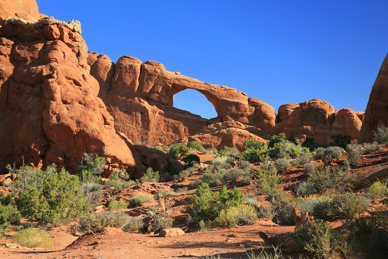
THE WINDOWS SECTION
Just past Balanced Rock, take a right and the road will end after a few minutes at the Windows trailhead. Take the trail/sidewalk and you’ll quickly get to the North Window Arch and South Window Arch on your left, or Turret Arch on your right. There’s an option to hike a slightly longer trail (the Primitive Loop) but really you can just stay on the paved trails and see the main arches.
Double Arch
Double Arch is an incredible formation of arches within the Windows area of Arches National Park, an area with the largest concentration of natural arches in the entire world. Double Arch takes its name because of it consists of two arches that share the same stone as a foundation for both of their outer legs. Double Arch was formed by downward water erosion from atop the sandstone, rather than from side-to-side water erosion.
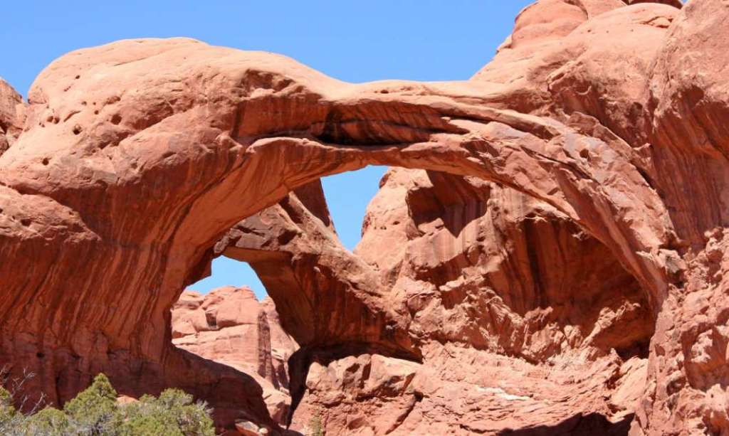
Double Arch is the tallest and second-longest arch in the park. You can view the arch from the parking lot or take a short walk to its base.
It only takes five minutes or so to reach Double Arch from the parking area, on a flat path, and then you can simply enjoy it or you can climb around. Plan for maybe half an hour at Double Arch.
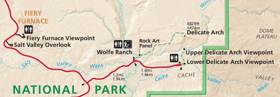
DELICATE ARCH VIEWPOINT
Continue to the Delicate Arch Viewpoint, follow the road all the way until the end. Here, you will need to park your vehicle and take a short walk to get a view of the Arch that is famous across the world.
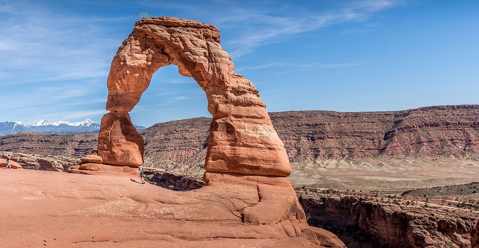
Other lists start with Delicate Arch as a must-see. It’s the iconic arch in the park, and it’s even on Utah’s license plates. But the hike is moderate and takes 45 minutes to an hour from the parking area (a few minutes down Delicate Arch road from Arches Scenic Drive).
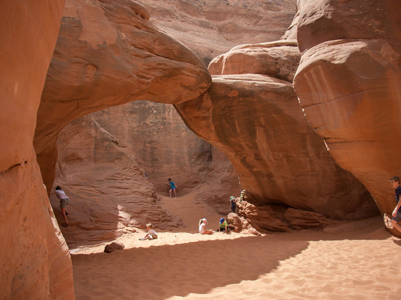
SAND DUNE ARCH
Sand Dune Arch is roughly a half-hour drive from the Visitor’s Center / Entrance Gate. Drive past the two main side roads of the park (the roads to The Windows and to Delicate Arch) and several miles farther on the parking lot for Sand Dune Arch will be on your right and nicely marked. Park and walk just a few minutes along the trail to a narrow canyon which leads to the arch. The sand is thick once you enter the canyon, so I highly recommend taking off your shoes, depending on how much scrambling you’re going to do.
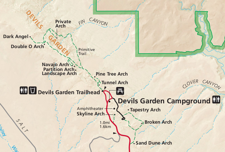
SKYLINE ARCH
Skyline Arch is an easily accessible and photographable arch and the last recommend stop before reaching the end of the park and making the turn around at Devils Garden.
This arch is very intriguing, because it doubled in size about 75 years ago when a large chunk of rock tumbled out. The trail under the arch leads to this rubble.
Even if you don’t plan to hike to Skyline Arch, make sure to stop and check out the sign at the trailhead. It shows the arch before it doubled in size, and you get a nice idea of how this slow process can happen quickly. The Arch is beautiful and always framed against the sky, which gives it the name Skyline. In fact, at the end of the trail, the arch is about 75 feet above your head at the top of an unscalable wall.
LANDSCAPE ARCH
At the very end of Arches Scenic Drive is the Devil’s Garden Trailhead mostly-flat path to Landscape Arch, stopping to see Tunnel Arch and Pine Tree Arch along the way. .
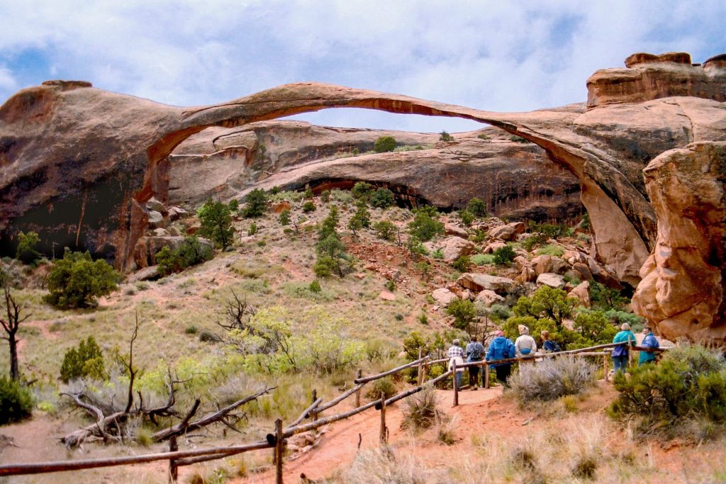
Landscape Arch is the longest of the many natural rock arches located in the Arches National Park in the U.S. state of Utah. The arch is among many in the area known as Devil’s Garden in the north area of the park. It can be reached by short walk/hike along a maintained trail.
EXIT PATH
You’ll exit the Park via the same road, so if you feel you missed something, you can catch it on the way out.