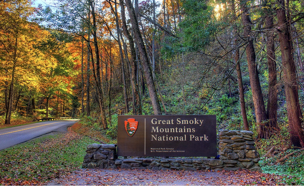
Day 1
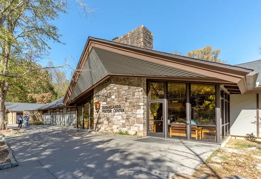
Sugarlands Visitor Center
Visit Sugarlands Visitor Center to pick up a free park map. Cell service is dodgy in the park, so a map is very helpful!
https://maps.app.goo.gl/1U1Rp4VMbJXXoCsP6
The Sinks
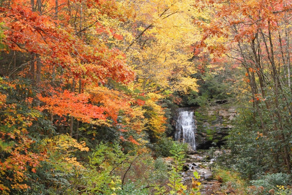
The Sinks area of the Smoky Mountains National Park is one of the most picturesque spots along the Little River Road scenic drive. This area, which is 12 miles west of the Sugarlands Visitor Center, offers visitors the chance to see Mother Nature at her finest!
The Sinks formed where a beautiful mountain river makes an S-turn creating natural pools that are outlined on both sides by humongous river boulders. It offers crystal clear water, natural pools, and a waterfall that make this an excellent spot to get out of the car and stretch your legs.
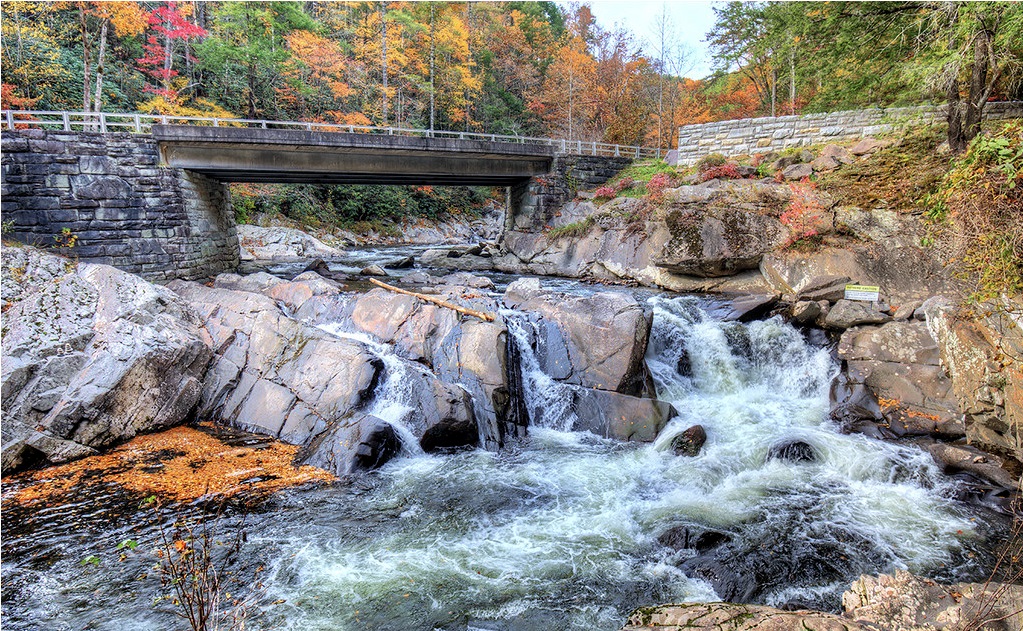
https://maps.app.goo.gl/ygzcLNcdbjBM7WxVA
Meigs Falls
You can see this one from the road so it’s a great spot for low effort, high reward.
https://maps.app.goo.gl/QEM3cyNRSBWFKaz38
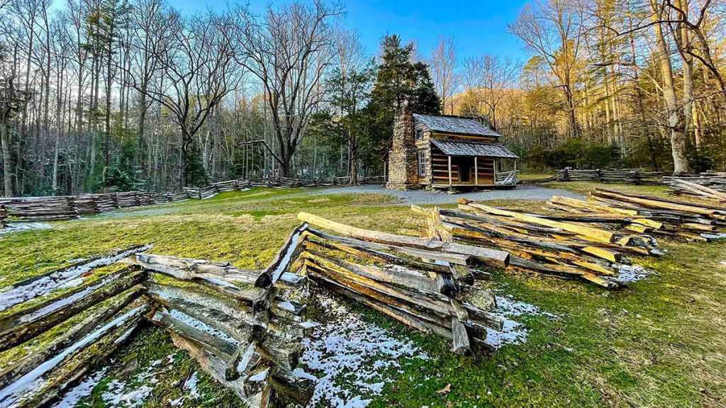
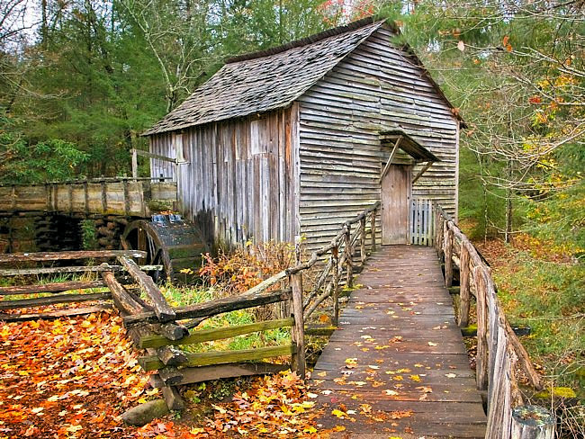
Cades Cove
Cades Cove is a picturesque valley with lots of places to stop, specifically for historic structures and wildlife. You can walk to John Oliver Cabin, Elijah Oliver Place, Cable Mill, and the Primitive Baptist Church, among other spots along the loop.
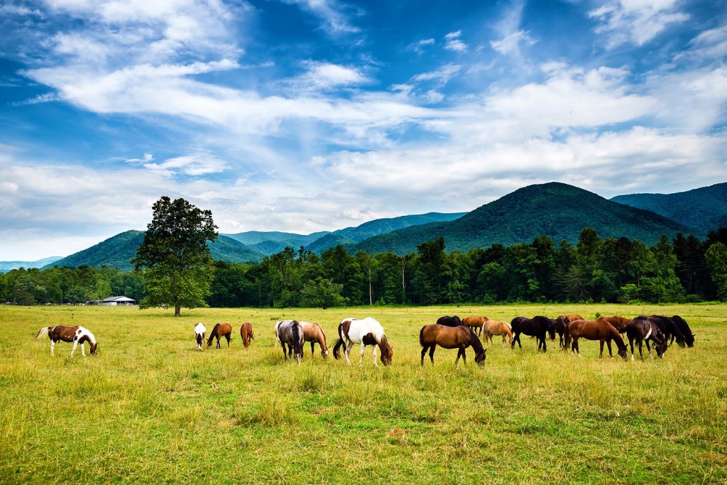
There are also horses, turkey, and occasionally bears that roam this area. Be safe and stay a safe distance away no matter what.
Cades Cove takes around 2-3 hours to drive, even though it’s only an 11-mile loop road. That is because the traffic is extremely slow, especially in the fall and summer. It’s a single lane road so be prepared to stop and be in the car (with no escape) for a couple hours.
https://maps.app.goo.gl/oRkqdTSe5GtM3WYC9
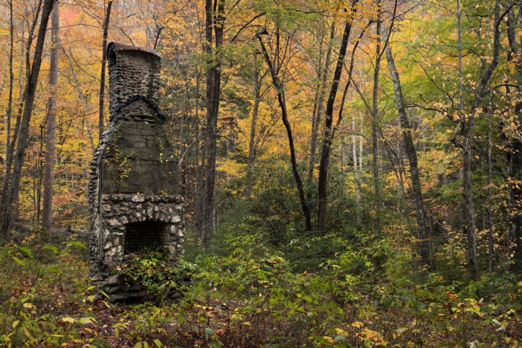
Elkmont Ghost Town
The area was originally settled in the 1840s and gained popularity in the early 1900s when a lumber company was formed. However, the national park was established in 1934 and by 1992 the residents’ leases expired and the town was abandoned. Now the historic structures sit there for travelers to visit.
Elkmont Ghost Town is located near Elkmont Campground so follow the signs for the campground at first. When you see a sign for the Elkmont Nature Trail turn left and you’ll find the parking lot for the ghost town.
https://maps.app.goo.gl/dzmMs2aJ82YparwP7
Emert’s Cove Covered Bridge
If you’re looking for an impressive historical spot located minutes from downtown Gatlinburg, pay a visit to Emerts Cove Covered Bridge. This impressive bridge takes you back in time as you think about the history of the community and its early settlers. Frederick Emert, a soldier in the Revolutionary War, settled in this area in 1790. The bridge is named after him and his family since he was the first settler in the area.
When you arrive, you’ll see the impressive architecture of this log cabin-style structure. It shows off themed decorations during certain holidays, including an evergreen wreath at the front. Cut-out windows line the bridge, giving you an impressive view of the surrounding Great Smoky Mountains National Park. The bridge sits above the water on concrete feet, surrounded by trees and the rushing river. When the water is clear, you may spot fish swimming up the creek as they look for food.
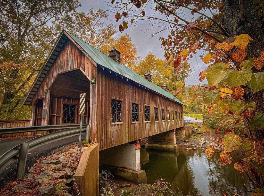
Emerts Cove Covered Bridge is the perfect spot to take photos, offering a beautiful backdrop with historical roots. You might catch a glimpse of a bridal party taking pre-wedding photos here since the deep green roof and natural wood structure contrasts a white wedding dress nicely. You can walk across the bridge and take a tour of the historic City Hall nearby. Keep walking for a short distance, and you will reach the cemetery, which is Frederick Emert’s final resting place.
https://maps.app.goo.gl/K8No1NFdYiK7Ry4q6
The Village Shops
634 Parkway, Gatlinburg, TN 37738
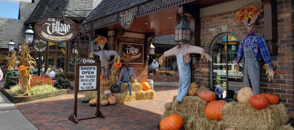
https://maps.app.goo.gl/GFEAr274hE7BhyHx8
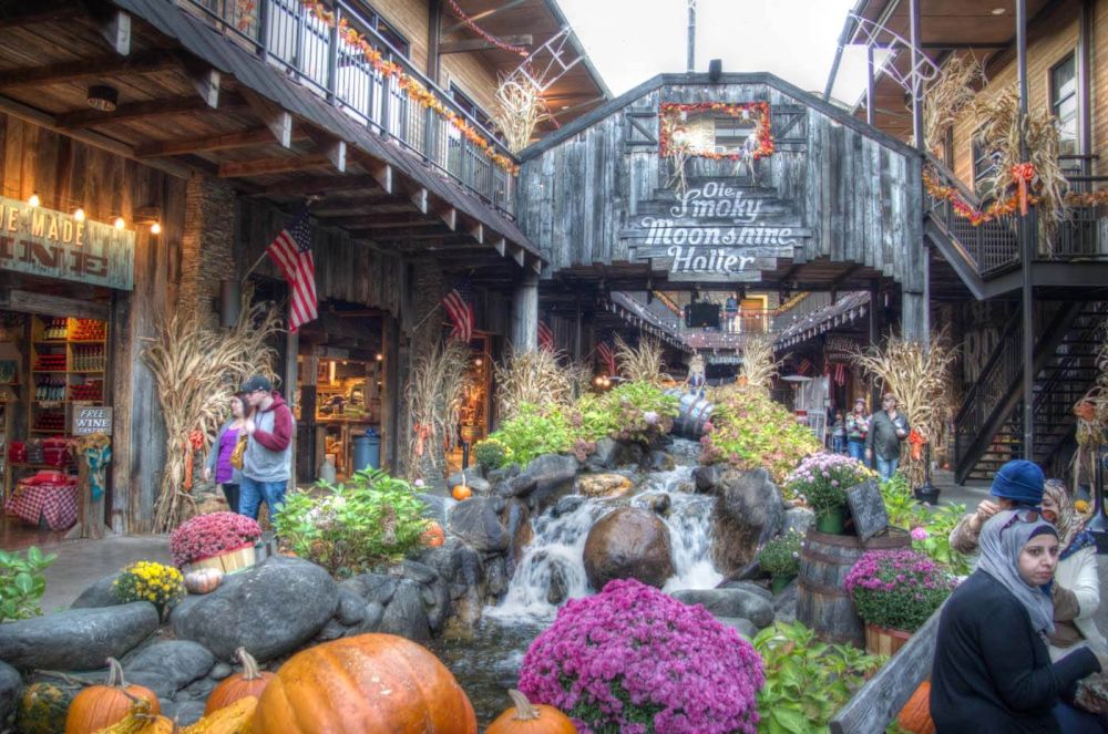
Ole Smoky Distillery
903 Parkway #128, Gatlinburg, TN 37738
Day 2
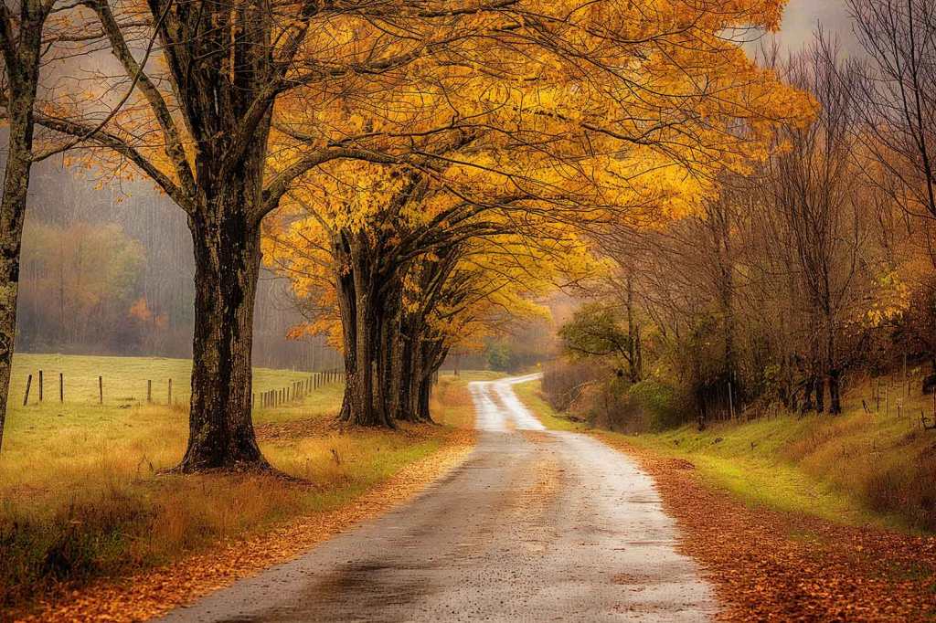
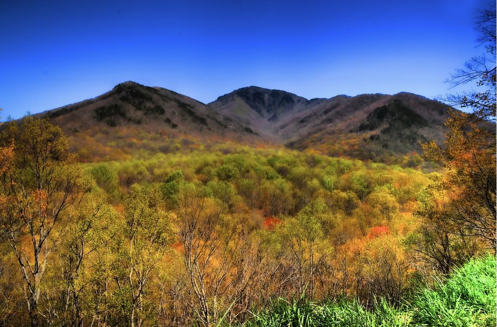
Newfound Gap Road is known as one of the most popular scenic drives in the Smoky Mountains. It has an elevation of 5,056 feet, making it the lowest drivable pass through the Great Smoky Mountains National Park. Along Newfound Gap Road, you can experience a variety of forests, like cove hardwood, pine-oak and northern hardwood forests, before getting to the evergreen spruce-fir forest at Newfound Gap.
Newfound Gap Road travels for 33 miles from Gatlinburg, Tennessee, to Cherokee, North Carolina. The reason why visitors love this scenic drive so much is because it allows them to experience a little bit of everything the park has to offer. It typically takes about an hour to drive, depending on traffic, of course. The drive includes plenty of opportunities for you to stop and enjoy the scenery. Start your driving tour at the Sugarlands Visitor Center, where you can buy a Newfound Gap Road driving tour booklet to learn more about what to expect along your drive.
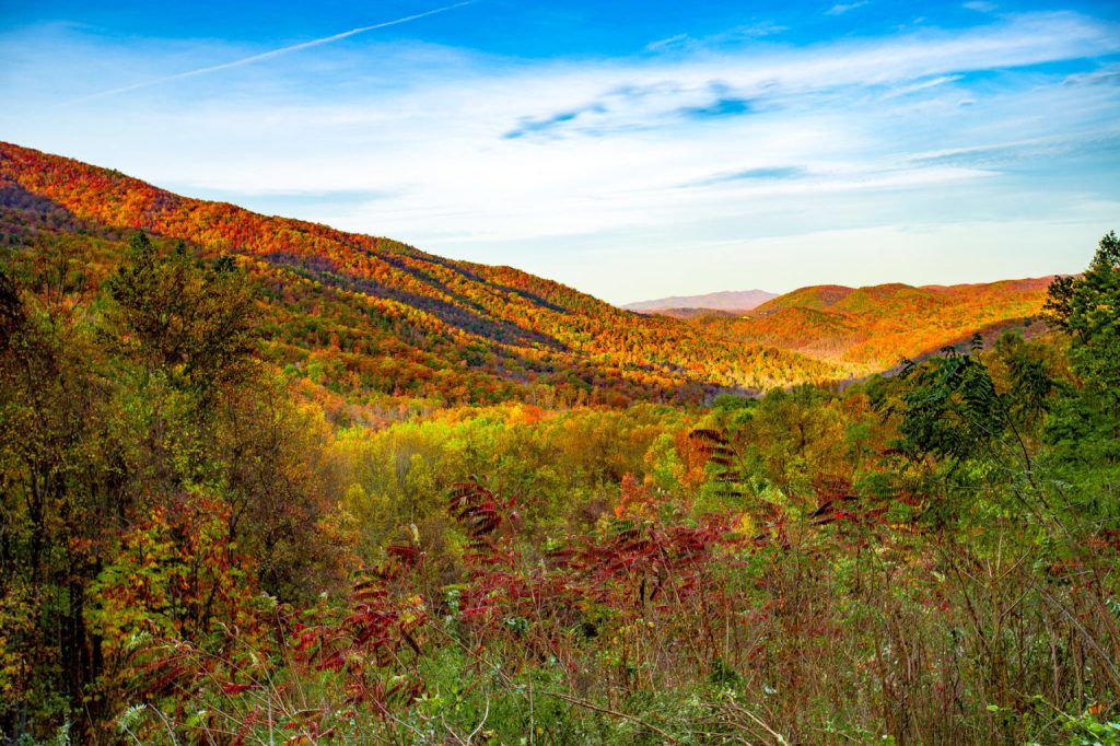
Carlos C. Campbell Overlook
This overlook is the first along Newfound Gap Road (US 441) when traveling south from Sugarlands Visitor Center. Campbell Overlook. You’ll have gorgeous views of Mount LeConte!
This scenic overlook provides a sweeping view of the various types of forests covering the slopes to the east. You’ll see spruce-fir forest at the top, northern hardwood below, hemlock forest nestled in the valley and, just to the north, cove hardwood forest. You can also spy pine-oak forest and a small heath bald. A signpost helps show where to look to see the different forest features.
The scene is at its most dramatic in autumn, when golds, reds and oranges blaze across the mountain. The overlook is located about 2.5 miles south of the Sugarlands Visitor Center. Look for the small parking area to the left as you’re driving south.
https://maps.app.goo.gl/YikrNTi8RaMewExWA
Newfound Gap
Newfound Gap & Rockefeller Memorial – Of course, one of the highlights of Newfound Gap Road is Newfound Gap itself. This is the place where President Franklin D. Roosevelt dedicated the Great Smoky Mountains National Park. You’ll be able to see the Rockefeller Memorial where it all happened! This can be found about 14.7 miles along Newfound Gap Road.
Newfound Gap provides one of the must-see spots of Great Smoky Mountains National Park, and it’s also one of the easiest to access. At the parking area off Newfound Gap Road, you can look out on the majestic Smoky Mountains and see what makes this area so beautiful.
This is the lowest driveable spot on the ridge of the Smokies at 5,046 feet. It’s also just seven miles or so from the highest spot in the mountains at Clinmans Dome, another 1,500 feet in elevation.
The Newfound Gap Overlook also allows you to stand in two states at once!
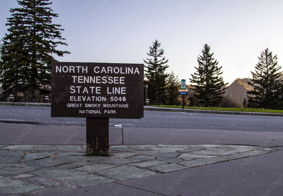
Another perk of stopping at the Newfound Gap Overlook is the draw to stand in two states at one time! Both Tennessee and North Carollina share Great Smoky Mountains National Park.
https://maps.app.goo.gl/QZsMRfP9pwsieXPP6
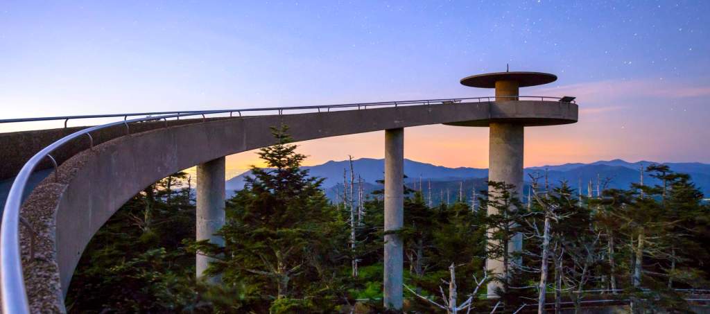
Clingmans Dome
Clingmans Dome Road – If you’ve always wanted to visit Clingmans Dome, Newfound Gap is the best route to take! Turn off of Newfound Gap Road onto Clingmans Dome Road, where you can drive to the parking area to then hike to the observation tower.
As the highest point in the Great Smoky Mountains National Park and in Tennessee, Clingmans Dome towers at 6,643 feet tall. Located along the state-line ridge, Clingmans Dome is a popular park destination.
The observation tower on the summit of Clingmans Dome offers spectacular 360° views of the Smokies and beyond for those willing to climb the steep half-mile walk to the tower at the top. On clear days views expand over a 100 miles.
Temperatures at the dome can be 10-20 degrees Fahrenheit cooler than in the surrounding lowlands. Dress in layers and be sure to bring a jacket, even in summer.
https://maps.app.goo.gl/MKTLbCUEHQ5xfGQQ8
Mingus Mill
Mingus Mill, in the Great Smoky Mountains National Park, is a historic and active grist mill, located just a short distance past the Oconaluftee Visitor center near Cherokee North Carolina.
Both the mill itself and the land surrounding the mill are beautiful. The mill is a popular stop for people traveling through the park, and especially for photographers.
Built in 1886, it still stands at its original site. It uses a water-powered turbine instead of a water wheel to power all the machinery in the building.
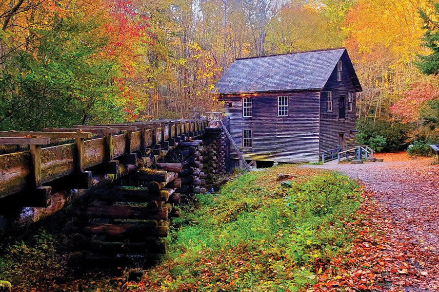
The gristmill is one of the most iconic signs of early Appalachian living, and one of the largest and best preserved is the Mingus Mill at Great Smoky Mountains National Park.
This mill is still in working order. It’s also one of the most interactive places to visit in the Smokies. You’ll find more than a mill here – demonstrations, stories, cemeteries, trails, and waterways all fuel the legendary Mingus Mill.
https://maps.app.goo.gl/cnKZTJQjGBLsQ2y78
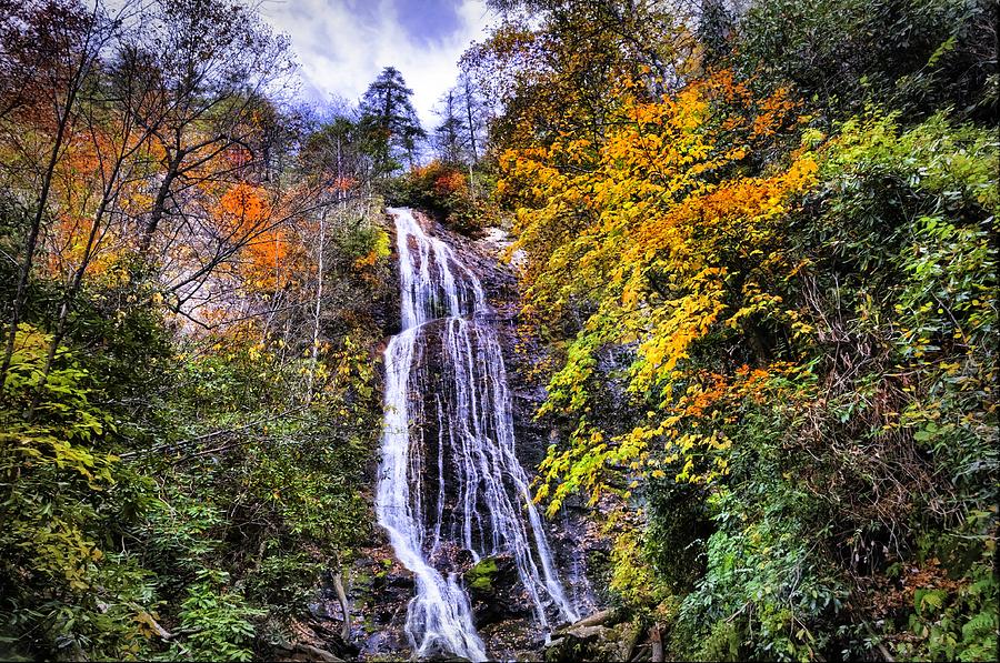
Mingo Falls
Mingo Falls, called Big Bear Falls in the Cherokee language, cascades nearly 200 ft. down granite boulders. It’s located near the town of Cherokee. The beautiful 1/4-mile hike to the waterfall along the rushing stream is short, but you must climb 161 steps. At the top of the stairway, a short path past impressive rock outcroppings leads to a viewing bridge at the base of the falls.
https://maps.app.goo.gl/Z6i5AoHLTDQSd5Sw8
Cherokee, North Carolina
Cherokee, NC, the capital of the Eastern Band of Cherokee Indians, one of only 3 Cherokee tribes recognized in the United States. The land itself is where Cherokee Indians have lived for centuries and is located on the border of Great Smoky Mountains National Park. The area is still rich in its ancient customs, culture, history and traditions.
https://maps.app.goo.gl/DNYRXkj2XQAkvzC57
Harrah’s Cherokee Casino Resort
777 Casino Dr, Cherokee, NC 28719

Day 3
Roaring Fork Motor Nature Trail
The Roaring Fork Motor Nature Trail is a one-way, scenic loop that is 6 miles long. The quick trip will provide plenty of views of mountains, streams, mills, and other historic buildings.
The narrow roadway only allows cars—trucks, trailers. Unfortunately, RVs cannot fit on this road. Drive along the road and immerse yourself in the mossy green rocks and boulders as you gaze at the water rushing through the mountains.
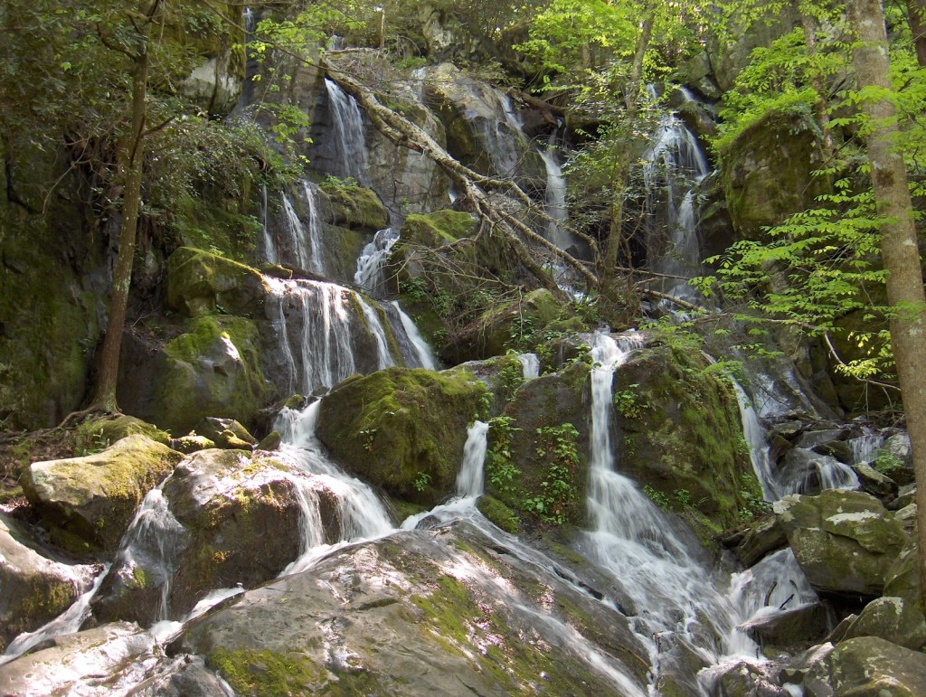
The Motor Trail Ends With The Place of a Thousand Drips. This cascading waterfall is fed by the Cliff Branch stream which flows out of a hole in the rock and cascades down 20-30 ft.
https://maps.app.goo.gl/as7tVCbkx8GDaJdCA
Foothills Parkway
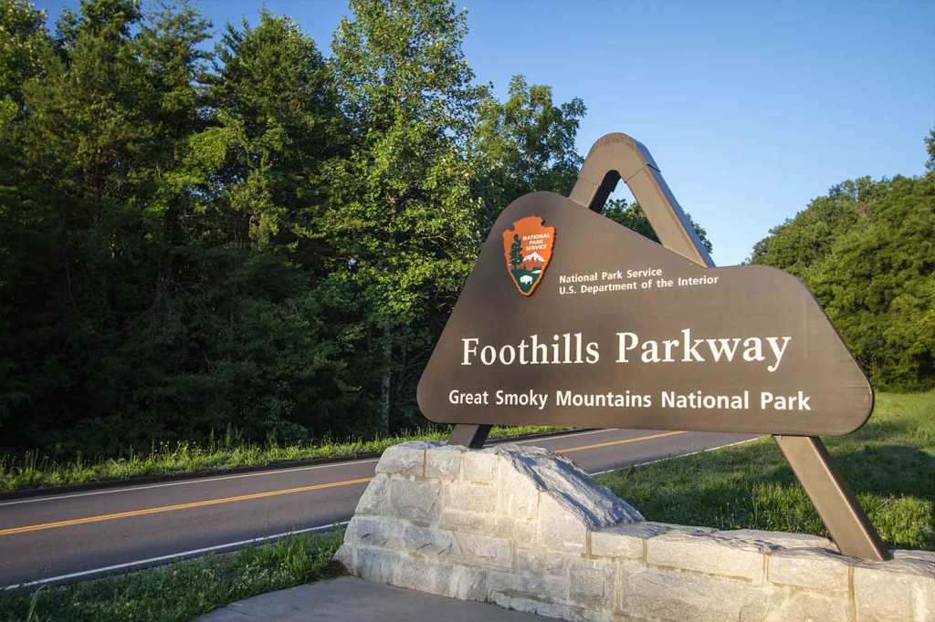
Spending time in the foothills of the Smoky Mountains has its way of elevating your spirits! Foothills Parkway offers panoramic views of the picturesque Smokies along a peaceful road that meanders through the area’s distinct features. Stop at one of several overlooks to breathe in the fresh mountain air, soak up the beauty and snap some photos! Take a break at a picnic area along this route for a family meal served with a hearty side of views.
https://maps.app.goo.gl/xqLz8YcCMj4XxWoD7
Pigeon Forge
Pigeon Forge, a mountain town and vacation area in eastern Tennessee, is the home of Dollywood, country singer Dolly Parton’s Appalachian-themed park consisting of rides, an adjoining water park and a museum of her costumes and memorabilia. The city’s other attractions include country music revues like the Smoky Mountain Opry, dinner theaters such as Dolly Parton’s Dixie Stampede and outlet malls.
https://maps.app.goo.gl/SvDQuMaGy76e4kk59
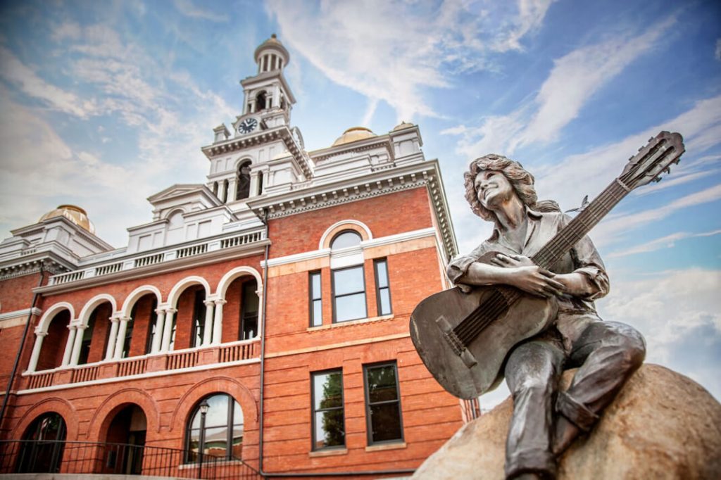
Dolly Parton Statue 125 Court Ave, Sevierville, TN 37862
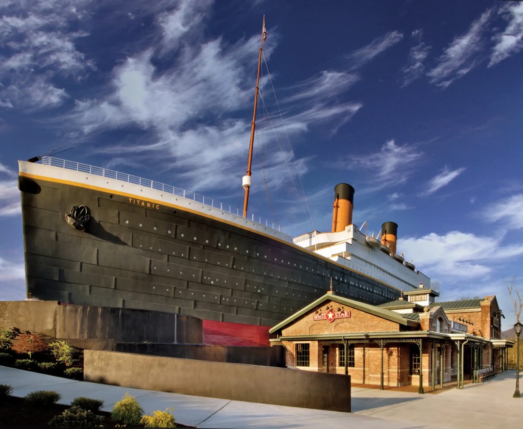
TITANIC Museum Attraction 2134 Parkway, Pigeon Forge, TN 37863
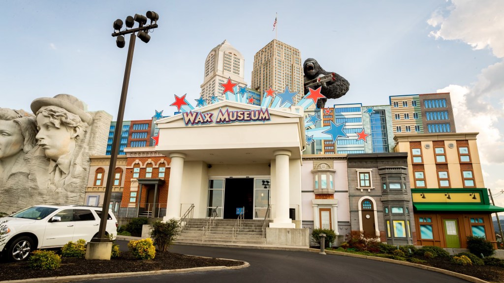
Hollywood Wax Museum 106 Showplace Blvd Unit A, Pigeon Forge, TN 37863
Dolly Parton’s Stampede Dinner Attraction
Address: 3849 Parkway, Pigeon Forge, TN 37863

https://dpstampede.com/pigeon-forge
Day 4
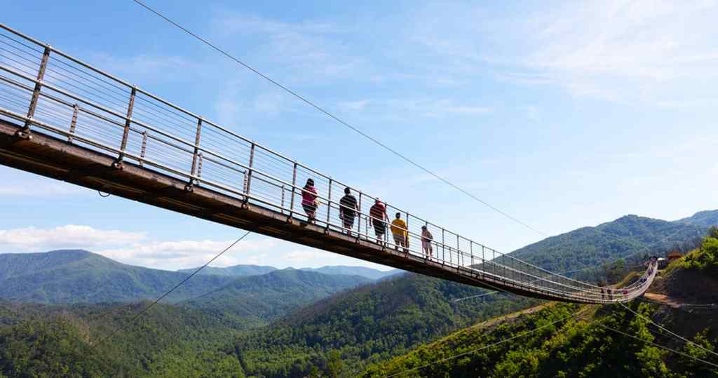
Gatlinburg SkyPark
765 Parkway, Gatlinburg, TN 37738
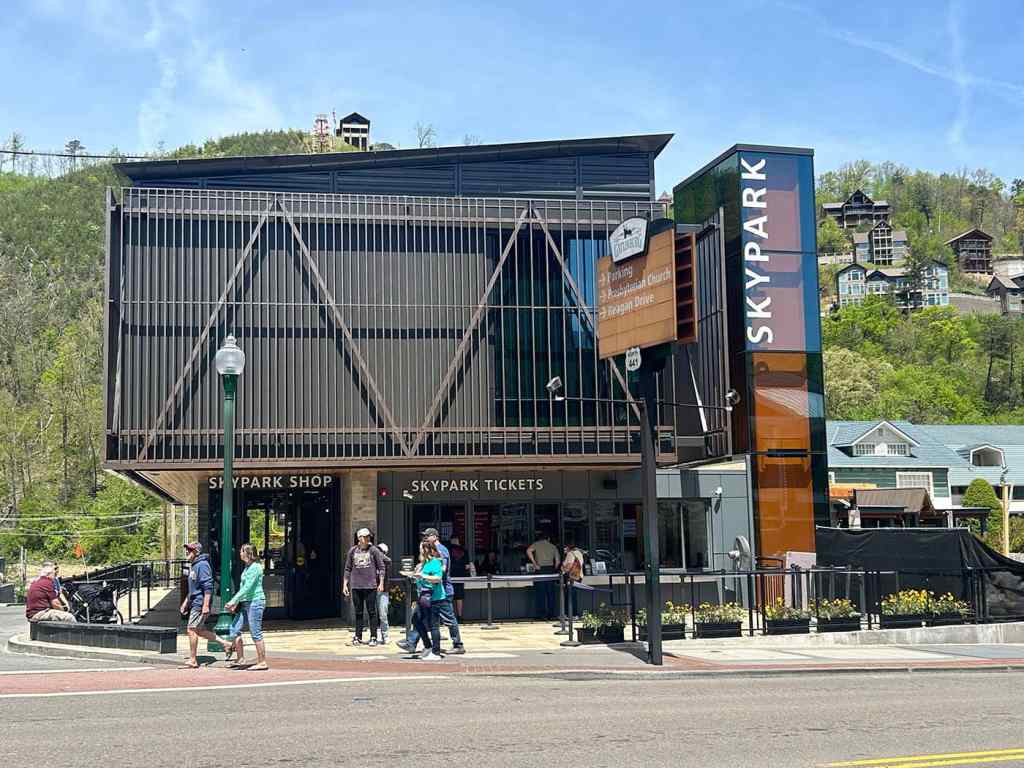
Ride the yellow chairlift to the best views in Gatlinburg and cross the record-setting SkyBridge, the longest pedestrian cable bridge in North America.
Walk across SkyBridge. Take a hike along the SkyTrail. Climb the Tulip Tower to the observation area. Relax and take in the view from the SkyDeck amphitheater.
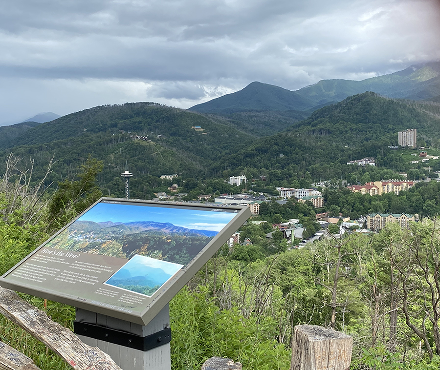
Gatlinburg Scenic Overlook
The Gatlinburg Scenic Overlook offers magnificent views of downtown Gatlinburg with its majestic mountain backdrop. Mornings present a beautiful mist covering the mountains below. Daytime hours show a clear view, and nighttime portrays all of the lights in the downtown area, including the Space Needle.
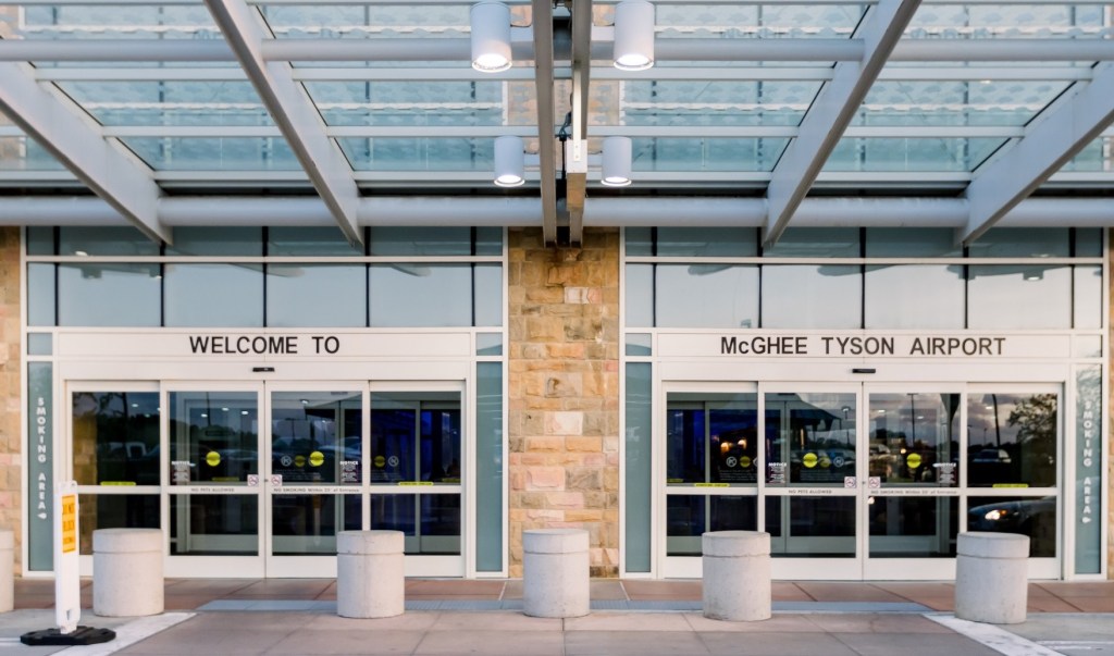
McGhee Tyson Airport