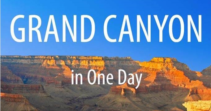
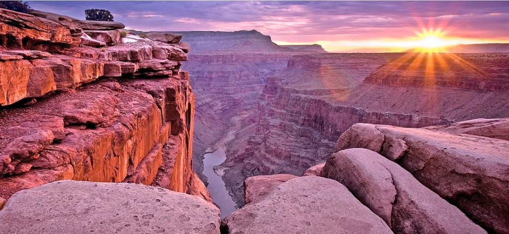
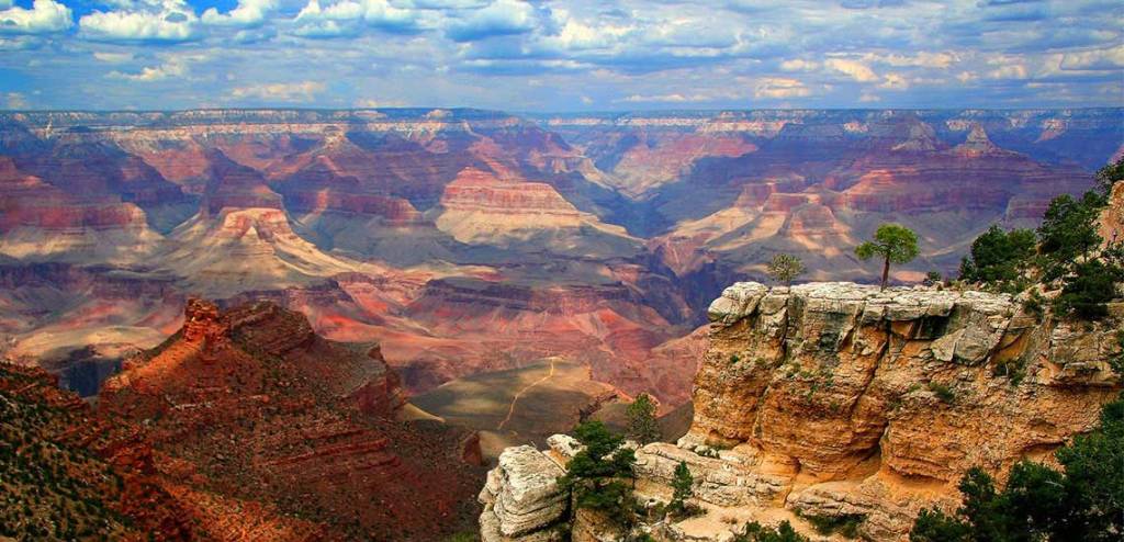
Điều đầu tiên mà tôi ấn tượng mãi khi đến tham quan nơi này là dãy núi đá trùng trùng, điệp điệp, kéo dài dường như vô tận. Kỳ lạ là quần thể này luôn chuyển màu theo vị trí, ánh sáng mặt trời và thời tiết. Lúc thì toàn vùng núi nhuốm màu đỏ sậm nhưng sau đó, lại là một màu tím ngăn ngắt hay vàng quạch, cứ lớp lớp chồng lên nhau, nằm xen kẽ với những hẻm núi khổng lồ, hiểm trở và bao quanh là con sông Colorado xanh ngắt, uốn lượn, tạo nên một bức họa vĩ đại của thiên nhiên.
Theo lời của hướng dẫn viên, đại vực Grand Canyon là một trong bảy kỳ quan thiên nhiên thế giới ở bang Arizona, nước Mỹ. Hàng triệu năm trước, con sông Colorado từ phía bắc rẽ xuống phía tây, bào mòn cao nguyên Colorado để tạo ra một hẻm núi lớn đầu tiên ở nơi này. Một thời gian sau, con sông này lại kiến tạo ra một hẻm núi khác ở phía đông. Sau đó, hai hẻm núi này bị vỡ, gặp nhau và tạo thành quần thể núi đá trùng trùng điệp điệp. Grand Canyon dài 446km, rộng từ 0,4km đến 29km và sâu hơn 1,6km.
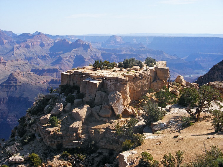
Giữa cao nguyên mênh mông, mặt đất bỗng sụt xuống tạo thành một lòng chảo khổng lồ, sâu hoắm, đầy những vết cắt ngang dọc. Từ lòng chảo đó mọc lên vô số những ngọn núi đá màu nâu đỏ, hình thù tựa như những ngôi đền cổ, nằm trùng điệp bên nhau. Những ngọn núi nơi đây có hình dáng rất kỳ lạ với những vân đá rất đều nhau và kỳ vĩ. Nước, gió và thời gian đã góp phần tạo trên bề mặt của nó những lớp đá, hình thành một dạng địa chất vô cùng đặc biệt.
Các nhà nghiên cứu cho rằng Grand Canyon có niên đại gần 2 triệu năm tuổi. Những hòn đá tạo nên hẻm núi lớn nhất thế giới này có xuất xứ từ vùng bờ biển phía Đông giáp với Đại Tây Dương và nguồn gốc lượng cát bao phủ 350.000km2 miền Tây nước Mỹ, bồi đắp nên các tảng sa thạch ở Grand Canyon khoảng 150 đến 300 triệu năm trước.
Trải qua hàng triệu năm chịu sự bào mòn của mưa, gió và dòng sông Colorado, Grand Canyon hiện nay có rất nhiều hình thù kỳ lạ. Ở nhiều nơi, các ngọn núi tựa như những ngôi đền, những lâu đài, thành quách hàng triệu năm tuổi nằm ẩn hiện trong sương mù. Grand Canyon có đến 12 tầng đá cổ, rất dễ phân biệt qua sự chuyển màu từ đỏ vàng sang đỏ tươi, đến nâu đỏ và nâu đậm trên các ngọn núi. Tầng cổ nhất nằm dưới chân núi có tuổi đời khoảng 1,84 tỉ năm, tầng mới nhất nằm trên đỉnh núi có 270 triệu năm tuổi. (Trái đất được cho là hình thành cách đây khoảng 4,5 tỉ năm).
Đã đành kỳ quan thì ở đâu cũng đẹp, nhưng Grand Canyon là cái đẹp không nơi nào có được. Đó là cái đẹp vừa hùng vĩ vừa sâu lắng, vừa hiện thực vừa mộng mơ, vừa rực rỡ vừa dịu dàng, vừa muốn bay lên vừa muốn chìm xuống, vừa thấy ta bé nhỏ vừa thấy mình bao la… Mà thôi, không nói nữa. Cách tốt nhất là bạn hãy đến đó mà chiêm ngắm, cảm nhận, giao hòa, và thổn thức.
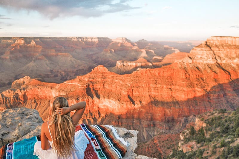
Khi đã lên đến được đỉnh của đại vực, nhìn ngắm bức họa vĩ đại của thiên nhiên bày biện trước mắt trong một không gian tĩnh lặng, ban sơ, bạn sẽ thấy mình nhỏ bé biết bao. “Trực tiếp đối diện, ngắm nhìn thắng cảnh hùng vĩ tại Vườn Quốc gia Grand Canyon cũng như Hẻm núi Grand Canyon, bạn sẽ thấy thế giới dường như lớn hơn, bão tố, hoàng hôn và bình minh rực rỡ và ngoạn mục hơn”, trích từ một tài liệu giới thiệu về Grand Canyon.
Rồi cũng như khi kết thúc một ngày, bình minh xuất hiện với dáng vẻ dịu hiền và khoan thai của ông mặt trời. Bức tranh Grand Canyon bắt đầu dậy lên muôn sắc màu: trắng, xanh, vàng, tím, đỏ, hồng… lộng lẫy, kiêu sa. Rất dễ có cảm tưởng như Grand Canyon là một mâm đồ chơi của các thần, ở đó vị thần nào cũng muốn gắng gổ phù phép cho đồ chơi của mình đẹp hơn, lung linh hơn, độc đáo hơn – tầng tầng lớp lớp những đỉnh đồi, chóp núi, khe, vực… trong tay các vị thi nhau khoe sắc; đến cả cây tuyết tùng chơ vơ bên bờ vực cũng cố sáng lên điểm tô cho bức tranh thêm màu minh triết. Cho đến khi ông mặt trời hoàn toàn hòa thân vào cái vũ trụ sáng bao la kia thì cũng là lúc trò chơi kết thúc. Nếu tôi là giám khảo cuộc thi, tôi sẽ không ngần ngại chấm điểm cho tất cả các thần thí sinh đều đạt loại ưu.
Thế nhưng, đó chưa phải là điều tuyệt vời nhất khi bạn tham quan nơi này. Nhiều người đến đây, trong đó có tôi, đã phải công nhận rằng: “Hạnh phúc nhất có lẽ là cảm giác được chạm chân đến tận cùng của đại vực, thò chân xuống dòng nước màu xanh mát lạnh của dòng sông Colorado. Bạn sẽ không hiểu mình đang đặt chân ở ngưỡng cửa thiên đường, nơi tuyệt đối yên bình tĩnh lặng hay còn đang ở giữa đường đi sâu xuống lòng trái đất”.
Bright Angel Trail gập ghềnh, khúc khuỷu, thoai thoải, uốn lượn giữa hai bờ vực. Bên kia lối mòn, dọc dài những vách đá dựng đứng; đó là loại đá sa thạch đỏ, nâu, vàng, tím, hồng… xen đá granit, lớp lớp chồng lên nhau, kỳ vĩ và đẹp mê hồn. Với các nhà địa chất, đó là cuốn biên niên sử của trái đất, với chúng ta, đó là kiệt tác của tạo vật cất dấu trong nó bao câu chuyện của thời gian. Gió từ các hẻm núi mang theo hơi lạnh cùng thứ âm thanh rất riêng của nó. Có lẽ đây là nơi duy nhất con người thấy được sự chuyển động của thời gian và nghe được âm thanh của vĩnh cữu.
Đường xuống vực, mỗi khúc quanh mở ra một cảnh giới mới, mỗi cung đường hứa hẹn điều ngạc nhiên. Tôi đặc biệt xúc động về những cây tuyết tùng chơ vơ trên bờ vực. Chắc nhờ đại vực mà nó sớm ngộ ra lẽ đời: đã không có gì tồn tại vĩnh hằng thì mắc mớ chi phải bận tâm về chuyện tồn tại hay không tồn tại, thì cứ an nhiên mà đùa giỡn với gió núi mây ngàn, mà lay lắc reo ca. Có lẽ nhờ thế, qua hàng triệu năm, trên các vách đá cheo leo loài tuyết tùng vẫn thay nhau mọc, mặc cho sự tàn phai.
Grand Canyon South Rim Tour from East Entrance
Desert View Drive
Desert View Drive is the most popular scenic drive in Grand Canyon National Park, providing spots to stop and take in the amazing views and breathtaking beauty of the canyon.
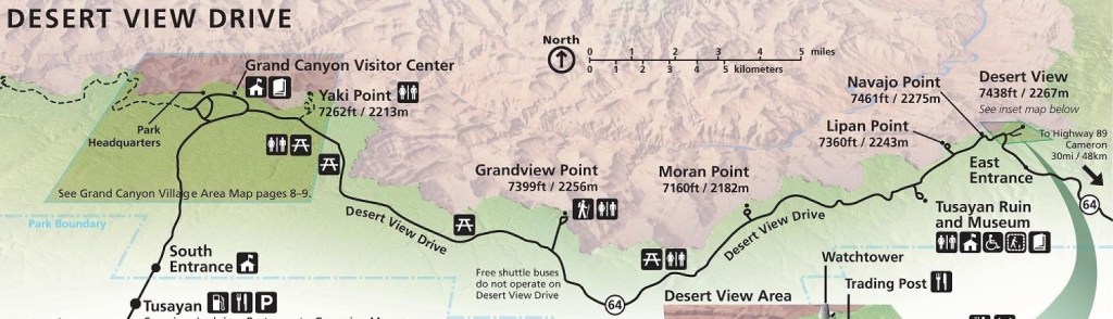
The Desert View Drive at the South Rim of the Grand Canyon is a very scenic stretch of Arizona Highway 64 that extends 25 beautiful miles along the canyon rim, running from the Desert View Overlook to the Grand Canyon Village area. It is the main scenic drive that can be done by private vehicles, and passes a large number of overlooks and other points of interest.
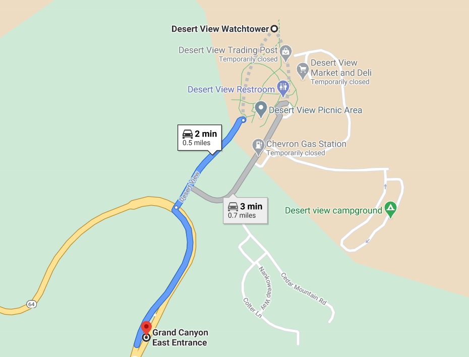
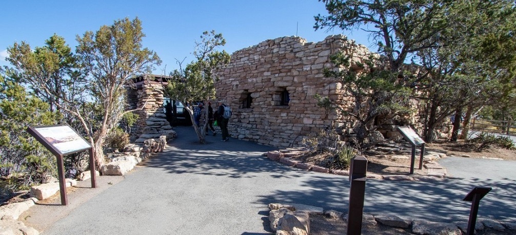
Stop #1: Desert View Watchtower
( 0.5 miles from East Entrance )
Time Needed: Count 20-30 minutes for a visit.
From the East Entrance, drive on Highway 64, turning right towards Desert View. After parking in the Desert View parking lot, walk down a short paved to the Watchtower.
A short ¼-mile (½-km) walk will lead you to this historic buildings, to the rim. From Desert View Point you will be able to enjoy the Colorado River make a big bend to the west. You can climb the stairs to the top of the watchtower for outstanding views of the canyon. A great photo opportunity for photographers.
At this location will find a bookstore, snack bar, general store, service station, restrooms and seasonal campground.
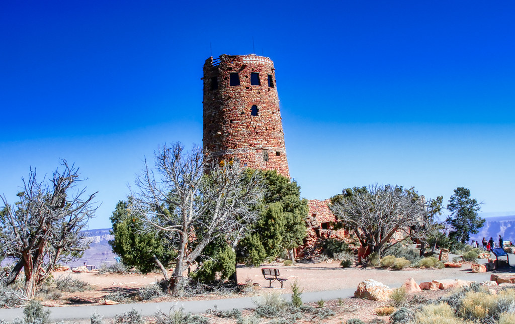
Desert View offers an all-ages experience that combines history, art, architecture and Native American culture.
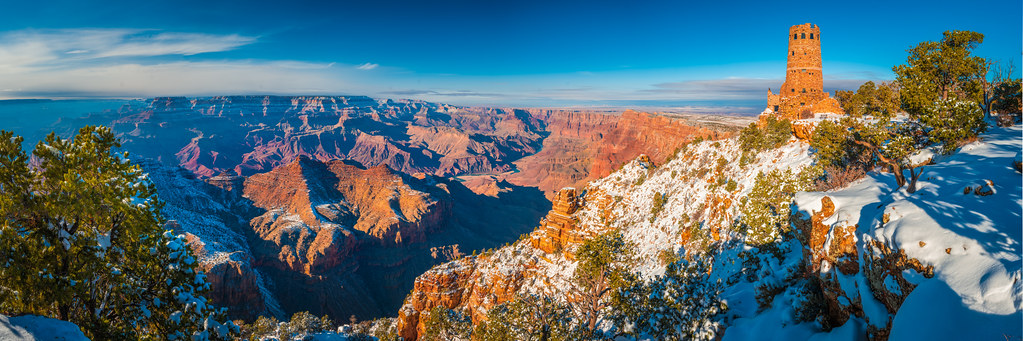
Anchoring Desert View is the watchtower, built in 1932 and designed by renowned architect Mary E. J. Colter. This iconic building was inspired by ancient Native American watchtowers and is decorated with murals by a Hopi artist. If you’re interested in native culture, the nearby Tusayan Museum and Ruins also provides a window into the lives of the Pueblo Indians, who inhabited the area over 800 years ago.
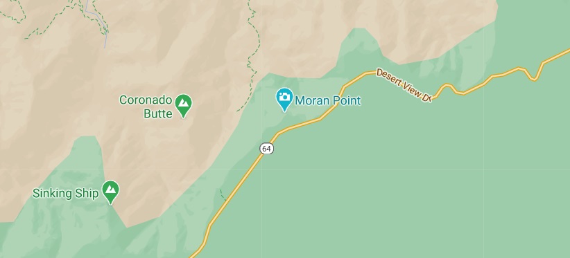
Stop #2: Moran Point
( 7.2 miles from Desert View Watchtower – 7.7 miles from East Entrance )
Time Needed: Count 15-25 minutes for a visit.
This is one of the most colorful spots in Desert View Drive, you must stop here and enjoy the scenic view of the rocks, the sediment colors are varied and the lights reflect off the rocks to provide beautiful views.
Moran Point is located at the end of a short spur road just north of Desert Scenic Drive at the Grand Canyon South Rim. It is about 17 miles east of Grand Canyon Village and about 7 miles from the Desert View East Entrance to the South Rim.
This point is named for landscape painter Thomas Moran, whose sketches and oil paintings introduced America to the beauty of the canyon in the years before photography. After accompanying John Wesley Powell on a surveying expedition in 1873, Moran illustrated Powell’s book, The Exploration of the Colorado River and its Canyons. The federal government bought one of Moran’s paintings, The Chasm of the Colorado, and sent it to Congress. It and other works helped lure the first tourists to the canyon in the 19th century.
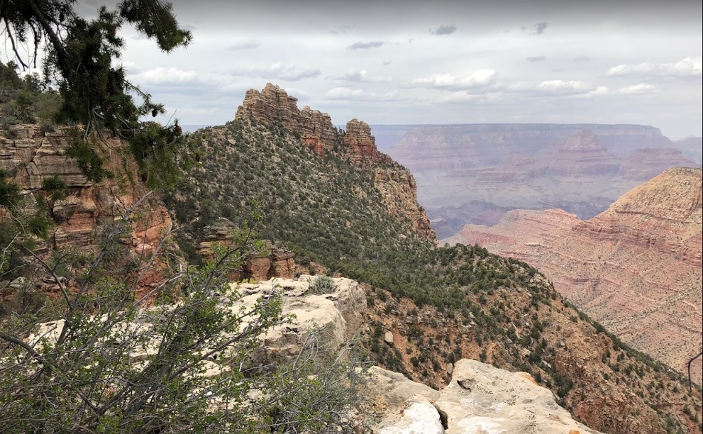
Moran Point is the best place from which to view the tilting block of rock known as the Sinking Ship. Standing at the end of the point, look southwest at the rocks level with the rim. You’ll see the Sinking Ship beyond the horizontal layers of Coronado Butte (in the foreground). It’s part of the Grandview monocline, a zone where rocks are bent in a single fold around a fault line.
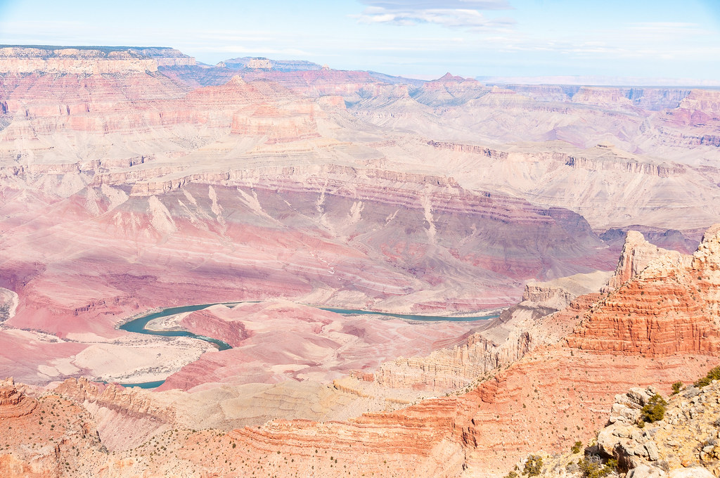
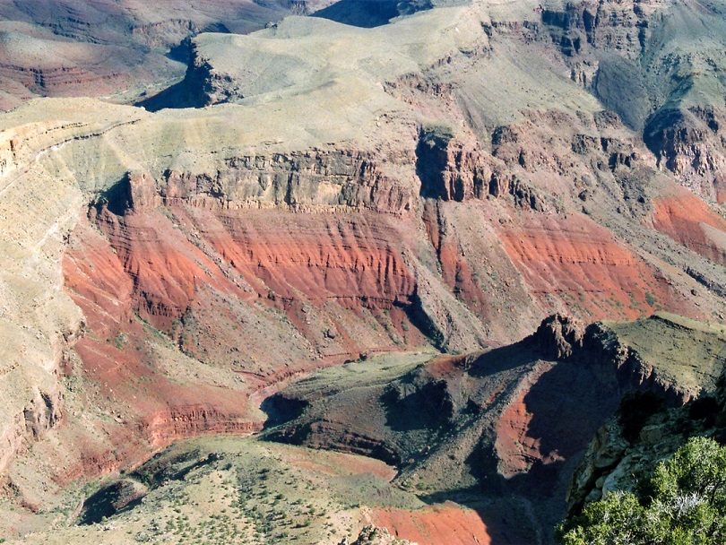
Directly below Moran Point is Red Canyon, a very colorful tributary and especially so at the lower end where deep red/orange layered rocks are exposed, formed of Hakatai Shale.
Moran Point. It’s one of the areas where you can clearly see the three main rock groups in the Grand Canyon.
The first group is the Layered Paleozoic Rocks, sedimentary rocks that make most of the canyon’s depth. The second one is the Grand Canyon Supergroup, the most significant geologic record, visible only in a few spots along the rim. This group of rocks is like an history book on the Grand Canyon: the scientists gathered so much information by studying it! The third group is the Vishnu Basement Rocks, the oldest rock formations in the canyon.
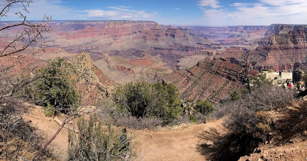
Stop #3: Grandview Point
( 7 miles from Moran Point – 14.5 miles from East Entrance )
Time Needed: Count 15-25 minutes for a visit.
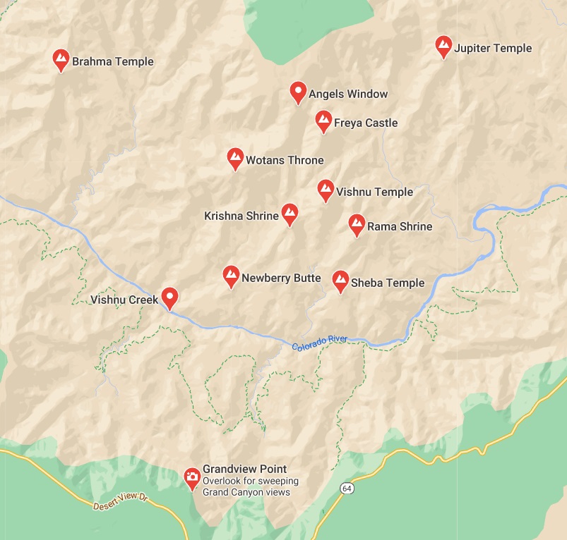
Located roughly halfway between the major landmarks of Desert View Watchtower and the Grand Canyon Visitor Center. Grandview Point is the southernmost lookout point at the South Rim of the Grand Canyon. At an elevation of about 7,400 feet, Grandview gets a bit more rainfall than other overlook points which is why it has a more dense forest of pine and oak trees. Although the trees do obstruct the views somewhat, it also creates a more tranquil environment.
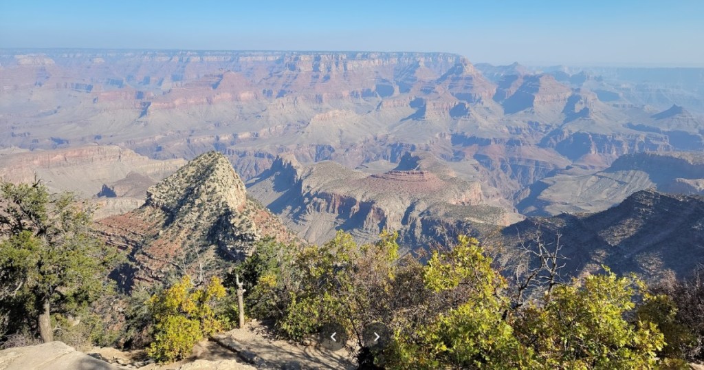
This is also the point furthest from the river and so with the largest area of intervening buttes and ravines.
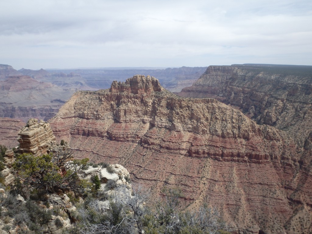
You’ll see prominent buttes including Rama Shrine, Krishna Shine, Vishnu and Shiva Temple, and you’ll glimpse a tiny stretch of the Colorado River far below as well.
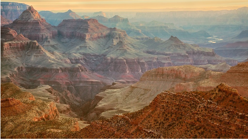
The course of the Grandview Trail is quite evident from the rim, as it descends along the side of a narrow ridge towards Horseshoe Mesa, a U-shaped formation between Cottonwood Creek to the west and Hance Creek to the east, and once the site of a copper mine.
Before the construction of El Tovar Lodge near Garden Canyon, Grandview was the first place along the rim to be developed for tourists, with facilities including a hotel built in 1895, but this became disused after only a few years of operation, and little trace remains today.
Stop #4: Mather Point
Time Needed: Count 15-25 minutes for a visit.
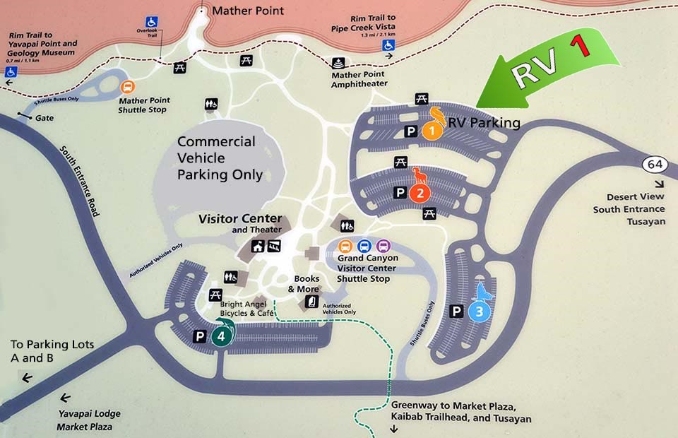
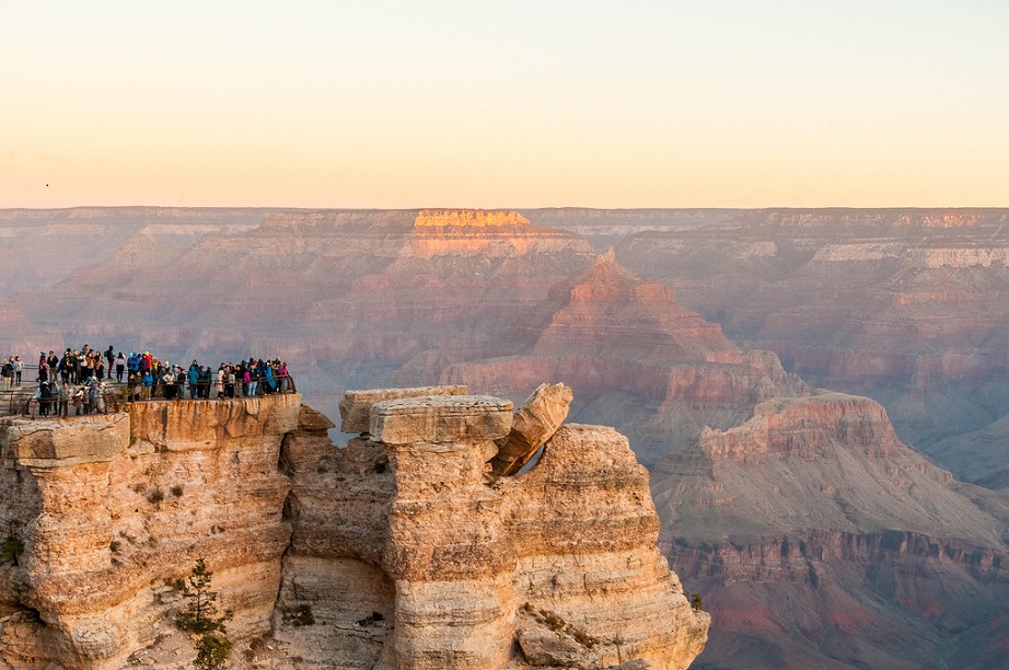
Grand Canyon Mather Point is one of the busiest and most sought-after lookout points among visitors, and is often referred to as the “True Grand Canyon” when it comes to providing majestic, sweeping views of the magnificent landscape.
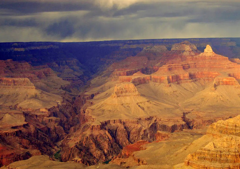
Visitors can gape at the 10-mile distance from where they are, to the Grand Canyon North Rim, or peer into the depths of the abyss below them. They can also take pictures of the stunning landscape presented before them – the canyon rocks showing off vibrant colors in perfect harmony with the painted skies above.
Visitors get to experience an unprecedented view of the heart of Grand Canyon- the Colorado River, and a firsthand look at the many-layered rocks (Vishnu Schist, Coconino Sandstone and Kaibab Limestone) that make up the canyon. Mather Point has two distinct outcroppings that feature railed overlook points over from Bright Angel Trail in the west, to South Kaibab Trail and Yaki Point in the East. Walking on the Rim Trail will lead you to the Grand Canyon Historic District and to Yavapai Point.
Four thousand feet below Mather Point rests the Phantom Ranch. This historic place dates back since 1050 A.D., accessible only by river, helicopter or by trail. Phantom Ranch is located just beside trail bridges that cross the long expanse of the Colorado River within Grand Canyon.
The Grand Canyon’s guardians stand towering over the horizon. Standing from Mather Point, look to the East for Wotan’s Throne, Brahman and Zoroaster Temples- they are pretty hard to miss, considering their 8,000 feet elevation. You can stay on Mather’s Point and observe how these formations take on different hues, depending on the hour of the day. The rock formations can appear to be grayish or tan at noon, and take on a burnt orange, red or purple (sometimes altogether) hue come dusk.
If you gaze west from the south of Colorado River you can see the wide swathe of Pipe Creek and the beautiful Bright Angel Trail. Scan the east coast and you can see the South Kaibab Trail along Cedar Ridge and a view of the O’Neill Butte. Turn your attention to the North Rim and you will be rewarded with a view of Bright Angel Creek, completely filled with carved formations such as rough buttes and deep ravines, further accentuating the majestic splendor of the Grand Canyon.
If you can’t find a parking spot. As an alternative, head to Yavapai Point which is about a half mile away or Park Headquarters which is about one mile away. The advantage of these two viewpoints is that in addition to the view, you also get access to free shuttle buses and rest rooms.
Stop #5: Yavapai Geology Museum and Yavapai Point
Time Needed: Count 20-30 minutes for a visit.
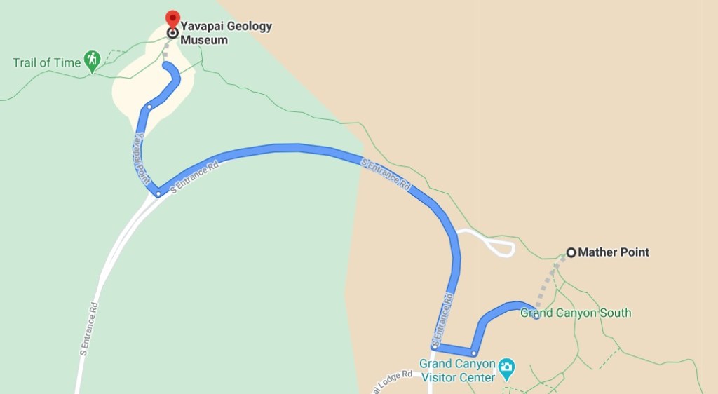
Perched right on the very edge of the canyon rim at Yavapai Point, Yavapai Geology Museum offers one of the best vantage points for an overview of Grand Canyon geology. Annotated displays at the base of the panoramic windows show you where to look to see each group of rocks. You can walk between rock column models of the North and South Rims, learn the names of the various rock layers, discover information about the geologic history recorded in the rocks, and visualize the carving of the modern landscape.
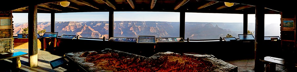
Yavapai Point features some of the most expansive views both up and down the canyon. The historic observation station here features huge plate-glass windows overlooking the central canyon, and interpretive panels identifying virtually all the major landmarks. There are also exhibits that explain the canyon’s formation and geology. The museum is open daily in summer from 8am to 8pm, and 8am to 6pm the rest of the year.
From here, you can spot at least five hiking trails. To the west, Bright Angel Trail can be seen descending to the lush Indian Garden area. The straight white line leaving from this general area and eventually dead-ending is Plateau Point Trail. Directly below the overlook and to the north, Tonto Trail wends its way across the blue-green Tonto Platform. Across the river, find the verdant area at the mouth of Bright Angel Canyon. The North Kaibab Trail passes through this area yards before ending at the river, just below Phantom Ranch. After turning to face east, find the saddle just south of O’Neill Butte; the South Kaibab Trail crosses this saddle.
Stop #6: Visit the Hopi House
Time Needed: Count 15-30 minutes for a visit.
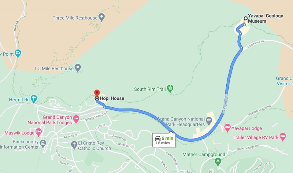
Hopi House is another landmark located on the South Rim that you probably should include in your one-day Grand Canyon itinerary. It’s located just near the Verkamps Visitor Center, and so it doesn’t take much effort to get there.
Constructed in 1904, the Hopi House was built to serve as a market for Native American crafts made by on-site artisans. The Hopi tribe, as the original inhabitants of this area, were chosen as the featured artisans. Hopi House was crafted out of adobe bricks to closely resemble a traditional Hopi pueblo.
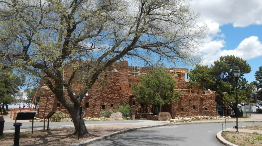
A National Historic Landmark, Hopi House combines retail shopping with museum quality artifact viewing. Here you will find a wide range of native arts and crafts available for purchase, such as hand-crafted kachina dolls, Native American jewelry and pottery, and hand-woven Navajo rugs.
Stop #7: Grand Canyon Historic Village
Time Needed: Count 25-35 minutes.
El Tovar (1905)
Begin your walking tour at the centerpiece of the Historic Village —the historic El Tovar. Step inside the hotel to marvel at the dark-stained timbers and walls adorned with moose, deer and buffalo heads, as well as large paintings of Grand Canyon. Designed by architect Charles Whittlesey and completed on January 14, 1905 at a cost of $250,000, it borrows styles from Swiss chalets and Norwegian villas. A must see and a true Historic Village gem.
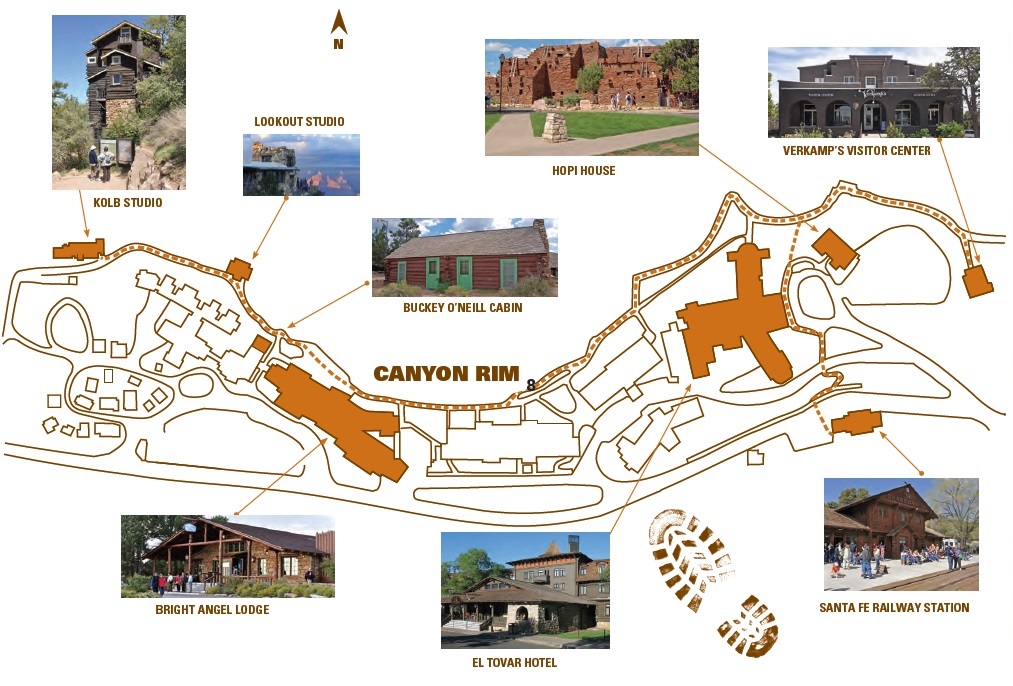
Bright Angel Lodge (1935)
The five minute walk along the paved Rim Trail from El Tovar Hotel to Bright Angel Lodge offers a chance to take in views of Grand Canyon. Built in 1935 by the Fred Harvey Company to provide moderately priced accommodations, Bright Angel Lodge stands as another Mary Colter masterpiece. Walk in and spend time in the lobby to examine the craggy fireplace and notice the American Indian iconography adorning the doors and panels. A second fireplace, in the History Room, features Colter’s ten-foot high geologic representation of the Grand Canyon rock layers. This room once served as a lounge for long-ago visitors; today it houses the Fred Harvey Museum. The Buckey O’Neill Cabin is significant for its first occupant and for being the oldest continuously standing structure on the South Rim. The cabin today is part of Bright Angel Lodge, functioning as a two-room suite for guests. It stands as a reminder of an important figure in Grand Canyon history.
Buckey O’Neill Cabin
The Buckey O’Neill Cabin is significant for its first occupant and for being the oldest continuously standing structure on the South Rim. The cabin today is part of Bright Angel Lodge, functioning as a two-room suite for guests. It stands as a reminder of an important figure in Grand Canyon history.
Lookout Studio (1914) :
Just west of the Buckey O’Neill Cabin is Lookout Studio, also designed by Mary Colter. Built of Kaibab Formation limestone, it blends with its environment on the edge of Grand Canyon. The uneven roof line adds to the effect of the studio appearing as if it rose from the Earth. Like Hopi House, Lookout Studio was designed to imitate the stone dwellings of the ancestral Puebloan tribes of the Southwest. The canyon side of lookout Studio features multi-level platforms from which visitors can look out at the canyon, watch mule riders and hikers laboring on the trails, and spot endangered California condors soaring on thermals or perched on the rocky ledges below. Inside, a rocky fireplace contributes to an inviting atmosphere. A must see Grand Canyon experience.
Kolb Studio
Few buildings demonstrate the quirky personality traits of their original residents like Kolb Studio. Follow the Rim Trail another few hundred feet (about 75 meters) to reach the multi-roomed, multistoried building. Brothers Ellsworth and Emory Kolb arrived at Grand Canyon in 1902. In 1904, they went to work building their home and studio near the head of the Bright Angel Trail. The brothers became famous for their photographs of Grand Canyon visitors on mule rides, as well as for their explorations of Grand Canyon and the Colorado River.
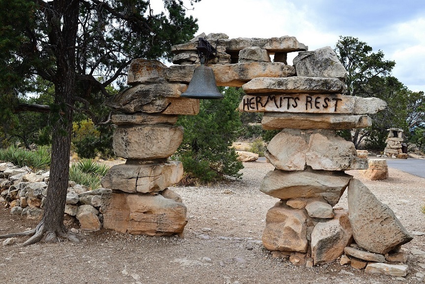
Stop #8: Hermits Rest
Hermits Rest is located at the end of Hermit Road and was built by architect Mary Jane Colter in 1914. The building was inspired by tales of the Grand Canyon “Hermit,” Louis Boucher, an early explorer who lived by himself for years inside the canyon. Colter’s building captures the rustic essence of what she imagined a miner’s cabin would look like and the size of the fireplace inside has to been seen to be believed. Today, the building houses a small gift shop and snack bar which are the only services available anywhere along Hermit Road.
Ride the shuttle along the rim – Hermit Road
One of the best ways to get the most out of your day in Grand Canyon is to combine walking with a shuttle bus. The extensive Grand Canyon shuttle service is free of charge and operates on four organized routes.
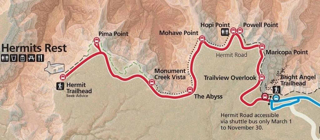
When visiting the Grand Canyon for just a day, I recommend boarding the Hermit Road shuttle bus (Red Route). This road is closed to private vehicles from March 1st through November 30th and is really too long to walk in the summer heat. So taking the shuttle is the best way to see the highlights along this 7-mile (11 km) stretch between the Village Route station and Hermits Rest. It stops at nine canyon overlooks along the way.
With some of the best Grand Canyon views that you can see anywhere, the Hermit Road Red Route gives you the chance to experience breathtaking scenery while someone else does the driving.
- From Trail View Point you can often see mules and hikers below.
- Some of the most scenic viewpoints are Hopi Point and Powell Point, which are located right next to each other. The sweeping views are very similar, but because it is less famous than Hopi Point, Powell Point has fewer crowds.
- Mohave Point is also a great one that offers slightly different views and various photo spots. It looks as if it’s floating over the canyon.
Hermits Rest Route (lộ trình sơn màu đỏ) dài 7 miles khởi hành từ Hermits Route Transfer, địa điểm xe khởi hành nằm trên con đường đi bộ cạnh bờ vực phía Tây lữ quán Bright Angel Lodge và cuối lộ trình là Hermits Rest. Lộ trình này chạy dọc theo bờ vực đi về hướng Tây trên con đường dành riêng cho xe buýt, không cho xe tư nhân lưu thông. Trên đường này xe dừng lại ở 8 điểm ngắm cảnh dọc theo bờ vực nhưng khi chuyến xe trở về chỉ ngừng lại tại 2 địa điểm Mohave và Hopi Point mà thôi.
Stop #9: Hopi Point
Trong hồi ký Living History, Hillary kể gia đình bà có lần đến Grand Canyon cắm trại. Tại đây, ông Bill Clinton nhận xét “Grand Canyon là nơi ngắm hoàng hôn đẹp nhất thế giới”.
Người ta nói Hopi Point là nơi tổng thống Bill Clinton đã ngắm hoàng hôn để rồi phán một câu vang lừng. Tôi nhủ thầm, với vợ và đám cận vệ kè kè bên cạnh mà còn thấy hoàng hôn Grand Canyon đẹp nhất thế giới, để xem thong dong tự tại như ta hoàng hôn Grand Canyon còn đẹp đến chừng nào. Khi chúng tôi đến, Hopi point đã đông đặc người. Đó là một mõm đá nhô ra phía bờ vực. Từ đây có thể nhìn toàn cảnh Grand Canyon. Dọc theo bờ vực hàng vạn du khách cùng náo nức chờ ngắm hoàng hôn.
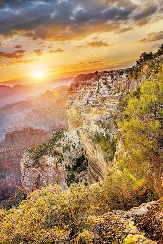
Về phía bên trái Hopi point, ông mặt trời đỏng đảnh núp sau tầng mây, từ từ bước ra khỏi tấm “bạch y”, rót xuống trần gian từng mảng vàng chói lọi. Sông Colorado uốn lượn qua các hẻm núi thường ngày không cách chi nhận ra, nay bỗng dậy lên, nơi này sáng láng như một thanh kiếm tuốt trần, nơi kia cong cong như nữa vầng trăng khuyết. Các vách đá, chỏm núi thi nhau phô hết vẻ kiều diễm độc đáo của mình, trong lúc các vực sâu lặng lẽ tối sầm lại. Bức tranh Grand Canyon nên sắc nét, sinh động, thăm thẳm khôn cùng. Và rồi, như bất cứ cái đẹp đích thực nào trong đời, giây phút chất ngất ấy chỉ tồn tại trong chốc lát rồi đột ngột tan biến, nhưng tôi thừa nhận rằng đó là hoàng hôn tuyệt trần, đẹp đến ngẩn ngơ.
Chẳng biết ngày ấy ngài tổng thống Bill Clinton có thức dậy sớm đón bình minh hay không, sao không nghe ông tuyên bố Grand Canyon cũng là điểm ngắm bình minh đẹp nhất thế giới.