Yellowstone Upper Loop Tour from West Yellowstone
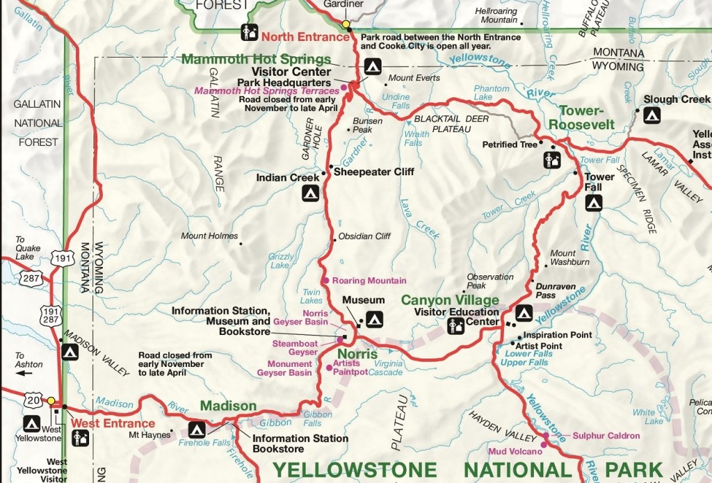
With a second day, you can tack on the sights of the upper loop to your plan (the loop itself is 70 miles long, although visiting the Lamar Valley will add 15–20 more miles out and back). Make your way north to Norris. From there, continue north to Mammoth Hot Springs. Get out and walk the upper and lower terraces to watch travertine formations being built before your eyes. Stop by Albright Visitor Center for background on park history and wildlife, then take the self-guided tour of Fort Yellowstone.
Next, the road swings east. Take the one-way Blacktail Plateau Drive for even better wildlife-spotting chances than you already have on the road, then press on into the Lamar Valley. This wide, rich expanse is home to most of the park’s major wildlife species; dawn and dusk are the best times to look for them, especially wolves.
Backtrack to Tower-Roosevelt and make a quick stop to see Tower Fall from the overlook. The next stretch is one of the park’s most scenic: a winding road that climbs to 8,859-foot Dunraven Pass, delivering sweeping views the whole way up and down. You’ll end up back at Canyon Village.
Get your cameras out and ready to capture some of Yellowstone National Park’s most remarkable features.
Tour are 12 hours long. You may see the following places:
Gibbon Falls, Artists Paintpots, Norris Geyser Basin, Obsidian Cliff, Mammoth Hot Springs, Gardiner, Lamar Valley, Soda Butte, Calcite Springs, Tower Falls, drive through Mount Washburn.
https://goo.gl/maps/UGK9CZsCQiH2K5d96
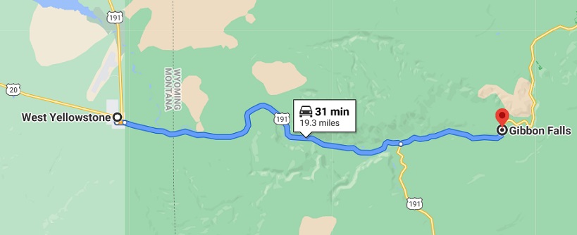
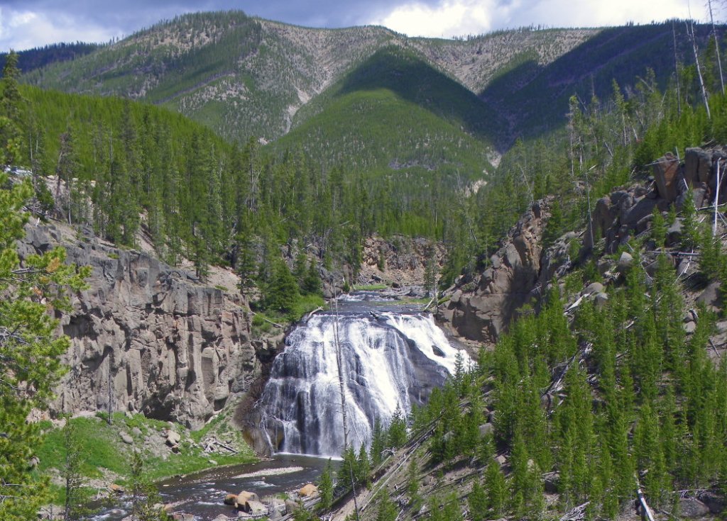
Stop #1: Gibbons Falls
(19 miles from West Entrance)
Time Needed: 20 minutes
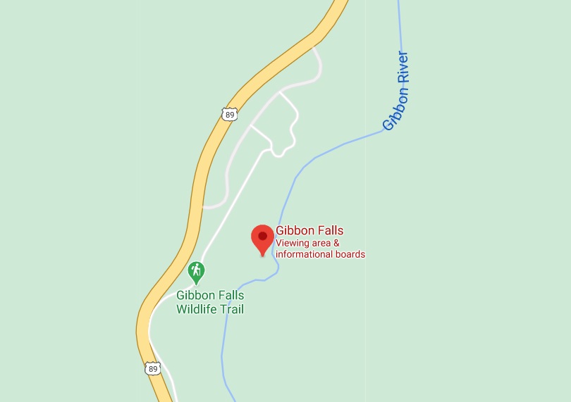
If you’re driving between and Madison Junction and Norris Geyser Basin, take a quick stop to spot Gibbon Falls, is located in the west central area of Yellowstone, about 4.7 miles northeast of the Madison Junction on the main loop road.
As one of Yellowstone’s spectacular waterfalls that can be seen from the road, Gibbon Falls is the spot where the Gibbon River flows 84 feet over the erosion-resistant rock of the giant caldera rim. There is a newly built parking lot available where you can escape the car and stretch your legs. A paved trail guides you high above the banks of the Gibbon River giving you great views of the falls.
https://goo.gl/maps/whBem3RHU2vmn68v7
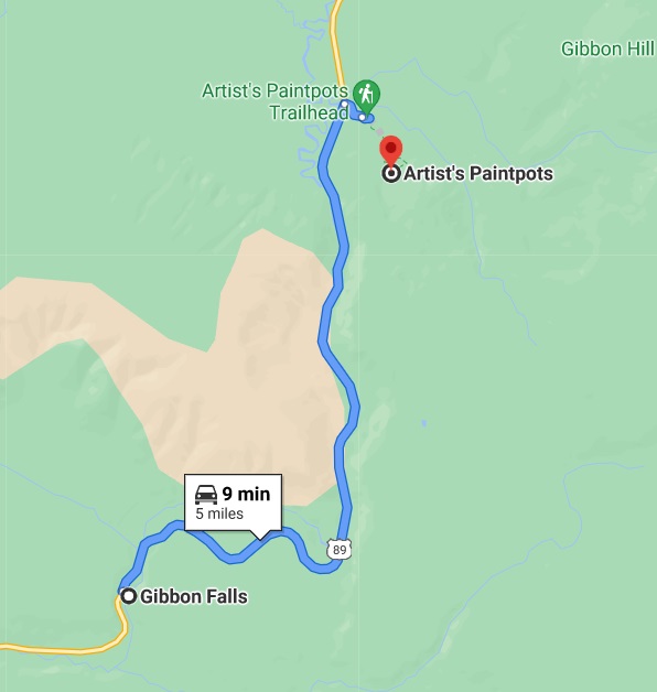
Stop # 2: Artists Paintpots
( 5 miles from Gibbons Falls – 24 miles from the West Entrance)
Time Needed: 30 minutes
The Artist’s Paint Pots trail is so full of vibrant colors, comparable only to an artist’s palette, it will be easy to see how they got their name. The short 1/3 mile trail begins at the parking lot just off the main road across from a wide open meadow. When the trail gets back to the paint pots, it climbs up a small hill to give you a birdseye view of the area and a close look at the mud pots. In the early spring after the snow has melted, the bright reds and blues of the thermal features alongside the deep green mosses and grass, make you feel like you could be in another world. As Yellowstone warms up in the summer, the mud in the paint pots becomes drier, and thick bubbles of mud dance around along the boardwalk. To see them at their most active state, come in late May or June when the snow melt has given the mud pots plenty of water.
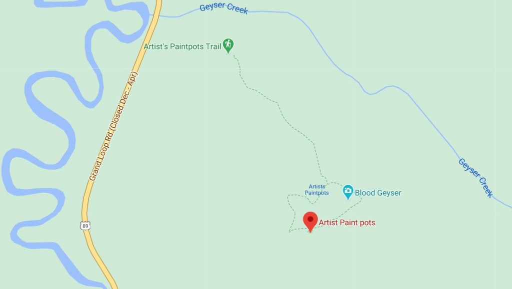
Heading left, you first cross some runoff from Blood Geyser and a few other thermal features, better visible as the trail starts to rise slightly. Blood Geyser gets its name from the iron oxide found within the water. This results in the rocks becoming stained with the red color. Eruptions can get as high as six feet, so keep an eye on it.
The trail begins to climb a bit and ultimately brings you to a fantastic lookout over some of the thermal features below you. Dome Mountain rises out of the otherwise flat lands in the distance. Interspersed below the greenery of the trees are various shades of oranges, reds, and purples mixing in with the white sinter and mud around them.

https://goo.gl/maps/f6RAA2jSQy1N6sJ68
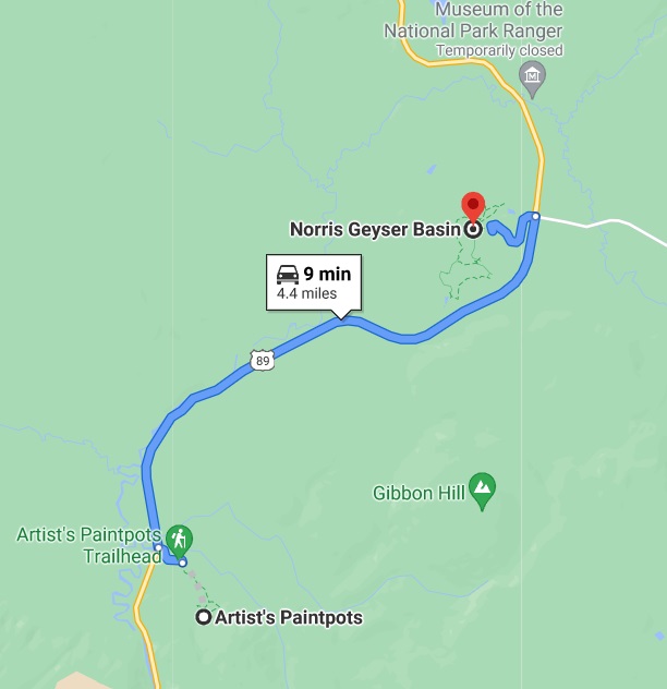
Stop # 3: Norris Geyser Basin
( 4 miles from Artists Paintpotss – 28 miles from the West Entrance)
Time needed: 30 to 45 minutes
From the Artist’s Paint Pots , head north on the main highway for 4.4 miles until you reach the Norris Junction. Make a left turn and follow the road into the parking area. Look for the walkway on the west end of the parking lot leading you to the Norris Geyser Basin.
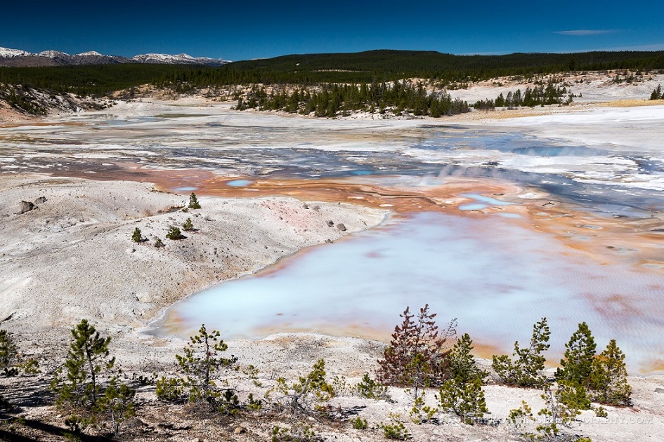
Walk the boardwalks through both larger, geyser-packed Back Basin and the smaller, bleached-white Porcelain Basin.
Back Basin: Emerald Spring -> Steamboat Geyser -> Cistern Spring -> Echinus Geyser -> Puff ‘n’ Stuff Geyser -> Green Dragon Spring -> Porkchop Geyser -> Vixen Geyser -> Minute Geyser -> Vixen Geyser .
Porcelain Basin: Black Growler Steam Vent -> Ledge Geyser -> Hurricane Vent -> Porcelain Springs
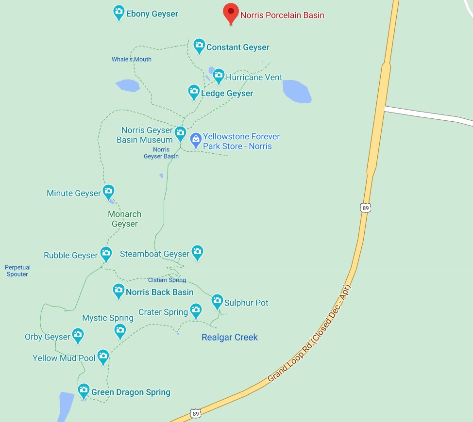
Norris Geyser Basin is one of the most thermaly active and diverse geyser basins in Yellowstone. Norris is comprised of two sections, the Back Basin and Porcelain Basin. These two boardwalks lead you across eeire landscapes of hot water and steam. Hundreds of tremors, most of which are too small to be felt by people, happen here every year, constantly changing the characteristics of the geyser basin. New springs and geysers form while others become less active or become dormant altogether. Steamboat, the largest active geyser in the world resides here in the Back Basin of the Norris area. When Steamboat erupts it can shoot water over 300 ft. into the air (that’s as tall as the Lower Falls of the Yellowstone River). Although very impressive when it does erupt, Steamboat is far from predictable, with intervals between eruptions lasting up to 50 years. There is also an easy one mile trail that will get you back and forth from Norris Geyser Basin to Norris Campground and the Ranger Museum. With hundreds of hotsprings, geysers and mudpots of all colors, shapes and sizes, you will definitely enjoy a stroll through the Norris Geyser Basin on your trip to Yellowstone.
https://goo.gl/maps/x6Sv1qQSakAxJjNR6
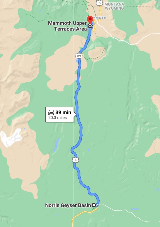
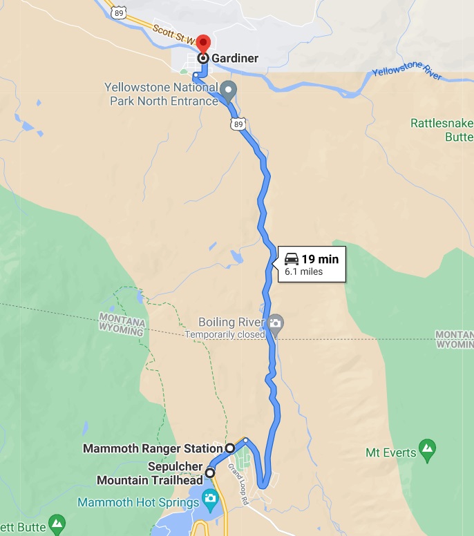
Stop #4: Mammoth Hot Springs
( 21 miles from Norris Geyser Basin – 49 miles from the West Entrance)
Time needed: 2 hours, maybe more!
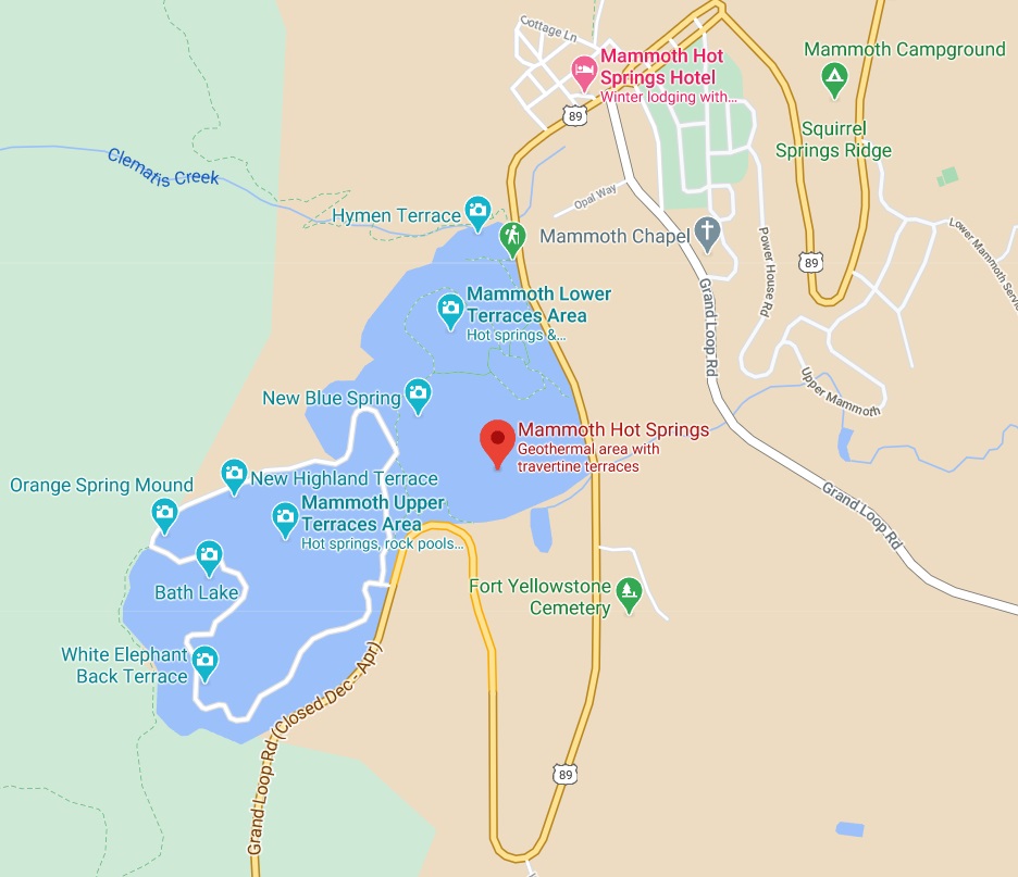
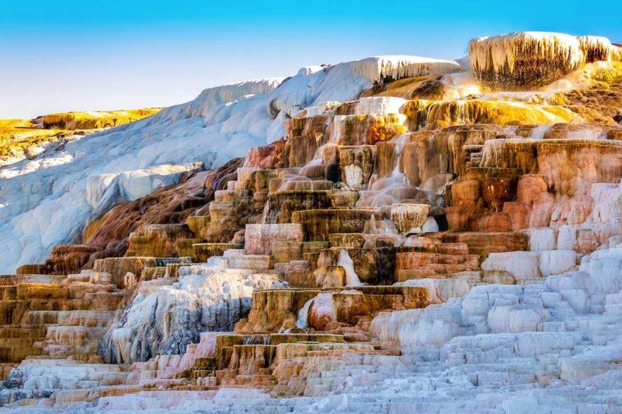
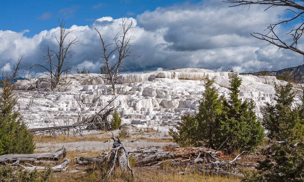
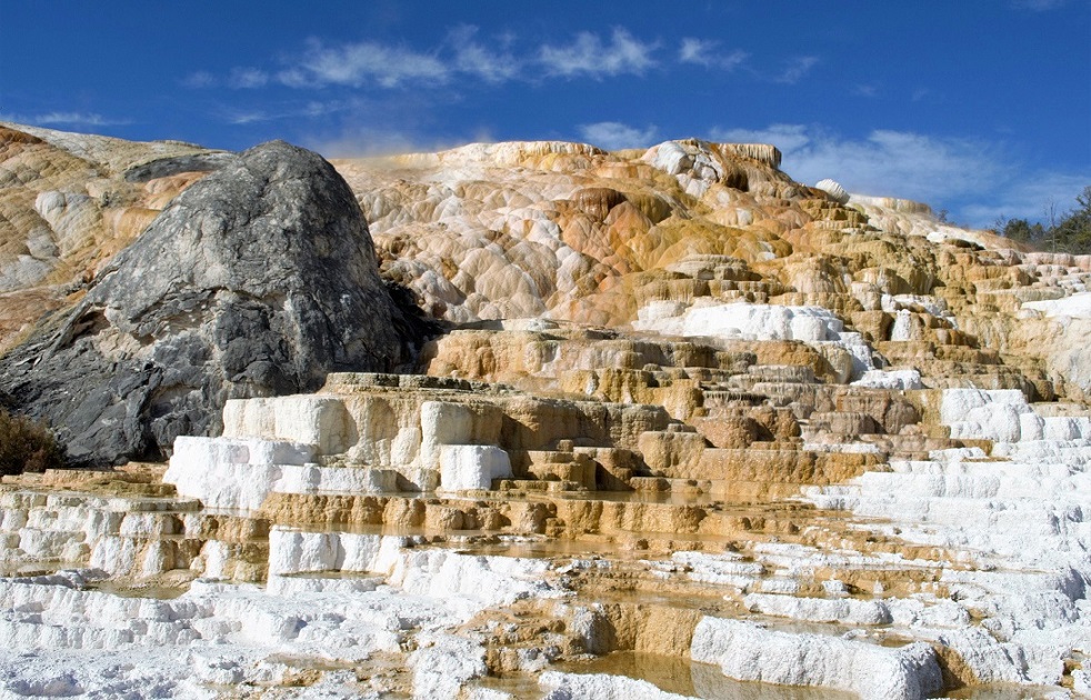
One of the park’s most photographed areas because of its sloping travertine terraces formed by the region’s geothermal springs.
At Mammoth Hot Springs, you’ll find a different kind of thermal feature than you’ve seen elsewhere in the park. The hot springs at Mammoth don’t erupt. They build spectacular travertine terrace formations which have been described as a cave turned inside out. The area consists of terrace boardwalks and numerous hot springs.
Mammoth Hot Springs features two main areas – Upper Terrace and Lower Terrace. There are boardwalks in both areas and staircases connecting them. Furthermore, you can also explore the Upper Terrace by driving the Upper Terrace Loop Drive Road.
Upper Terrace Loop Drive
Upper Terrace Loop Drive is another must-do in the Mammoth Hot Springs area. This one-way road is for cars or foot traffic only – no RVs, trailers, or buses are allowed.
This road connects several springs for 1.5 miles, including New Highland Terrace, Prospect Terrace, Orange Spring Mound, Snow Pond, Bath Lake, White Elephant Back Terrace, and the unpredictable Angel Terrace, which is most popular for its perfectly white formations. The road then loops back for half a mile.
You can slowly drive this road and see most of the geothermal features from the car. If you have the time and don’t mind some more walking, you can also choose to explore this area on foot.
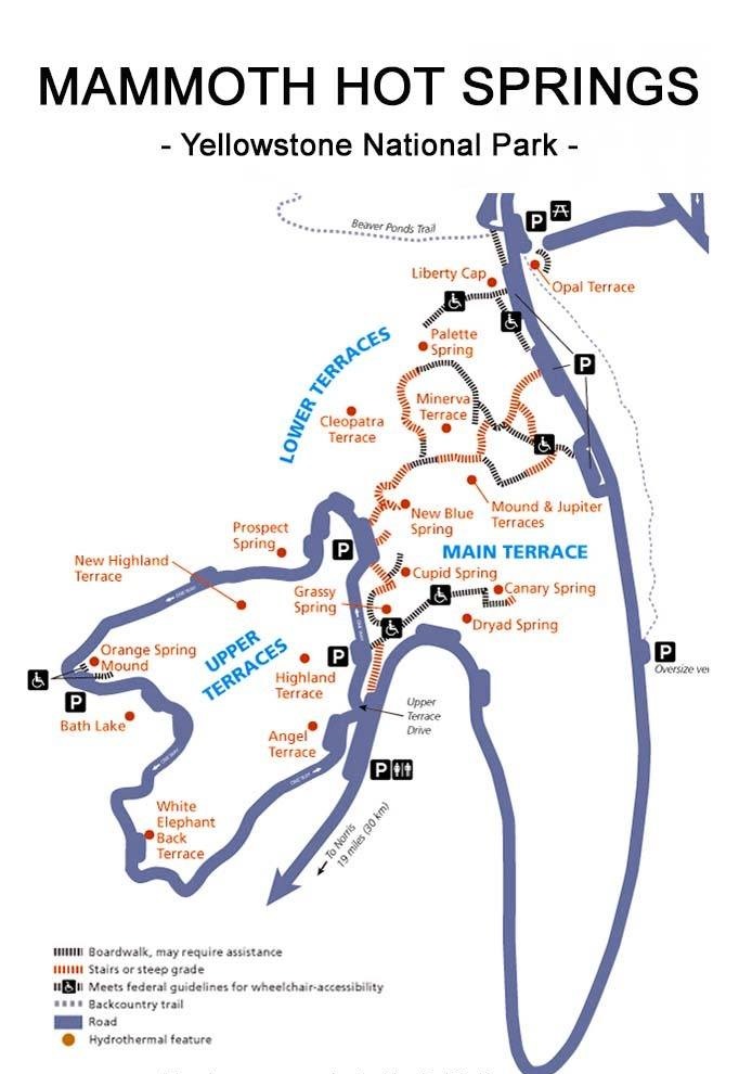
Lower Terrace
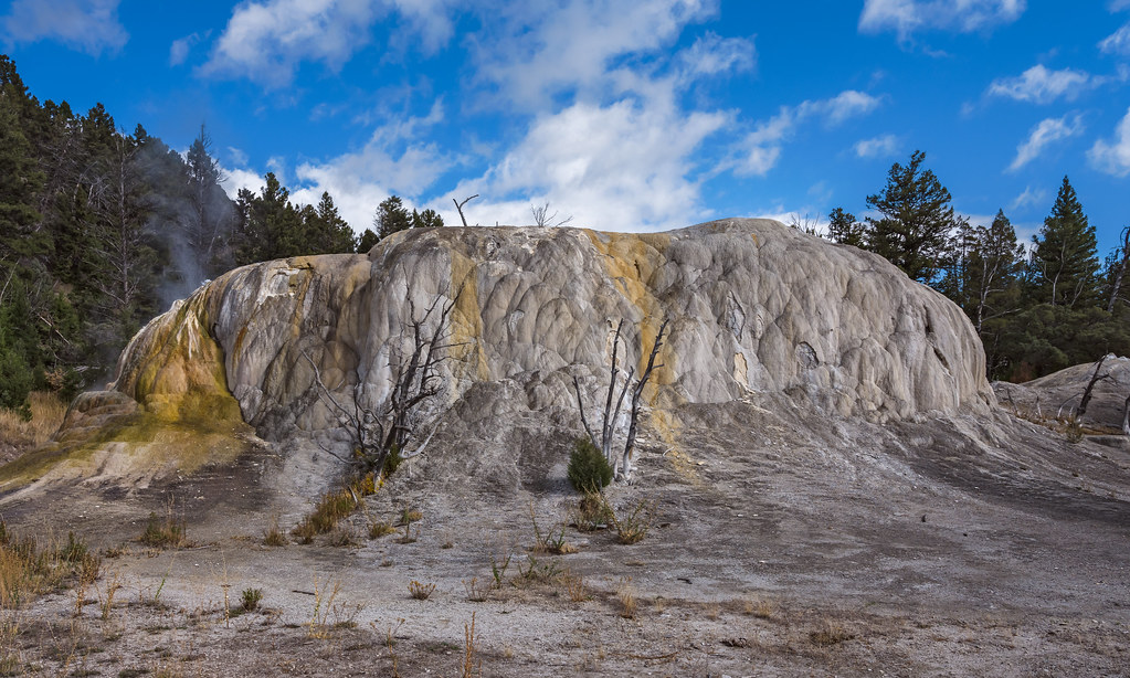
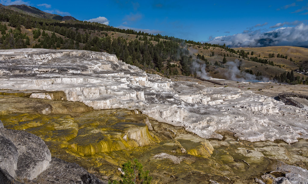
The Lower Terrace boardwalk is where you’ll find one of the best-known features, Liberty Cap, rising 37 feet in the air, and Minerva Spring, favored for its wide range of colors and intricate travertine formations. Once you’ve had your fill of the Lower Terrace, make your way to the Upper Terrace. The Mammoth boardwalks cover an easy 1.75 miles that take about an hour.
The stroller-friendly Lower Terrace boardwalk is accessed from either the Grand Loop Road or the lower parking lot. If you visit just one area of the Mammoth Hot Springs, make it this one as it provides the best views.
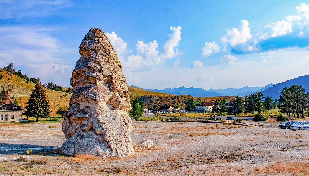
The 37 foot high Liberty Cap, near the start of the trail, is one of Mammoth’s most well-known features. This hot spring cone was got its name in 1871 inspired by the peaked caps that were worn during the French Revolution.
Its distinctive shape was formed by a continuous flow through the hot spring, maybe over hundreds of years. The spring’s internal pressure caused the water to shoot high up into the air, allowing the deposits to build up.
From there, continue to the viewing platform for Palette Spring, possibly the most striking feature in this area! Criss-crossing flows of water from the spring have created smooth bumps of orange and white, plus pink, orange and white terraces.
Whenever you see photographs promoting the Mammoth Hot Springs region, chances are that the feature you are seeing is the beautiful Minerva Terrace, located just beyond Palette Spring. That’s because its intricate travertine formations are quite beautiful, giving it the appearance of a wedding cake.
Beyond Minerva Terrace sits Cleopatra Terrace – an orange formation that stands alone. Further, you’ll find staircases up to the overlook, where you can connect to the Upper Terrace Drive and continue your walk through the Upper Terrace boardwalk.
Upper Terrace
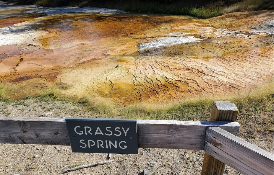
You can also reach the Upper Terrace boardwalk and Overlook from the parking lot next to the Main Terrace. Just head right from the parking lot and down a few steps to the Grassy Spring. You’ll immediately see hot water beneath the plank walkway – a great reminder that this is a very active, ever-changing area!
The boardwalk ends at the very edge of Canary Spring, with its jaw-dropping yellow and white terraces descending around 20 ft. This very active spring is overtaking the trees around it – plus several inches of the boardwalk – and the sight of the steaming water flowing down the terrace is awesome!
A short hike back to the parking lot in the opposite direction takes you to the overlook of New Blue Spring, which is just before the boardwalk that descends to the Lower Terraces.
https://goo.gl/maps/HiuMAzEi7Ck7t9ag9
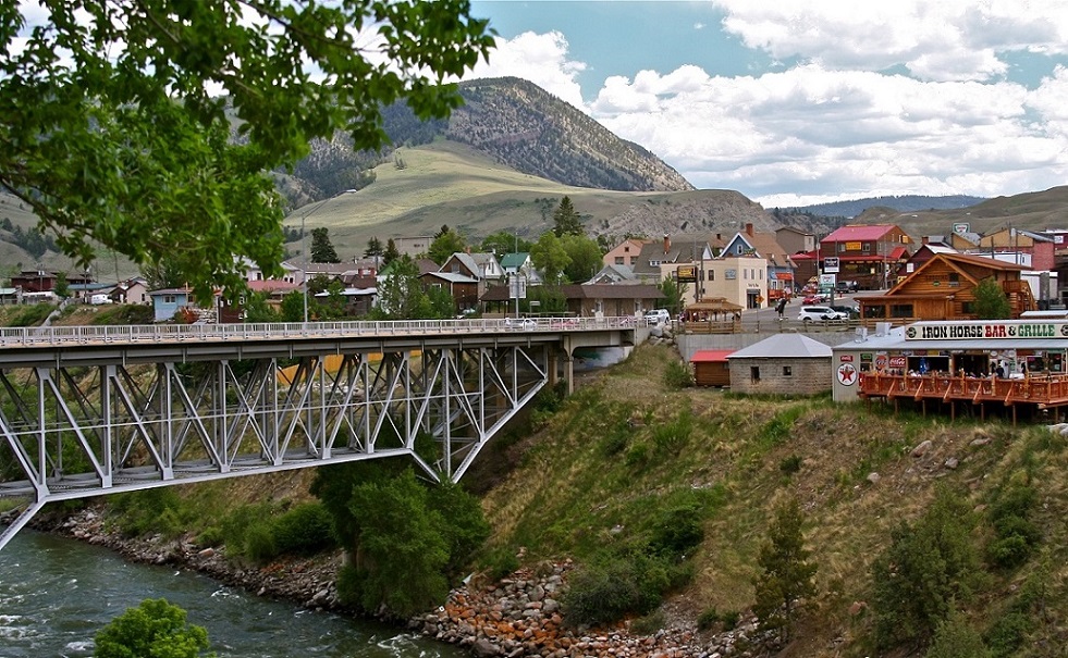
Stop #5: Gardiner
( 6 miles from Mammoth Hot Springs )
Time needed: 20 minutes
Chúng tôi chạy ra của Bắc YS thăm cho biết thị trấn Gardiner. Đoạn đường chỉ có 6 miles và thấy khô khan hẳn so với đoạn ở giữa YS, cũng như phía Nam.
Chúng tôi tới chiếc cổng lịch sử Roosevelt vì do Tổng Thống Theodore Roosevelt đặt viên đá đầu tiên ngày 24-4-1903. Trước thời điểm đó mặc dù công viên đã được thành lập từ 1872 nhưng vì không có phương tiện lưu thông (mãi đến năm 1915 mới có xe hơi) nên không ai tới chơi công viên Yellowstone. Ðến năm 1903 hãng xe lửa Pacific Rail Road mới khánh thành con đường tới thị trấn Gardiner (Montana) nằm ngay Cổng Bắc (North Entrance) vào Yellowstone và từ dạo đó mới có đông du khách đến và Tổng Thống Roosevelt cũng đi bằng xe lửa đến dự lễ đặt viên đá đầu tiên xây dựng cỗng chào cũng vào năm đó.
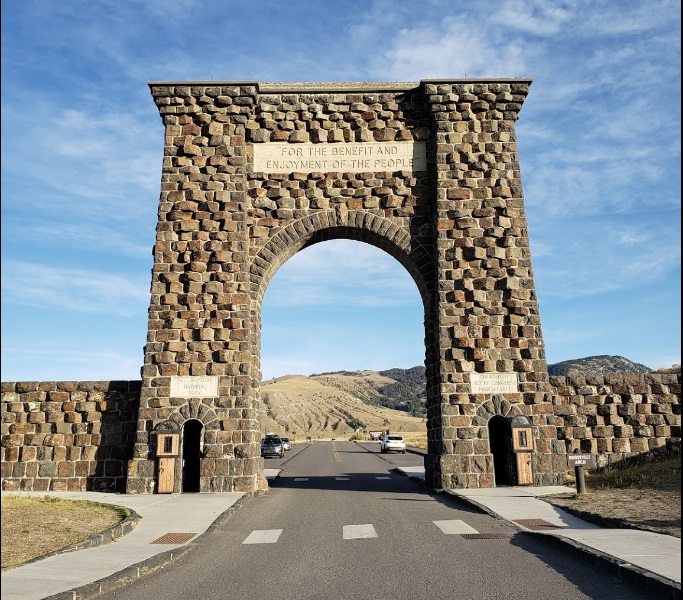
Cái cổng phía Bắc này đẹp nhất trong năm cổng đi vào YS. Trên cổng có mang hàng chữ “FOR THE BENEFIT AND ENJOYMENT OF THE PEOPLE” mới hay chứ. Thị trấn West Yellowstone “đi dăm phút đã về chốn cũ”, nay gặp Gardiner thì chỉ cần đổi lại một chữ thành “đi hai phút đã về chốn cũ”. 🙂 Thành phố Gardiner nằm bên sườn núi và chỉ có một con đường chính chạy ngang rồi hết. Tôi nghĩ thành phố này được lập ra là để đáp ứng nhu cầu của du khách đi vào YS bằng cửa Bắc.
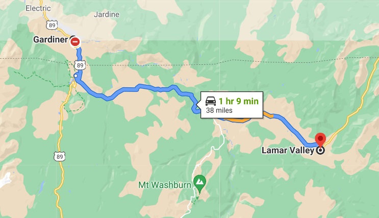
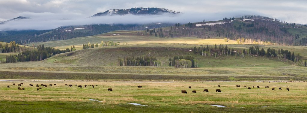
Stop #6: Lamar Valley
Time needed: Allow approx. 2 hours for this activitys
Located between Tower Junction and the Northeast Entrance at Cooke City Montana, the wildlife viewing actually starts the instant you turn onto the highway at Tower Junction / Roosevelt. Within a mile, you’ll cross the Yellowstone River, and that’s when “the games begin!”
The perfect place to spot Yellowstone National Park’s most famous residents: bison, wolves, antelope, elk, and more. In addition to bison, Lamar Valley is also renown for its gray wolf population. These crafty creatures are harder to spot than the big bison, but you’ll have a better chance of spotting one around sunrise and sunset.
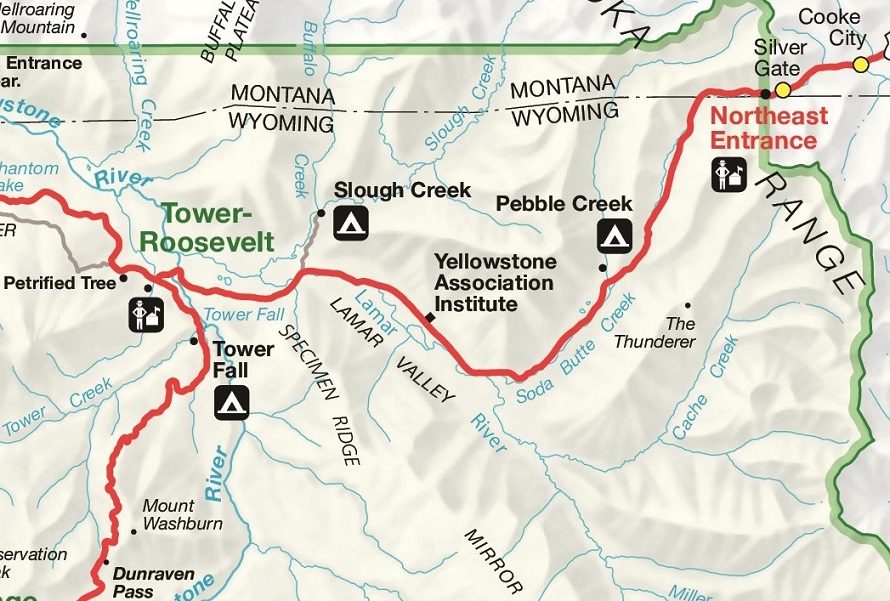
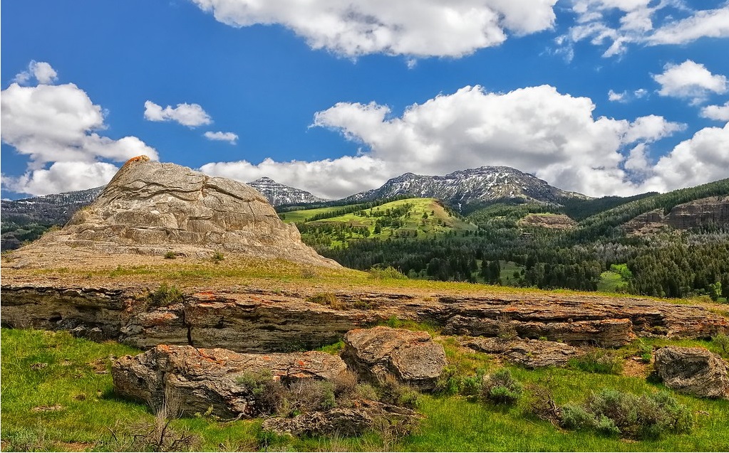
Stop #7: Soda Butte
( 1.3 miles from Lamar Valley )
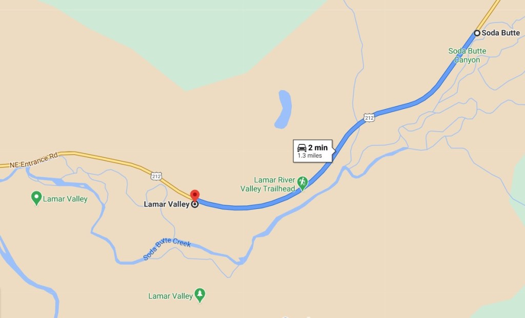
Lamar Valley is not known for its thermal activity. That is why this mostly extinct hot spring looks so out of place standing all by itself with vast valleys and rugged mountain peaks in the background, and sometimes surrounded by bison. The smell of thermal gas is a sign that there is still some thermal activity around Soda Butte. However, the activity is minimal compared to the activity that must have created this massive travertine cone many years ago. There is a pullout on the Northeast Entrance Road right next to Soda Butte.
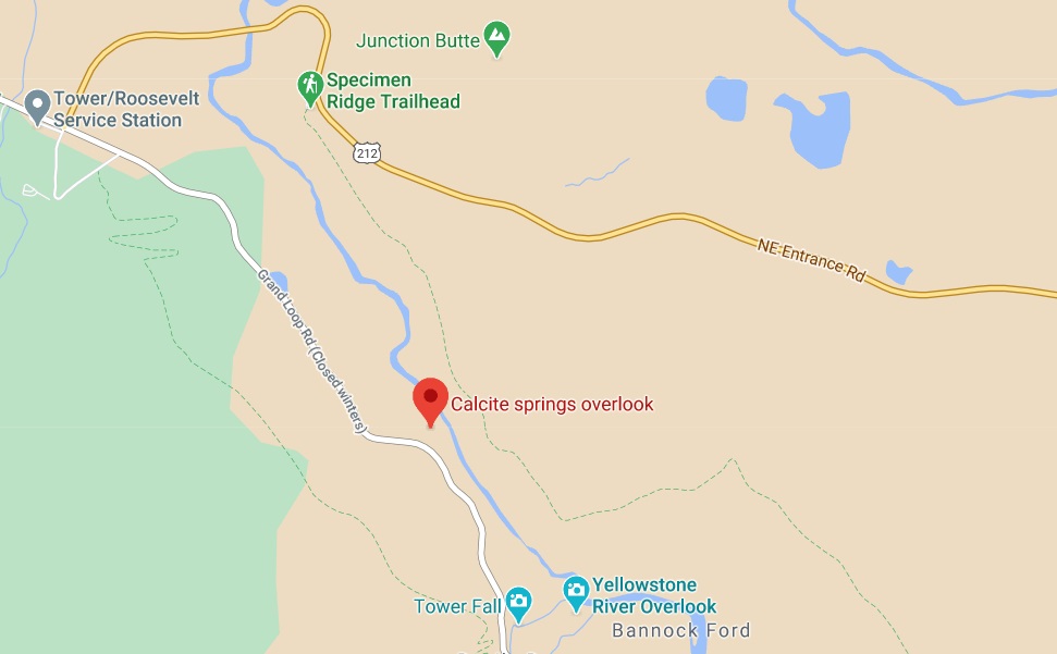
Stop #8: Calcite Springs Overlook
( 1.5 miles from Tower-Roosevelt Junction )
Time needed: Allow approx. 10-15 minutes for this activity
One of the most fabulous overlooks, just 1.5 miles south of Tower-Roosevelt Junction offers fantastic views of the famous area in Yellowstone – the Narrows, the narrowest section of the Grand Canyon.
Yellowstone National Park is known for some of the amazing views that it offers. Calcite Springs Overlook is one of those views. An 800 ft. path will take you along the edge of a deep canyon where the Yellowstone River flows swiftly hundreds of feet below you. Mountain backdrops, unique cliff formations, and a thermal feature in the distance on the banks of the river is what you can expect at this must-see wonder. There are some stairs to go up and down but it is very easy. Keep an eye out for black bears on your way to or from this area. They are often spotted wandering in the grassy woods on the side of the road.
The Calcite Springs grouping of thermal springs show us the ending of the Grand Canyon of the Yellowstone National Park. But it doesn’t mean that the park ends here, this gorge and cliffs are home for numerous wildlife species, such as red-tailed hawks, osprey, bighorn sheep and more.
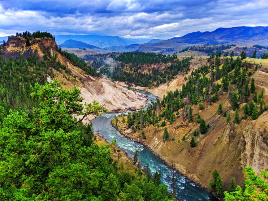
Calcite Spring Overlook will mesmerize hikers by the great views of the Yellowstone River, sulfuric walls and other hydrothermal features. This trail is an easy one, but provides unforgettable views. Just imagine, this is the place where history and present blend together. Be attentive and you will see steam that is rising from a pale slope. Mesmerizing views of the powerful nature!
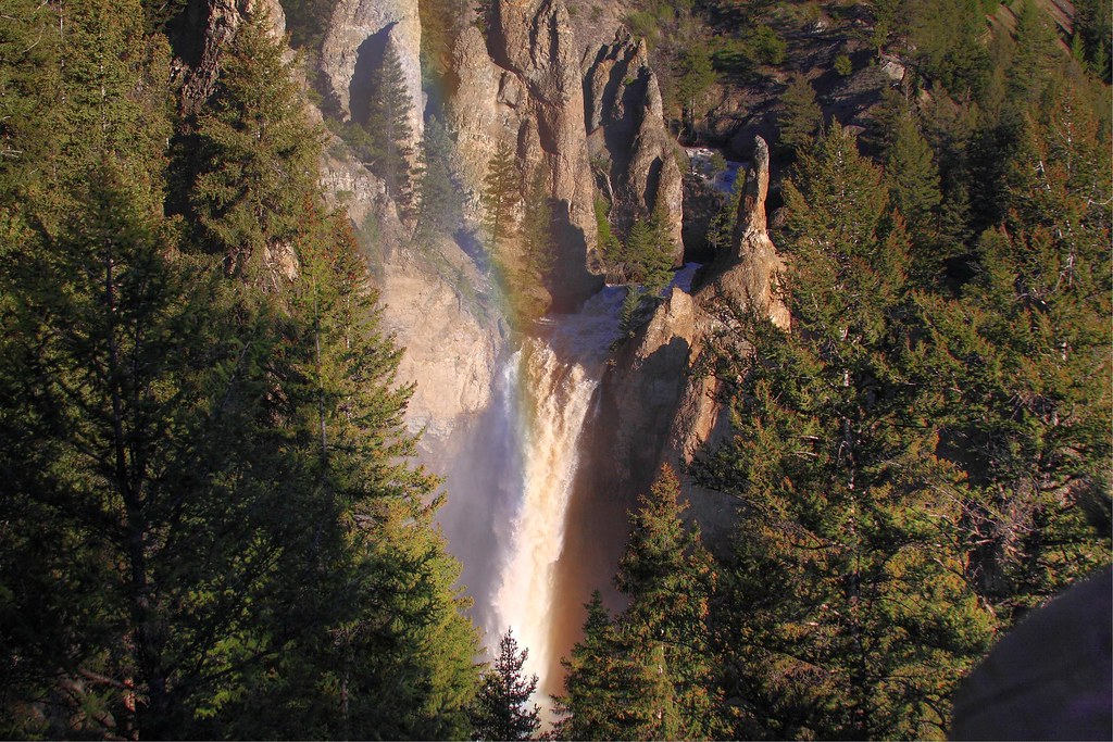
Stop #9: Tower Falls
Time needed: Allow approx. 10-15 minutes for this activity
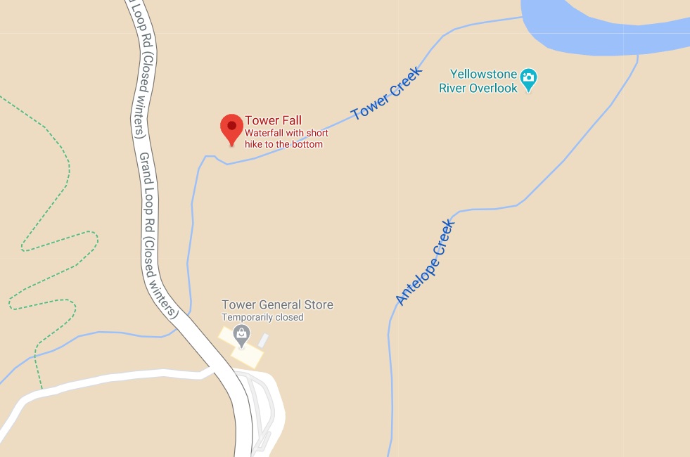
An easy 150 yard paved trail from the parking lot at the Tower General Store will get you to Tower Fall. Tower Fall is the point where Tower Creek drops 132 feet over a rocky ledge with some interesting and unique looking rock formations on the cliffs around it. Your adventure at Tower doesn’t have to stop at the viewpoint platform. A 3/4 mile trail goes down to the confluence where Tower Creek meets the Yellowstone River. The hike down can be steep in some places and may be a somewhat strenuous climb on the way back up.
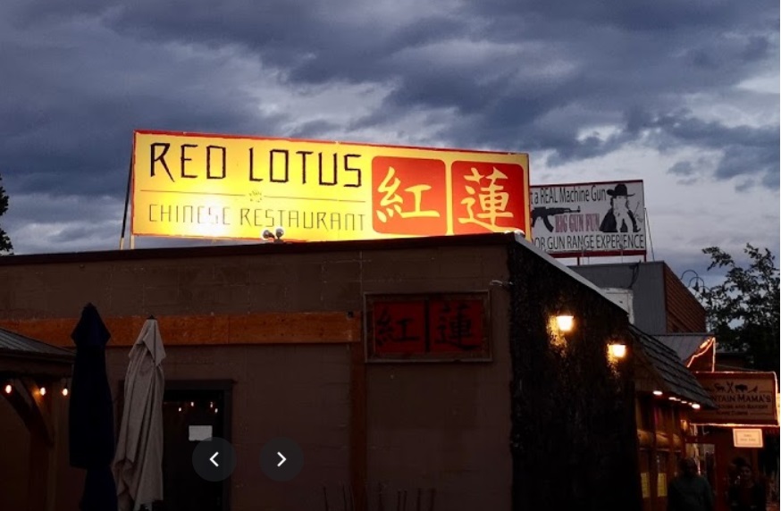
Red Lotus Restaurant
19 Madison Ave, West Yellowstone, MT 59758